Introduction
In this release, we introduce contour labels, an easier Web Map Service import and more control over XYZ exports. Read on below for more details.
Please contact our Sales team if you'd like to arrange for an evaluation of Fledermaus
Contour labels
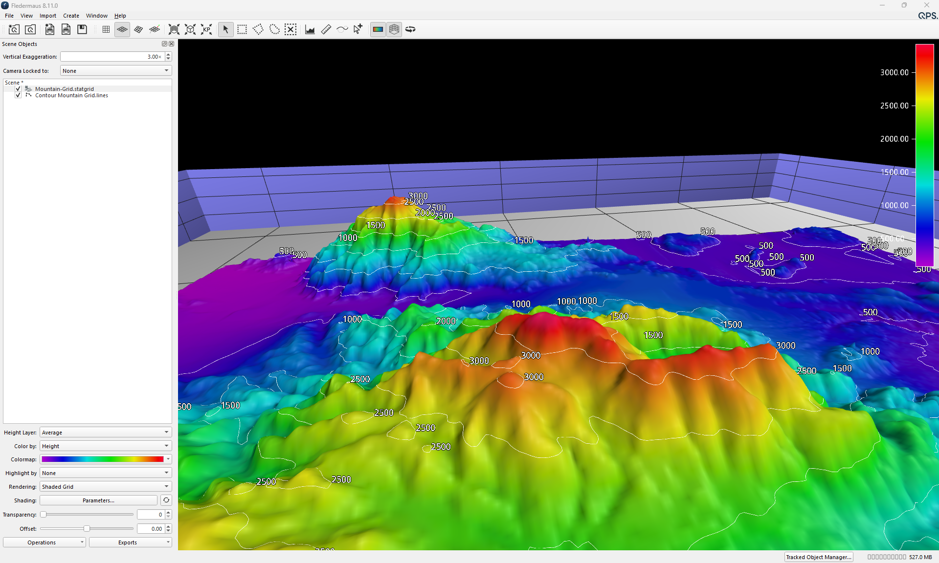
Fledermaus can now add labels to contours, showing the contour value directly in the scene. This brings Fledermaus in line with the contour labelling already available in Qimera and Qinsy.
Easier Web Map Service import
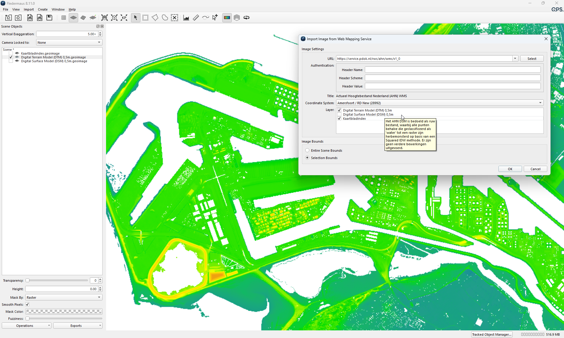
Working with Web Map Services (WMS) is now faster and easier:
-
Import multiple layers from a WMS server at once, instead of one layer at a time.
-
Search the coordinate systems offered by the server by name or EPSG code, which makes it easier to find the right one on servers that list many options.
-
Hover over a layer to see information about it in a tooltip.
Export to XYZ: precision and coordinate system options
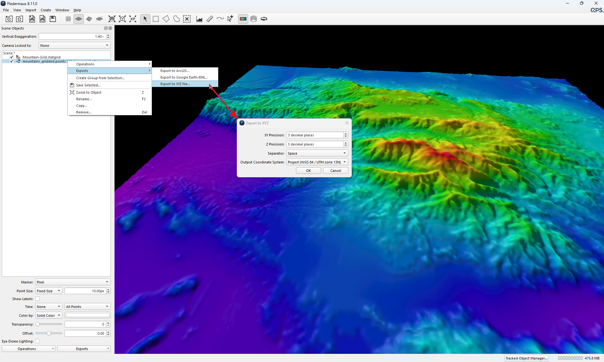
Export to XYZ now opens the same options dialog for QPD, LAS, PTS, point cloud and grid objects. You can choose:
-
the XY and Z precision;
-
the separator (space, tab or comma);
-
whether to write coordinates in the project coordinate system or in the object's own (native) coordinate system.
The default precision is 9 decimals for geographic XY, 3 for projected XY and 3 for Z. The export runs in the background with a progress bar and is saved to the project's Export folder by default.