|
Summary |
Release Notes |
|---|---|
|
Console - Generic Editor - Logfile naming include fix number |
|
|
Displays - Navigation - Static Grid - Propagate Level 0 to higher levels - Default Enabled |
This is now by default enabled in both the Navigation display and the Survey Manager. |
|
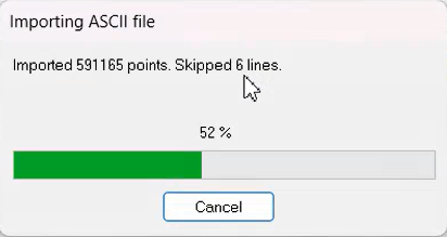
Online - Session Setup - Storage - Static Grid - Report results of the import ASCII |
|
|
Survey Manager - CAD - Line planning - Drape - Order target layers alphabetically |
The combobox now sorts the layers alphabetically. |
|
Survey Manager - File Management - GeoTiff - Show file name with warning |
In case you import a Geotiff that does not geodetic information that matches with the Qinsy Geodetic information, you will get a warning. This warning now also mentions the name of the file. |
|
Survey Manager - Plan View - Settings - Change "Mariner Settings" into "ENC" |
This was changed to be better alligned with the Navigation display. See example below. |
|
Survey Manager - Plan View - Settings - Remove the word "settings" from each category |
Removed the word settings from each category. This has been done for other languages too. 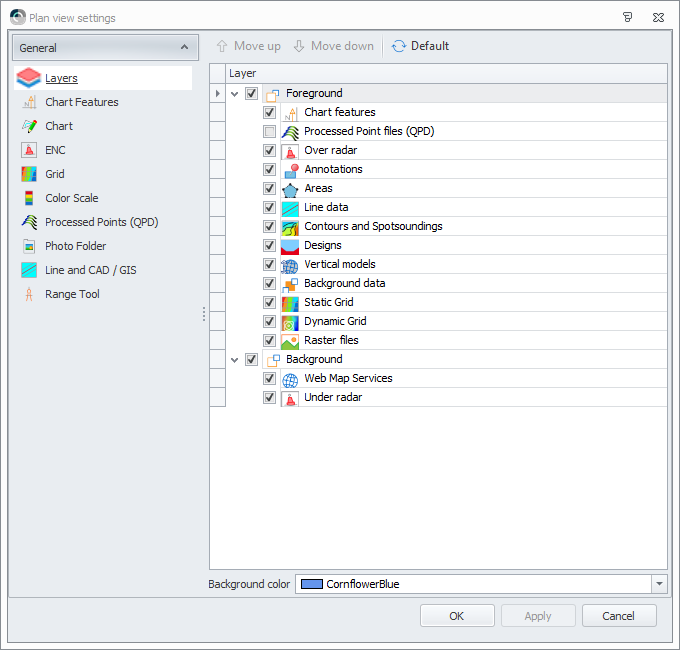
|
|
Survey Manager - Plotting - Charts - Properties - Show Element type |
If you now click on an element it will show the type in a newly added row. |