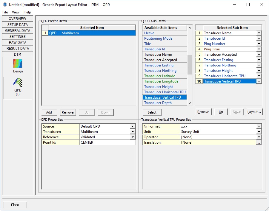
QPD
QPD items are only available for Export and not for Display, Driver nor Log File

Note
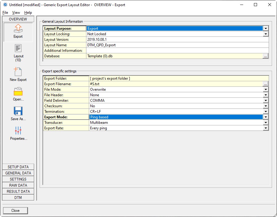
It is recommended to set the Export Mode to Ping based in order to export all DTM QPD data:

Note
More information about the Export Generic Wizard can be found here.
| Parent Item | |
|---|---|
| Source: |
|
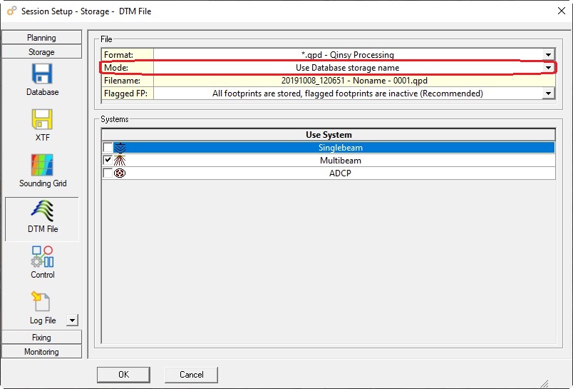
| Filename: | Use the button to browse for a QPD file. The filename will be displayed in red when the (last) selected file is not found. This option is only visible when the source is not the Default QPD. |
| Transducer: | Select from the list with all possible transducers being used the one that should deliver the ping and footprint data. |
| Reference: |
|
| Point Ids: |
|
| Sub Item | Description | Value Type | ||
|---|---|---|---|---|
| Comment | User defined text
| text | ||
| Filename | The file name of the selected (or active) QPD file
| text | ||
| Reference | Value depends on the Parent Items Reference property and will be 'Raw' or 'Validated' | text | ||
Ping Time | Time of the ping. Default in UTC, but you may use the Time Zone property to change this. | time | ||
| Ping Counter | Internal issued incrementing ping counter. Same value as seen as in the Validator Point Info pane, field: Ping (See all the way below). (Used to be named 'Ping Number' in Qinsy v9.6.x and older) | int | ||
| Ping Number | Unique ping id as issued by the driver and stored in the raw databases. Same value as seen as in the Validator Point Info pane, field: ID (See all the way below). (Used to be named 'Ping Id' in Qinsy v9.6.x and older) | int | ||
| Object Id | Unique Id of the reference node of the object where the selected transducer is located on. The same Id can also be seen as Object reference number in the right pane of Db Setup. Will be empty when the Transducer is the Detected Pipe. | int | ||
| Object Name | Name of the reference node of the object where the selected transducer is located on. Will be empty when the Transducer is the Detected Pipe. | text | ||
| Object Accepted | Value will be 'Yes' or 'No'. Same value as seen as in the Validator Point Info pane, field: Accepted, when the mouse cursor is above an object track point (See all the way below). Will be empty when the Transducer is the Detected Pipe. | text | ||
Object Easting Object Northing Object Height | Grid position of the reference node of the object where the selected transducer is located on. Easting and northing are always on Survey Datum, also known as Horizontal Datum. Height is always on Chart Datum, also known as Vertical Datum. The values depend on the selected Reference property:
Will be empty when the Transducer is the Detected Pipe. | double | ||
Object Latitude Object Longitude | Geographical position of the reference node of the object where the selected transducer is located on. Co-ordinates are by default on Survey Datum (or Horizontal Datum), but WGS84 (or ITRF2008) can also be selected. The values depend on the selected Reference property:
Will be empty when the Transducer is the Detected Pipe. | geo | ||
| Object DX | Distance across (DX) value for the object reference node location with respect to the current mainline. Value remains empty when Reference property is Validated and the object position status is Not Accepted. Will also be empty when the Transducer is the Detected Pipe. | double | ||
| Object KP | Kilometer point value for the object reference node location with respect to the current mainline. Value depends on the selected Reference property (Raw or Validated). Value remains empty when the current mainline is a POINT or when Reference property is Validated and the object position status is Not Accepted. or when the selected Transducer is the Detected Pipe. | double | ||
| Heading | Heading of the object where the selected transducer is located on. When sub item reference property is grid, it will be the same value as seen as in the Validator Point Info pane, field: Heading (See all the way below). Value remains empty when Reference property is Validated and the object position status is Not Accepted. Will also be empty when the Transducer is the Detected Pipe.
| double | ||
Roll Pitch Heave | Motion of the object where the selected transducer is located on Same value as seen as in the Validator Point Info pane, field Pitch, Roll and Heave (See all the way below). Value remains empty when Reference property is Validated and the object position status is Not Accepted. Will also be empty when the Transducer is the Detected Pipe. | double | ||
Positioning Mode | Value (also known as Solution mode) coming straight from the Positioning System being used during the online acquisition of the DTM data. Same value as seen as in the Validator Point Info pane, field: Position Mode (See all the way below). Value remains empty when Reference property is Validated and the object position status is Not Accepted. Will also be empty when the Transducer is the Detected Pipe. | int | ||
| Tide | The tide value that has been applied to the z component of the DTM points. Value will be empty when no tide has been applied, or when Reference property is Validated and the object position status is Not Accepted, or when the Transducer is the Detected Pipe. | double | ||
| Transducer Id | System Id of the selected Transducer. The value is unique and issued automatically when adding the system in the template setup. Value will be -4 when the selected Transducer is the Detected Pipe. | int | ||
| Transducer Name | System name of the selected Transducer. | text | ||
| Transducer Accepted | Value will be 'Yes' or 'No'. Same value as seen as in the Validator Point Info pane, field: Accepted, when the mouse cursor is above a transducer track point (See all the way below). | text | ||
Transducer Easting Transducer Northing Transducer Height | Position of the selected transducer node location. Easting and northing are always on Survey Datum, also known as Horizontal Datum. Height is always on Chart Datum, also known as Vertical Datum. When the selected multibeam system has separate TX/RX elements, the node of the TX element will be used. The values depend on the selected Reference property:
| double | ||
Transducer Latitude Transducer Longitude | Geographical position of the selected transducer node location. Co-ordinates are by default on Survey Datum (or Horizontal Datum), but WGS84 (or ITRF2008) can also be selected. The values depend on the selected Reference property:
| geo | ||
Transducer Horizontal TPU Transducer Vertical TPU | Horizontal and vertical component of the Total Propagated Uncertainty value for the selected transducer node. Same value as seen as in the Validator Point Info pane, field: Horizontal/Vertical TPU when the mouse cursor is above a transducer track point (See all the way below). Value remains empty when Reference property is Validated and the transducer position status is Not Accepted. | double | ||
| Transducer Depth | The depth of the selected transducer under the waterline. Note that it is this depth that is used as starting point for SVP ray-tracing. | double | ||
| Transducer DX | Distance across (DX) value for the transducer node location with respect to the current mainline. Value remains empty when Reference property is Validated and the transducer position status is Not Accepted. | double | ||
| Transducer KP | Kilometer point value for the transducer node location with respect to the current mainline. Value depends on the selected Reference property (Raw or Validated). Value remains empty when the current mainline is a POINT or when Reference property is Validated and the transducer position status is Not Accepted. | double | ||
| Nadir Depth | The water depth at Chart datum of the transducer node location and is a combination of the transducer node height and the height of the closest DTM point (nadir beam). Value depends on the selected Reference property (Raw or Validated) and remains empty when Reference property is Validated and the transducer position status is Not Accepted. | double | ||
| Point Id | Unique point number. Lowest value is 1 (or 0 in case of Detected Pipe). Same value as seen as in the Validator Point Info pane, field: Beam (See all the way below). Notice that in the Controller Echosounder Settings, Exclude beams field you will have to use the same value. When the Transducer is the Detected Pipe, the following values can be expected: | int | ||
| Point Accepted | Value will be 'Yes' or 'No'. Same value as seen as in the Validator Point Info pane, field: Accepted, when the mouse cursor is above a footprint data point (See all the way below). | text | ||
Point Easting Point Northing Point Height | DTM point (or footprint) co-ordinate. Easting and northing are always on Survey Datum, also known as Horizontal Datum. Height is always on Chart Datum, also known as Vertical Datum. Same value as seen as in the Validator Point Info pane, field: Easting/Northing/Height (See all the way below). The values depend on the selected Reference property:
| double | ||
Point Latitude Point Longitude | Geographical co-ordinate of the DTM point (or footprint). Co-ordinates are by default on Survey Datum (or Horizontal Datum), but WGS84 (or ITRF2008) can also be selected. The values depend on the selected Reference property:
| geo | ||
Point Horizontal TPU Point Vertical TPU | Horizontal and vertical component of the Total Propagated Uncertainty value for the concerned point. Same value as seen as in the Validator Point Info pane, field: Horizontal/Vertical TPU when the mouse cursor is above a footprint data point (See all the way below). Value remains empty when Reference property is Validated and the concerned point is Not Accepted. | double | ||
| Point Quality | DTM point quality value. Always between 0 and 255. Same value as seen as in the Validator Point Info pane, field: Quality (See all the way below). Value remains empty when Reference property is Validated and the concerned point is Not Accepted. | int | ||
| Point Intensity | DTM point intensity value Same value as seen as in the Validator Point Info pane, field: Intensity (See all the way below). Value remains empty when Reference property is Validated and the concerned point is Not Accepted. | double | ||
| Point Slant Range | Slant range (3D, grid) between the transducer node location and the point The value depends on the selected Reference property (Raw or Validated) Value remains empty when Reference property is Validated and the concerned point is Not Accepted. | double | ||
| Point DX | Distance across (DX) value for the DTM point co-ordinate with respect to the current mainline. Value remains empty when Reference property is Validated and the concerned point is Not Accepted. | double | ||
| Point KP | Kilometer Point (KP) value for the DTM point co-ordinate with respect to the current mainline. Value depends on the selected Reference property (Raw or Validated). Value remains empty when the current mainline is a POINT or when Reference property is Validated and the concerned point is Not Accepted. | double | ||
| Point Status | An integer number, a bit-wise value (flag) representing one or more possible states about the concerned point. It is recommended to use the Mask Operator together with a Translation table to convert the individual bits into readable text: For an overview of all possible states please refer to the Footprint Data Status Table. | int | ||
| Point Extended Status | An integer number, a bit-wise value (flag) representing one or more possible extended states about the concerned point. It is recommended to use the Mask Operator together with a Translation table to convert the individual bits into readable text: For an overview of all possible extended states refer to the Footprint Data Extended Status Table. | int |
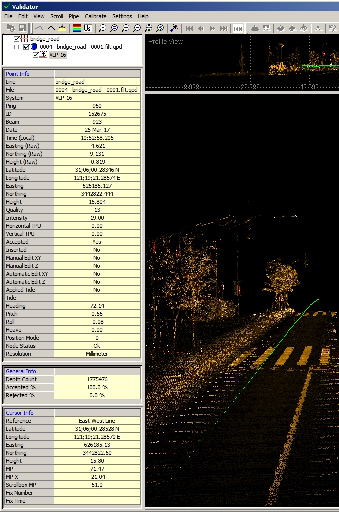
Several sub item descriptions refer to fields in the Validator Point Info pane:


