
This How-to describes step-by-step how to create your own geoid model file or height level correction model and use it within Qinsy.
See Questions & Answers for more in formation.
Also for items with an asterisk *.
Related pages:
Questions & Answers
|
Subject |
Question |
Answer |
|---|---|---|
|
Projected |
What is projected data? |
We assume that this is projected on project datum and the separation value is also relative to project datum. |
|
Point spacing |
What is regular and irregular spacing? |
Irregularly spaced:
Regularly spaced:
|
|
What is meant by having a different spacing in x and y? |
The data can be regularly spaced but still have a different spacing in X and Y. |
|
|
Area size |
What is a small area? |
This is a bit tricky since it mostly depends on points in an area:
If the QGFVOM is larger than 15MB it is also a good indication that you might need to use either a smaller area or try the BIN workflow. |
|
Datum |
What is Project datum and Source datum? |
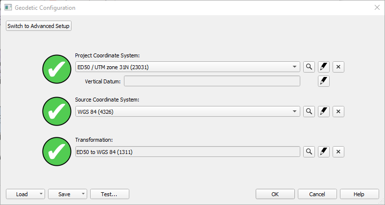
Example of geodetic setup:
Project datum: ED50
|
|
Purple steps |
What do they refer to? |
|
|
Storage locations |
Were are the different types of geoid model files stored? |
See table below for more info. |
|
QGFVOM VS BIN |
What is the advantage of one format over the other? |
See table below for more info. |
.png?cb=9319965334fbe6d8099e3f3732880100)
.png?cb=9f2213f367e23be26c6d0dec838063d4)
More info on storage locations
|
Source |
Type |
Format |
File location |
Additional info |
|---|---|---|---|---|
|
QPS Installers |
Geoid Models |
bin |
C:\Program Files (x86)\Common Files\QPS\GeodeticResources\Geoid Before Qinsy 9.6.0:
|
All (pre-defined) Geoid BIN files installed by Qinsy using the separate Geodetic resources installer: Release Notes |
|
Created by user |
Geoid models |
bin |
C:\Users\Public\Public Documents\QPS\Shared\Geo\Geoid |
Geoid BIN files (Lat/Long and E/N), created from a Sounding Grid exported as Geoid Model |
|
Vertical Offset Models |
qgfvom |
Project folder\Geoid |
Vertical Offset Models (VOM) in *.qgfvom format as created in the Survey Manager. Previously: River Line Model and VORF models in PRO format. |
More info on QGFVOM VS BIN
|
|
QGFVOM |
BIN |
|---|---|---|
|
Used in all QPS software |
|
|
|
Use for large areas |
|
|
|
Irregularly spaced points |
|
|
|
Regularly spaced points |
|
|
|
Datum (ellipsoid) aware |
|
|