How-to Create a Vertical Offset Model (QGFVOM)
This How-to document explains how to create a vertical offset model in the *.qgfvom format.
We suggest to look at the following How-to before continuing here:
Note: VOM Heights are applied after Projection
Please note that when a Vertical Offset Model is used as a Vertical Datum, the heights will be applied after projection.
So the height correction is then always applied relative to what you selected here (an example):
Importing ASCII points into a Vertical Offset Model file (QGFvom)
Open the Survey Manager
In the Project Explorer tree - Vertical models: click with the right mouse button
Select New
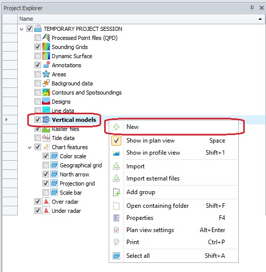
The New VOM Wizard will be started.
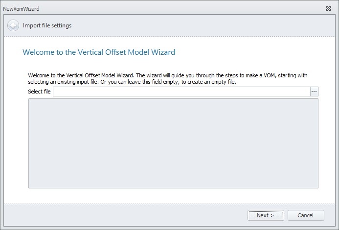
Use the browse button [ ... ] to select the file containing the separation data.A regular Windows search window opens.
Select the file type you wish to import.
The most likely import is an ASCII points file, which we will work with in this example, but other import file types are supported as well.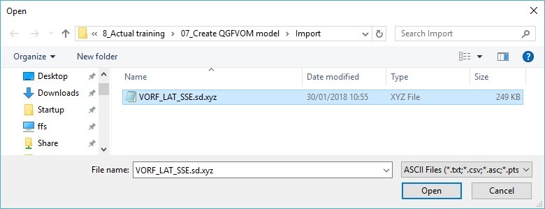
Select the file to use and click 'Open'Depending of the format of the file, you can either select a standard layout or create one yourself.
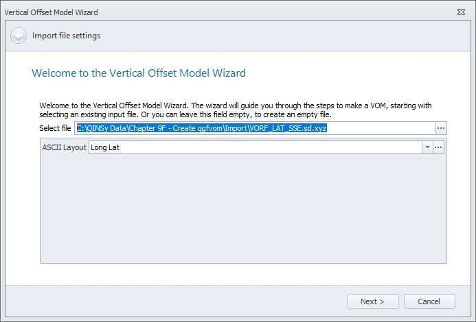
If you need to create one yourself, you can continue with step 7.
Otherwise you can go directly to step 8.This dialog can be used to indicate the specific layout of the file to be imported.
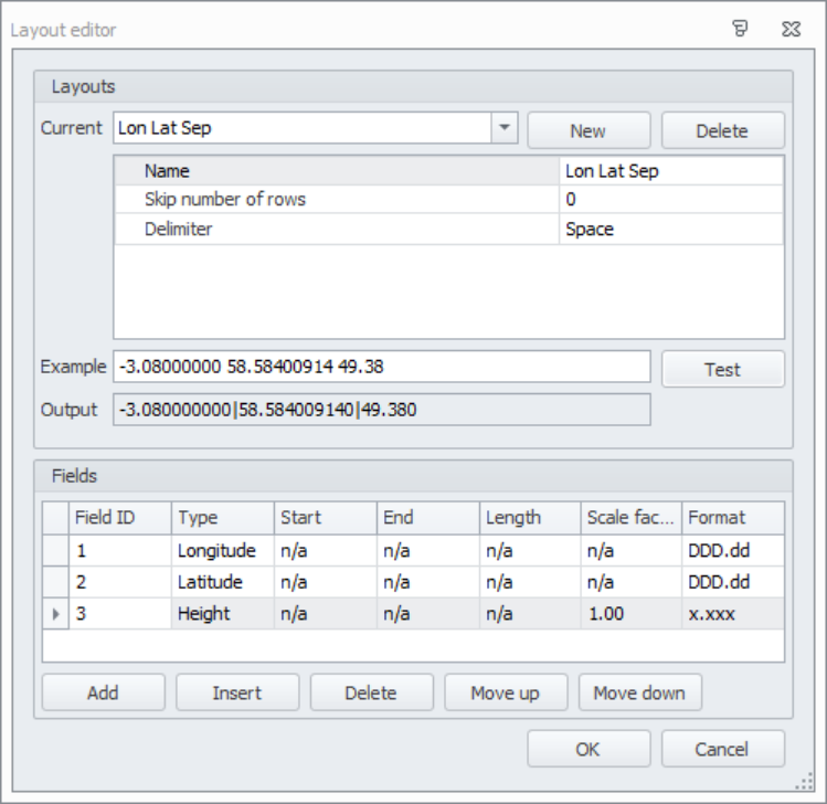
Paste a line of your file in the 'Example' field and click 'Test'.
The data as it will be stored in the VOM file will be shown in the 'Output' field.A Vertical Offset Model (QGFvom) consists of Easting, Northing, Height Correction and therefore the imported Lat Long data needs to be converted.
/wa
The imported Lat Long data needs to be on Project Coordinate System (called Horizontal/Survey Datum in Qinsy 8) to be correctly converted to Easting Northing on the Projection.
This is the reason why the user cannot select any other datum than Horizontal/Survey Datum to correctly convert to Easting Northing on the Projection.
You could ignore this and just select the Horizontal/Survey Datum.
We see users doing this for using VORF (https://en.wikipedia.org/wiki/Vertical_Offshore_Reference_Frames ) on ED50, but be aware that the height correction is applied on ED50 and not on the ETRS89 as intended to.
Click 'Next' to continue to the next page of the wizard, click the arrow button at top left to return to the previous page.
We have 2 open Feedback issues to improve this:FQI-459
FQI-511
In case you have a boundary in which the triangles should be created it can be selected here.
Optimize allows you to remove triangles for which the link angle and distance are bigger than the entered maximum.
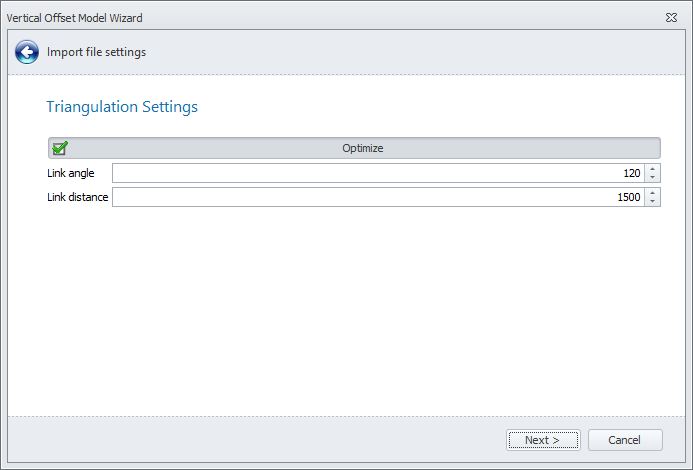
There is an option to run this again once you have created the VOM. This can be done in the CAD ribbon.
Note that you can only remove extra triangles. Restoring triangles would require you to create a new QGFVOM.Type in a name for a new file or use the browse button [ ... ] to select an existing file.
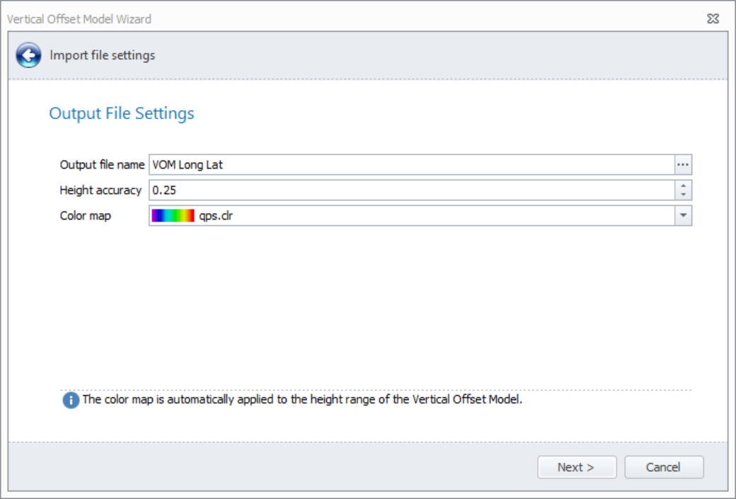
Height accuracy: This value represents how accurately the height difference was determined.
Color map: Choose a color map to show the height variations in the offset model.
This page shows all the settings as entered in the previous wizard pages.
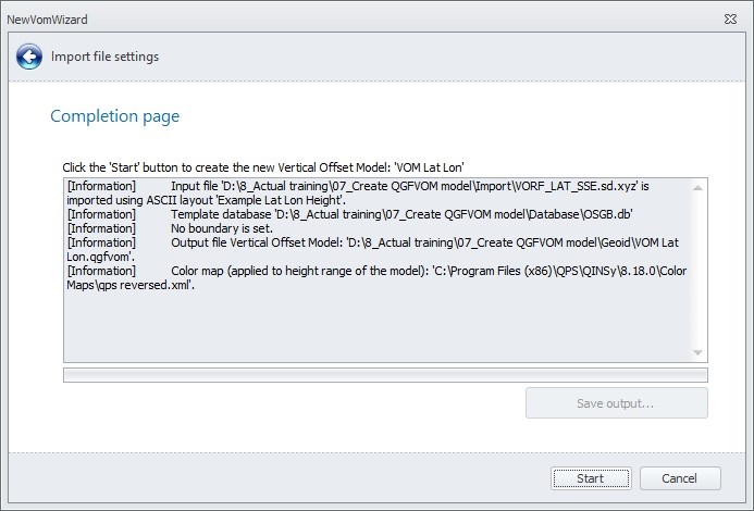
Click 'Start'.The VOM has now been created.
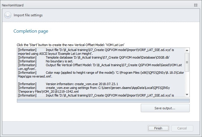
Click 'Save output' if you would like a log file record of the process.
Click 'Finish' to close the wizard.The new qgfvom file is listed in the Project Explorer window under Vertical models.
A GEOIDAREA and GEOIDPOINTS layer are automatically created.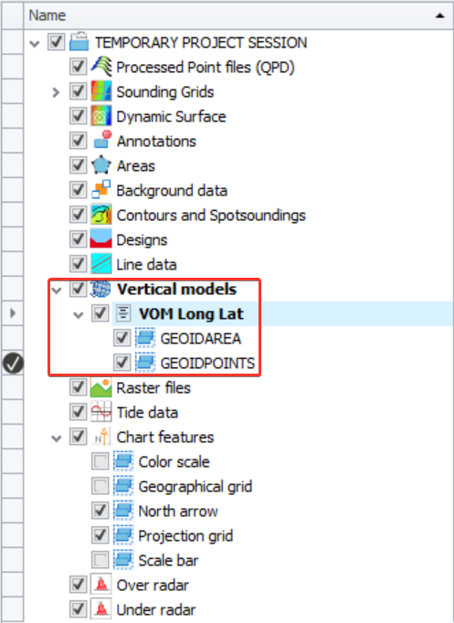
The layer GEOIDAREA contains the outline of the imported points.
The layer GEOIDPOINTS contains the VOM in color.The model is visible in the Plan View.
If it doesn't display right away, then right mouse click on the GEOIDPOINTS layer and select 'Zoom to fit'.To check whether the links between the points are to your satisfaction, the grid can be switched off:
- Select the vertical model in the Project Explorer tree
- Right click on it
- From the menu select 'Color scale settings'
- For Color map select <No color map>The DTM links are now shown.
Use the right mouse menu again to return to the color scale used earlier.The easiest way to check the heights, is to draw a Quick profile.
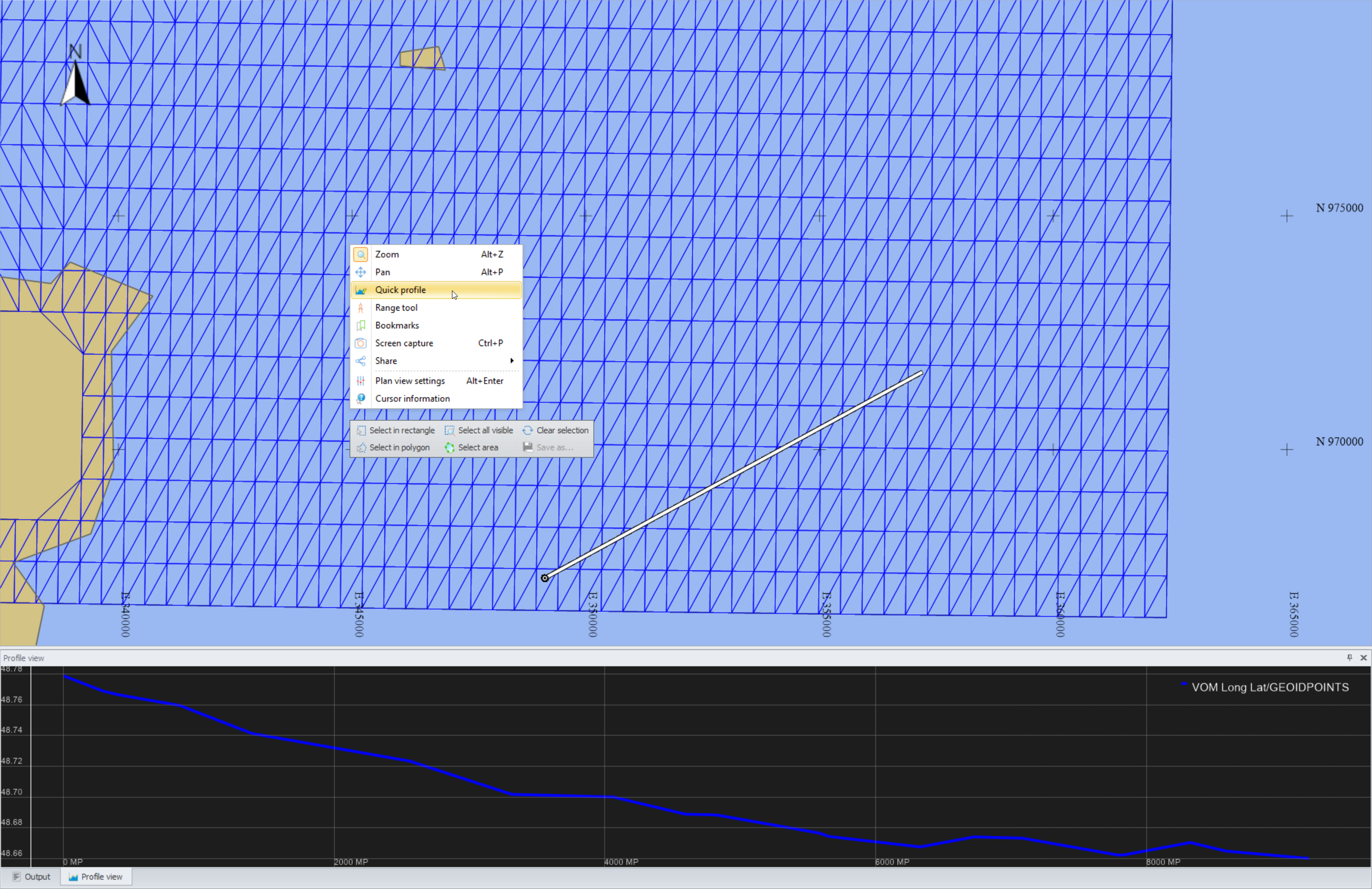
Make sure the following is enabled though:
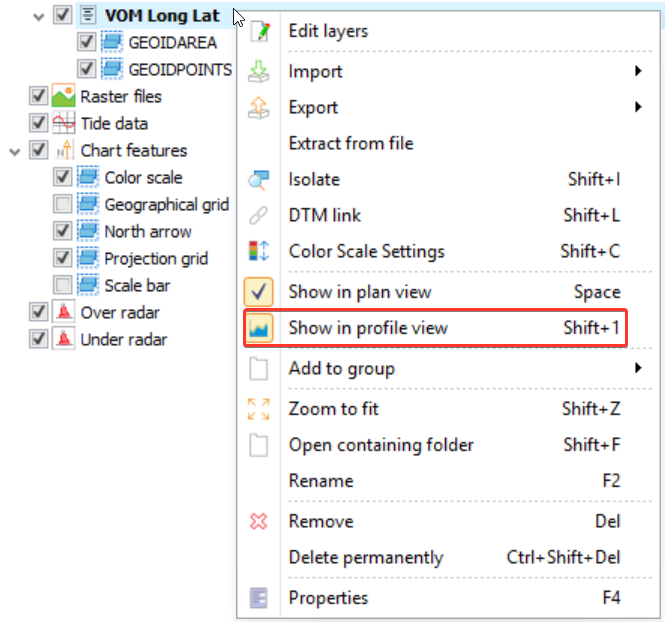
The model is stored in the Geoid folder of the Project Folder or Common Files Folder.
Note that the QGFVOM can also be placed in the following folder so that it can be selected in all your QPS projects: C:\Users\Public\Documents\QPS\Shared\Geo\GeoidIn the Console - open the Geodetic Configuration Overview - set up the Geoid Height Model - in the drop down menu the predefined Geoid Height Models can be selected.
Here you can select the Vertical Offset Model as created in the Survey Manager.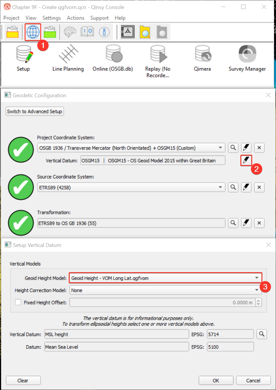
Info: Surveypoints, Geoidpoints
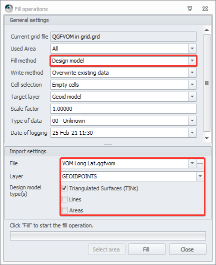
The Vertical Offset Model is like a 3D Design model and can be imported into a Sounding Grid to check if the model does not contain strange features. 