
This How-to is a step-by-step description for using the Vertical Shift tools on the dynamic surface , available from Qimera 2.3 and up.
On this page:
Introduction
There are three different vertical shift tools available in Qimera:
-
Static vertical shift
-
How-to Qimera - Line height matching tool
-
How-to Qimera - Varying Vertical Shift
This how-to will discuss the Static Vertical shift vertical shift tool.
Benefits:
-
Static vertical shift offsets due to:
-
Shift to design
-
Correct for vertical anomalies
-
Geodetics
-
Old and newer surveys
-
ROV survey overlap
-
-
This tool computes an average vertical offset between two surfaces using the statistical data generated by a traditional surface difference. For more information on the surface difference algorithm, please see the section on the Surface Difference Wizard. This type of tool is useful in situations where your survey data must be made to vertically align with a reference surface that has a constant vertical mismatch. This can occur when matching a ROV or AUV surface to one from a surface vessel. It could also be used to recover from an error in vertical referencing in either your new surface or in the reference surface. The shift is preserved in the Processing Settings for the contributing files and can be reviewed, reported and reverted with ease.
Good to know
-
Shift apply to the files not to the dynamic surface only, if you have multiple dynamic surfaces, applying the shift will affect all surfaces.
Step-by-Step guide Static Vertical Shift
Step 1 - Assess Your Data
To asses your data, a reference grid or design is required, as this will be used to check if there are any height offsets at all. This type of tool is useful in situations where your survey data must be made to vertically align with a reference surface that has a constant vertical mismatch.
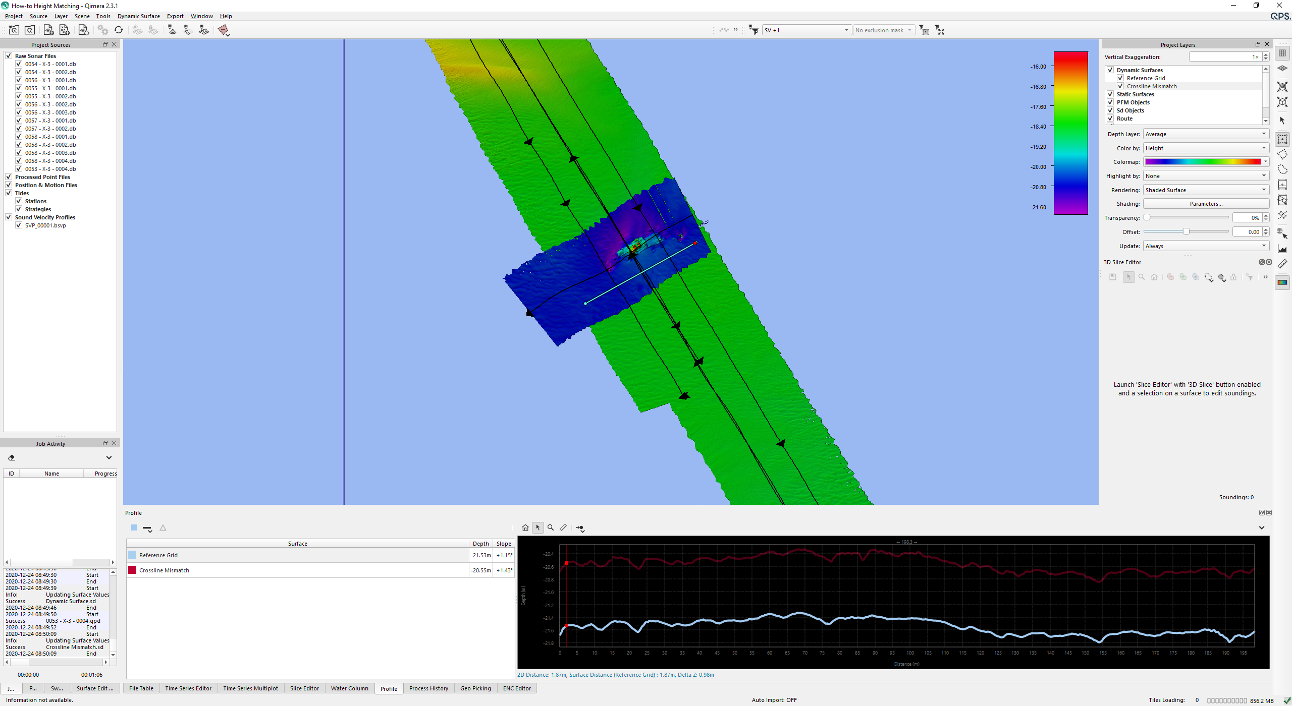
In the example below we see a constant mismatch of roughly 1 meter, we can correct for this.

Step 2 - Save a Before Image
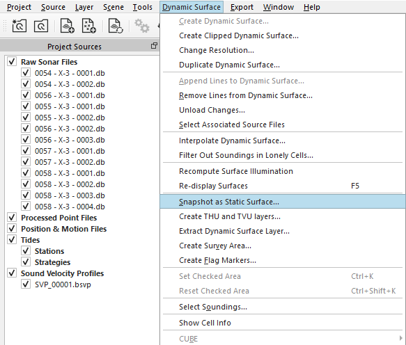
It is best practice to help you assess the results of the algorithm by capturing a snapshot of the results before any changes are done. From the Dynamic Surface menu select 'Snapshot as Static Surface' so a Static Surface is generated. You will be prompted to define a name and attributes.
Step 3 -Select The Data That Needs Shifting
In the Project Sources Window, select the appropriate line(s) for which you'd like to compute a correction (the left image below).
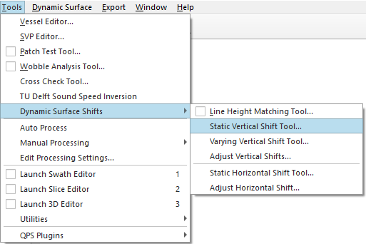
Select the Static Vertical shift tool, available on the Tools drop down menu under Dynamic surface shift
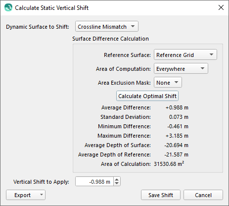
Step 4 - Start Static Vertical Shift Tool
Parameters
There are four parameters which can be set to the users preferences: Dynamic Surface to shift, Reference Surface, Area of Computation, Area Exclusion Mask;
|
Option |
Used for |
|---|---|
|
Dynamic surface to Shift |
Selection of Dynamic Surface which is to be shifted with a fixed offset to the Reference Surface |
|
Reference Surface |
Surface used for reference of the static shift |
|
Area of Computation |
You can constrain where the computation is made using a selection in the scene: For example, you could select a known relatively flat area of the seabed. |
|
Area Exclusion Mask |
you can select a line object in the scene, this will mask out areas you don't want to be part of the statistical computation. For example, if the primary survey contains rock dumping and the reference surface does not, you can mask out the area of the rock dumping which allows the algorithm to compute more accurate statistics. |
Once you save the results using the Save Shift button, every raw sonar file that is part of the Dynamic Surface you are shifting will have a static vertical shift applied.
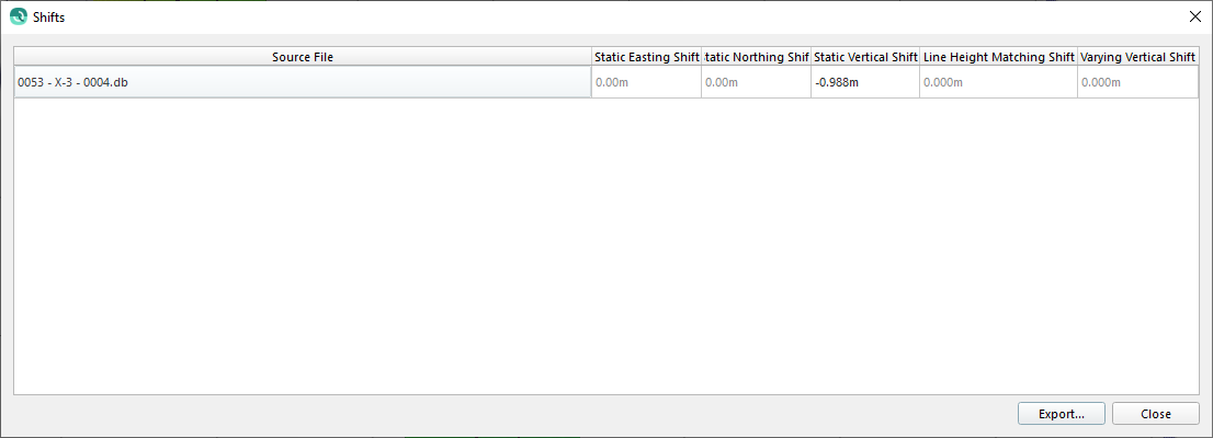
Qimera will then prompt you to update all Dynamic Surfaces containing the affected lines. The static shifts can be reviewed in the Processing Settings Dialog.
Step 5 - Assess Your Results
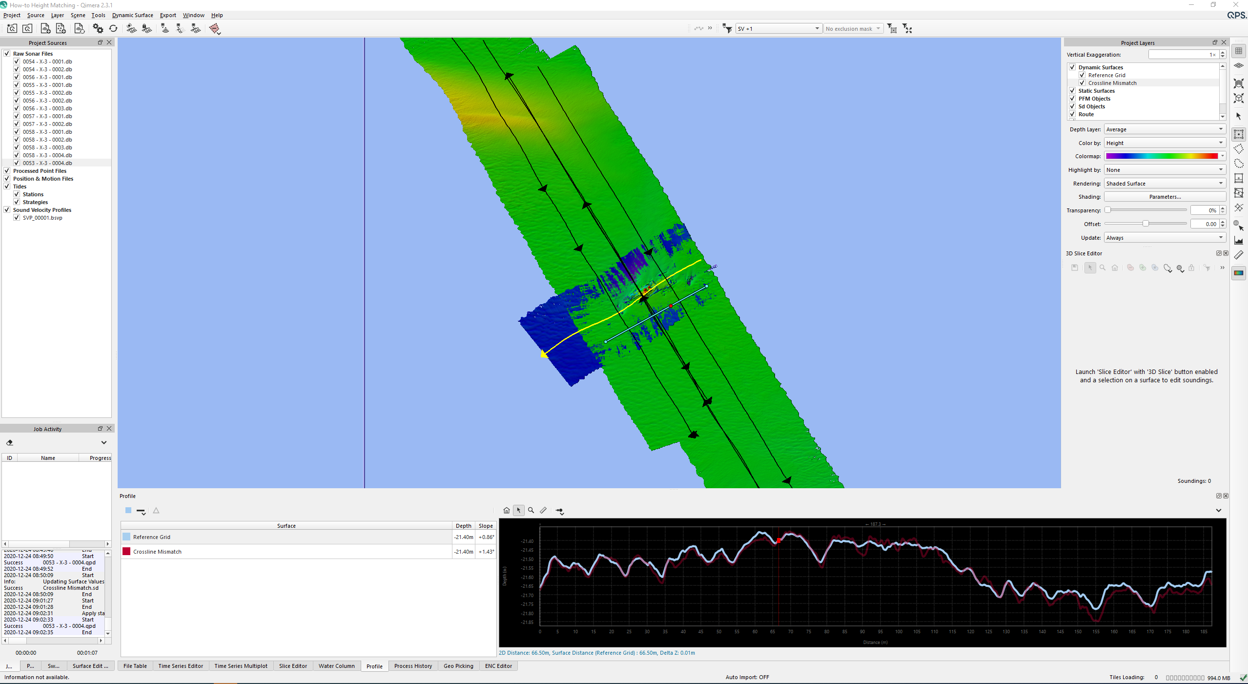
After applying the results the profile display can indicate if the lines do overlap.
Revert to original
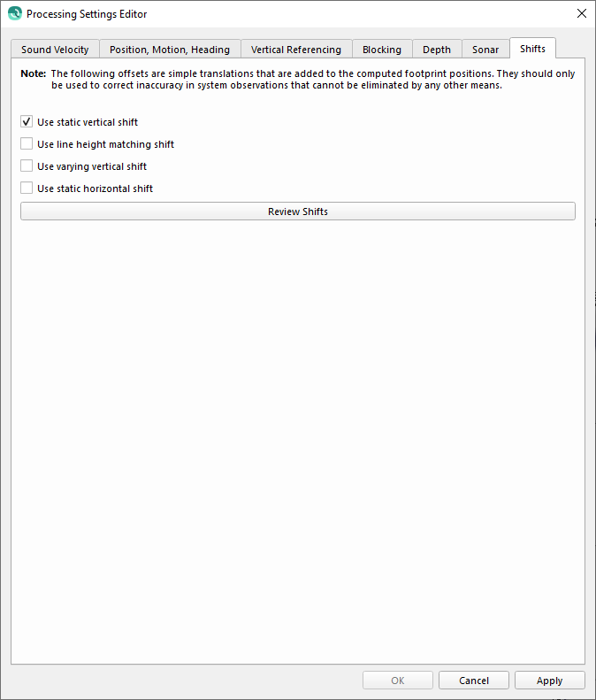
Notice that you are able to check and/or disable the Varying Vertical shift under the processing settings:
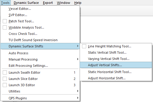
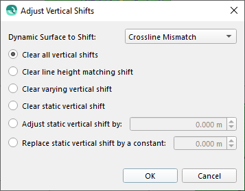
To clear generated shifts:
|
Option |
Used for |
|---|---|
|
Dynamic surface to Shift |
Change the combo box to display the Dynamic Surface containing the raw sonar files that you wish to apply or clear the vertical shift.
|
|
Clear all vertical shifts |
Clear all shift applied by any of the available tools. |
|
Clear line height matching shift |
This will clear the shift applied by the Line Height Matching Tool. |
|
Clear varying vertical shift |
This will clear the shift applied by the Varying Vertical Shift Tool . |
|
Clear static vertical shift |
This will clear the static vertical shift applied by this dialog or by the Static Vertical Shift Tool . |
|
Adjust static vertical shift by |
This option will apply the additional specified shift in an additive manner to the current static vertical shift. |
|
Replace static vertical shift by a constant |
This option will replace the static vertical shift for the raw sonar files by an entered constant. |