
Introduction
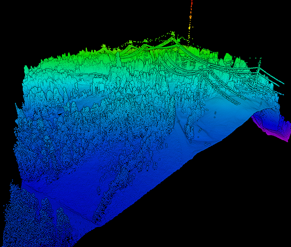
The LAS format is a file format created for storing LIDAR point cloud data. It was created by the American Society for Photogrammetry and Remote Sensing (ASPRS). LAZ files are the compressed version of the aforementioned object type.
LAS and LAZ files ( with the file extension .las or .laz) can be loaded directly into Fledermaus as a native object type without the need to import them. In terms of visualization and operation capabilities they are very similar to QPD, PTS, and Point objects.
Storage Format
LAS and LAZ files have the .las and .laz file extensions respectively. Note that once loaded in Fledermaus a companion .lasatb or lazatb will be created to store addition (optional) Fledermaus specific information as well.
Properties
|
Name |
Description |
|---|---|
|
Point Count |
The total number of points in the selected LAS/LAZ file. |
Attributes
This object type shares much in common with the Points object and provides a similar set of attribute tailored to the needs of this type.
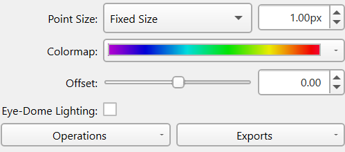
The Point Size is limited to Fixed Size for this object type but you can control the size of the point pixels displayed.
The Colormap widget provides the control of the color map selection and mapping.
The Offset is a simple vertical offset applied to the visualization of the points, the internal data is not modified by this offset.
The Eye-Dome Lighting toggles turns on/off this point illumination algorithm which can improve the visualization of the points and help show their depth. When enabled two extra options are available which control how the algorithm illuminates the points.
Operations
To see the operations available for the point object type right click the object's name and look in the Operations sub-menu or look at the Operations dropdown menu at the bottom left of the attribute panel. These operations include:
Change Object Coordinate System
While this should be very rarely needed it can be used if necessary to change the coordinate system currently applied to the object. No projection is done here you are just telling it that this new coordinate system is what the object should have been in in the first place.
Create Surface
This operation provides a convenient method to create a surface for any selected QPD objects. See the gridding documentation for details on making a surface from points.
Create Mesh
This provides a quick way to start the mesh creation process on any selected QPD objects. See the Meshing documentation for details on the processing.
Exports
There are currently no additional exports for the QPD Object type.
Return to Fledermaus Visual Objects
Return to Fledermaus Reference Manual