Magnetometer (Geometrics G880) - 35
Description
Driver to decode depth, altitude and/or magnetometer observations, such as field strength and field signal from a Geometrics G880 Magnetometer system.
Driver Information
Driver | Magnetometer (Geometrics G880) | Interface Type | Serial | Driver Class Type | Terminated |
|---|---|---|---|---|---|
No | Input / Output | Input | Executable | DrvGeometricsMagneto.exe | |
Related Systems |
| ||||
Related Pages |
| ||||
Qinsy Config
Database Setup
Magnetometer (Maggy)
To decode the magnetometer field observation (nT) a Magnetometer system needs to be defined. The quality factor (e.g. shown in the Observation Physics Display) is the actual signal strength of the reading.Miscellaneous system
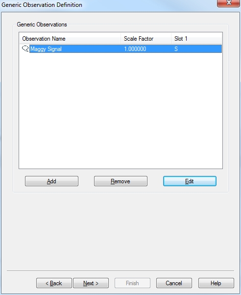
To decode the magnetometer signal and field observation a Miscellaneous system needs to be defined. After this system has been added the user needs to define the magnetometer field and signal observation.
To be able to decode the correct observation the user needs to enter slot information.
For each observation the identifier that corresponds with the field for which you are defining the observation needs to be entered as the slot i.e. 'S' when defining the magnetometer signal observation.
Underwater Sensor
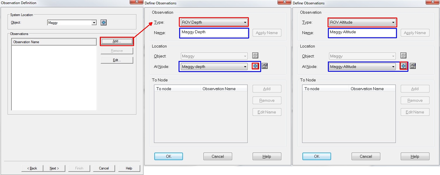
To decode the fish depth and altitude observation an Underwater System needs to be defined. After the system has been added the user needs to define the fish depth and altitude observations.
Additional Info
Additional Information
Database Setup
Add manual echosounder
Please be aware that you need to add a Manual echosounder to your towed object to be able to process the track of the towed object.
Online / Replay
Since Qinsy version 8.10.2014.10.20:
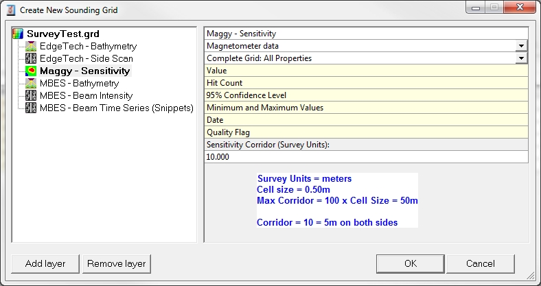
Storing magnetometer data to a sounding grid has the option to create a corridor perpendicular to the sailing direction. I.e. that the full path of the corridor is filled automatically with each single reading of the magnetometer.
To set this corridor width value, go to the layer properties in the Controller Session Setup, Storage, Sounding grid or use the Sounding Grid Utility, making sure that the layer type is 'Magnetometer data'.
The maximum width of the corridor is 100 times the minimum cell size of the sounding grid

