Console
HTML documentation server
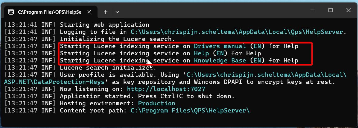
This version contains a new documentation/Help Server,
The new Help Server contains Help, the Knowledge Base and Drivers Manuals.
When pressing F1 it will open a web page for the related item:
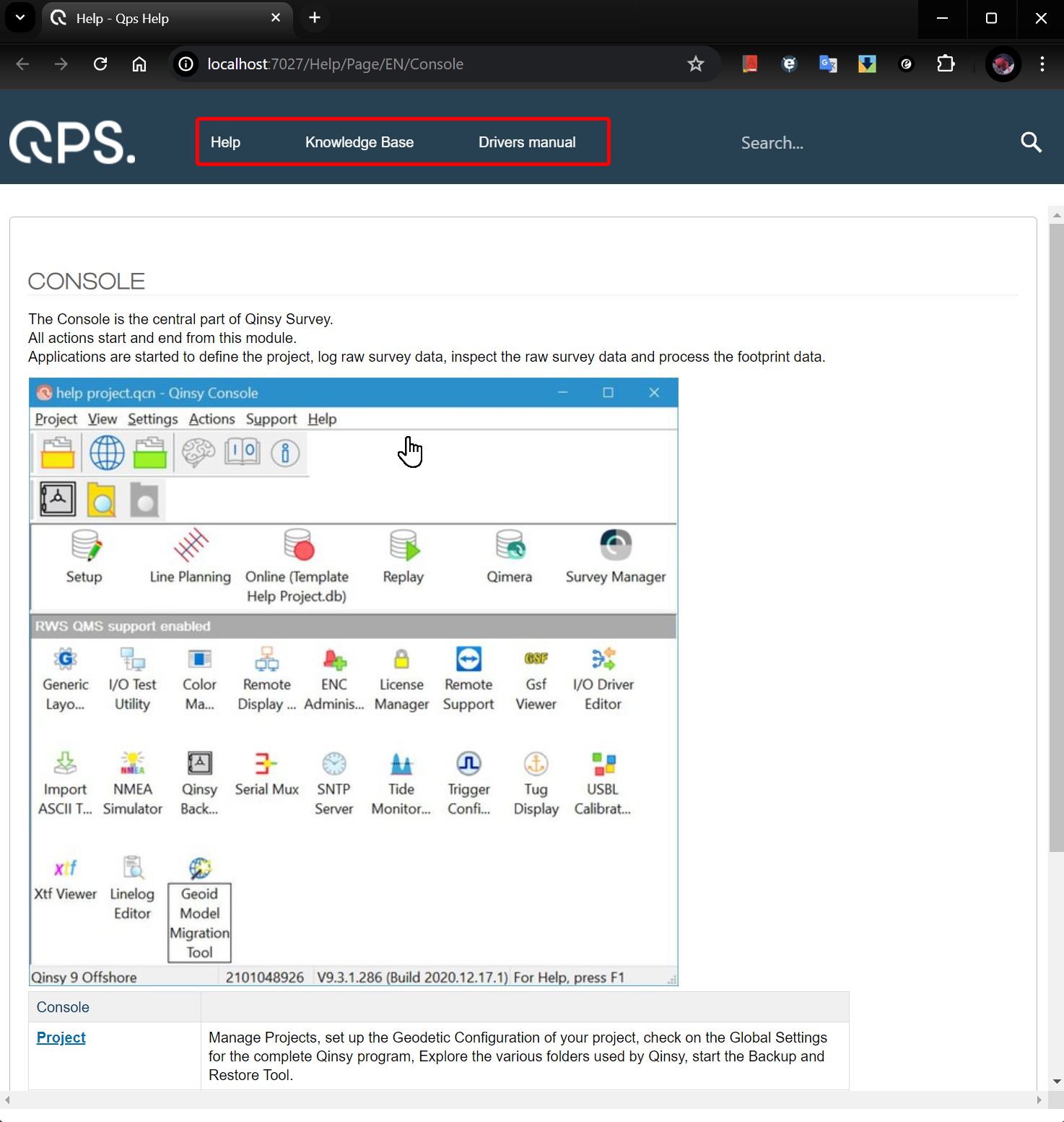
You can type a word in the search and it will then search all documentation sources.
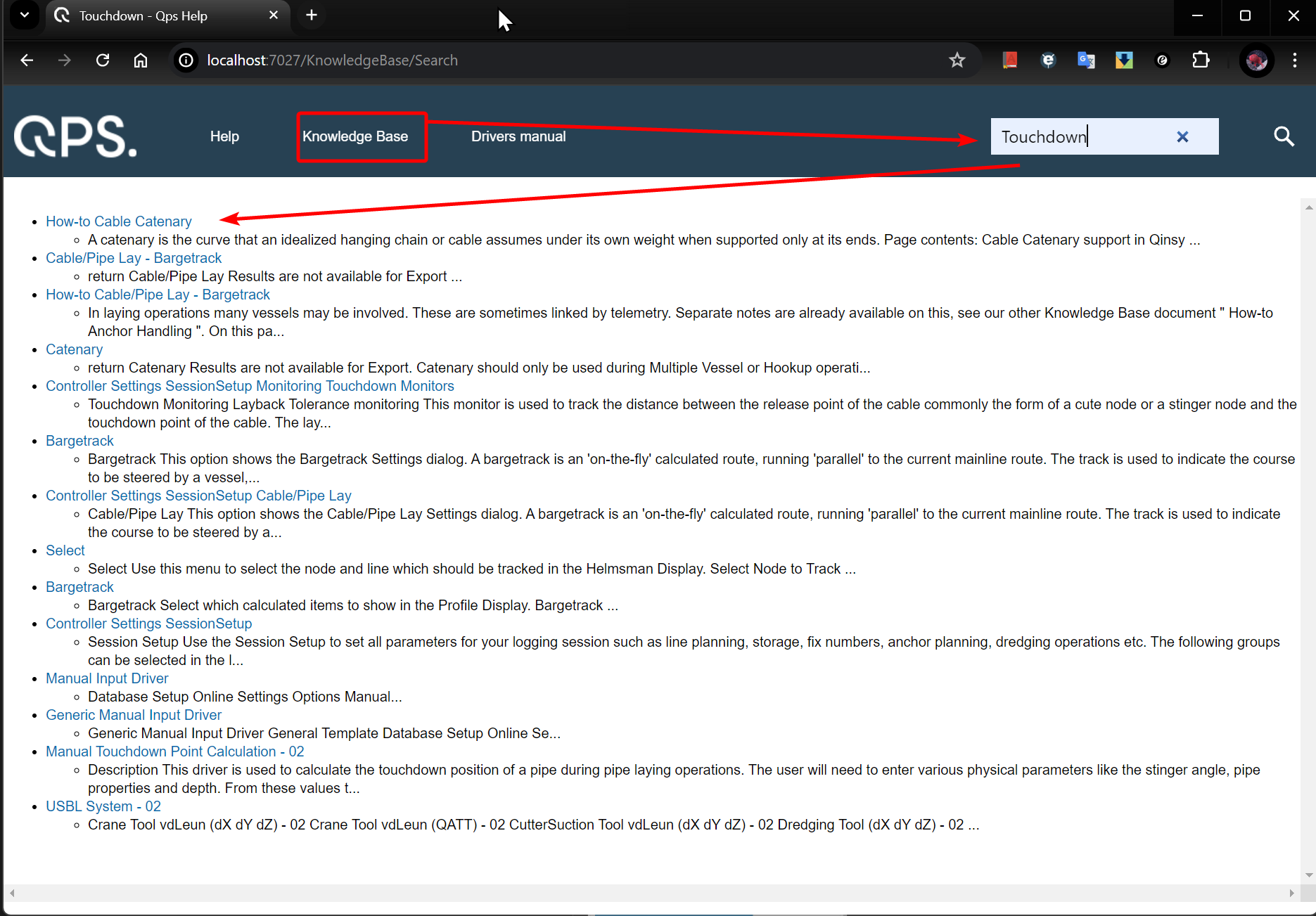
When you have first clicked on Knowledge Base (KB) and use the search (Touchdown) it will first list the KB articles and then the other sources:
If you first select the Drivers Manual and then search it will start with the DM results.
Work Around
This version contains a new documentation/Help Server, but the windows service has in some rare situations trouble starting up.
When you run into this problem you can use the following workaround:
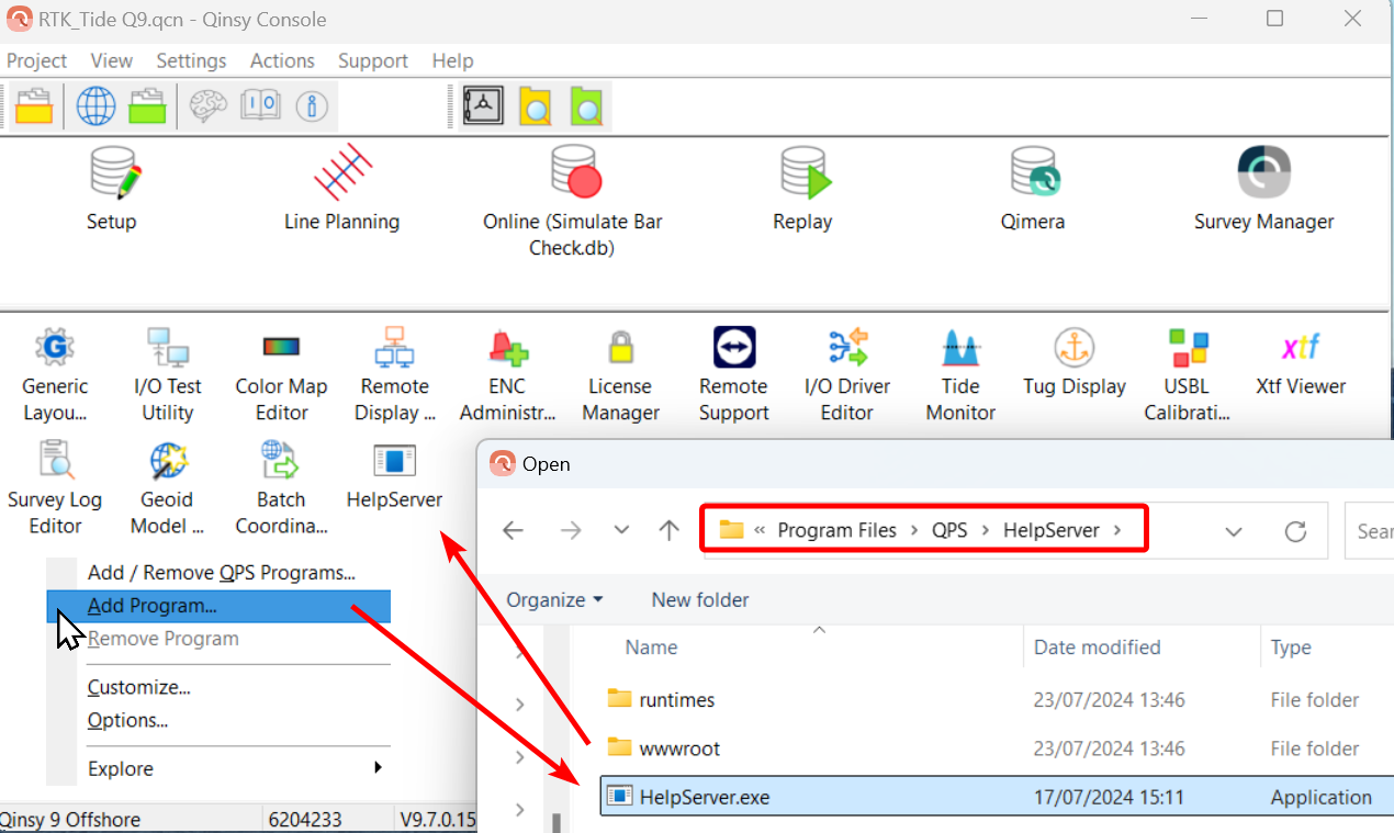
You can add the HelpServer.exe to the Console and you need to start it.
It will then open a window:
This can just stay open or be closed by Ctrl+C when no longer needed.
Online
Touch Down Monitoring (TDM)
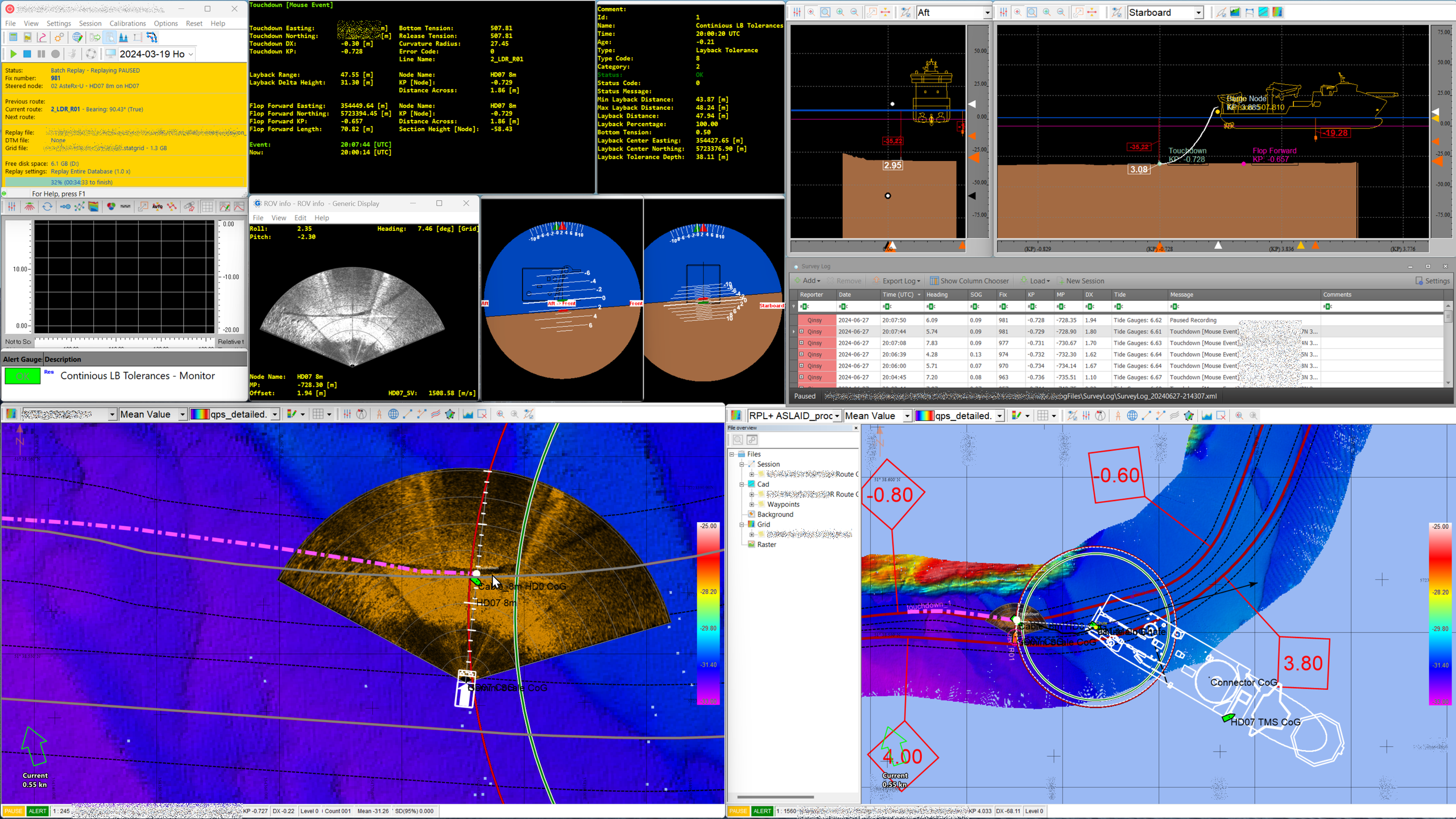
How-to Touch Down Monitoring (TDM)
How-to Monitor - Touchdown Layback Tolerances
Your license needs to contain the Cable Lay Add-on to use the Touch Down Monitoring functionality.
Grid Update Monitor
The Grid Update Monitor monitors a folder for New Qps Grid Update Packages (QGUP) files that can be exported to the Survey Manager.
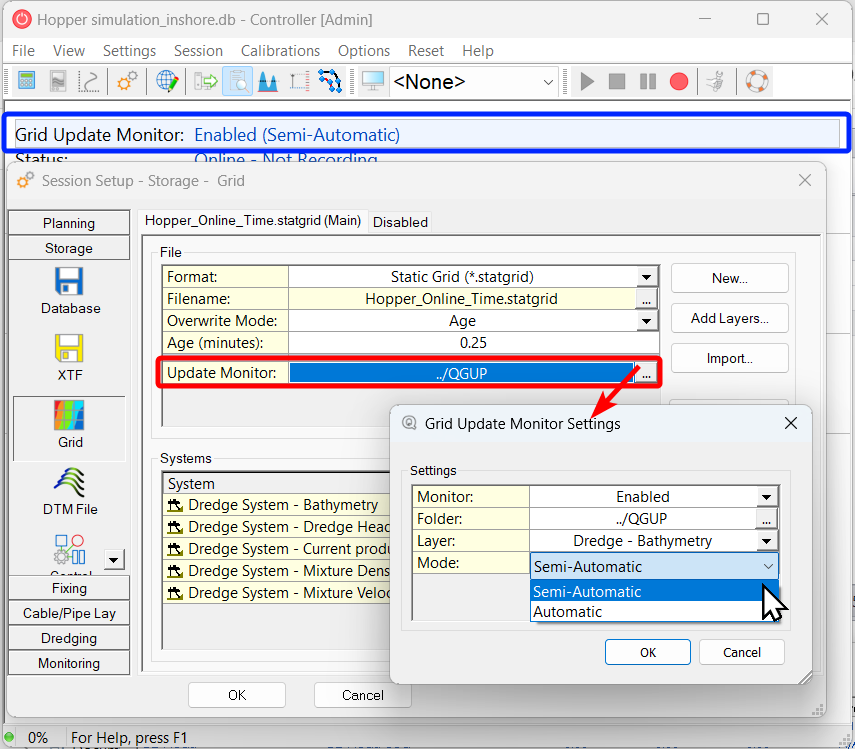
The monitor of offer 2 modes:
-
Semi-Automatic
-
Automatic
Read more...
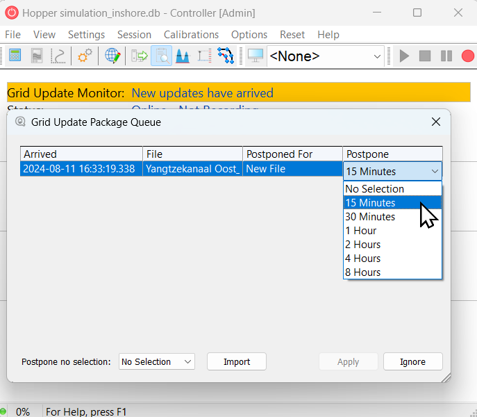
Semi-Automatic
When using semi-automatic a User Interface will pop-up that allow you to:
-
Import and update the Grid during recording, but we will pause the recording during the update
-
Postpone the update(s) per file or for all the (new) received files at once when operations do not allow the recording to pause
-
UI will pop-up gain when one of the postpone times has passed
-
When the file does not comply with the safety checks, warnings will be generated:
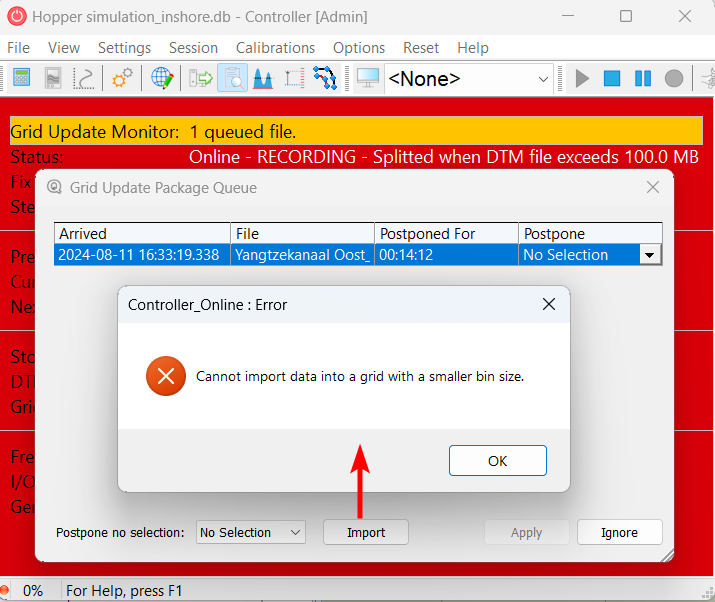
When a file cannot be imported it will be moved to the “Rejected” folder in de selected folder to monitor:
Default: <Project>\Import\QGUP\Rejected\
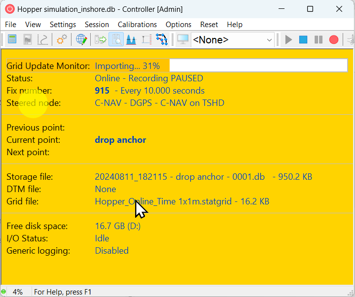
Recoding is paused during updating and progress is show.
After imported it will be moved to the “Completed” folder in de selected folder to monitor:
Default: <Project>\Import\QGUP\Completed\
QGUP arrival time and update time will be logged in the Online Survey Log:
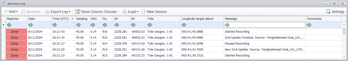
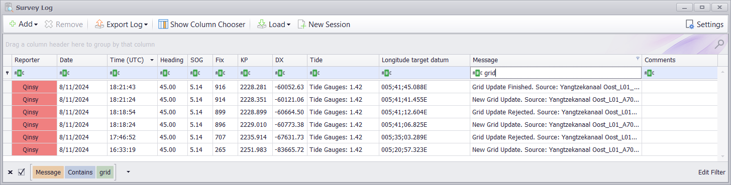
Default filter option allow you to get a quick overview which files have arrived, updated, rejected:
Automatic Updating
When Automatic updating is selected and Qinsy is:
-
Not recoding,
It will automatically update the Grid -
Recording
It will not show a UI but the Grid Update Monitor will change color and show that a file is queued: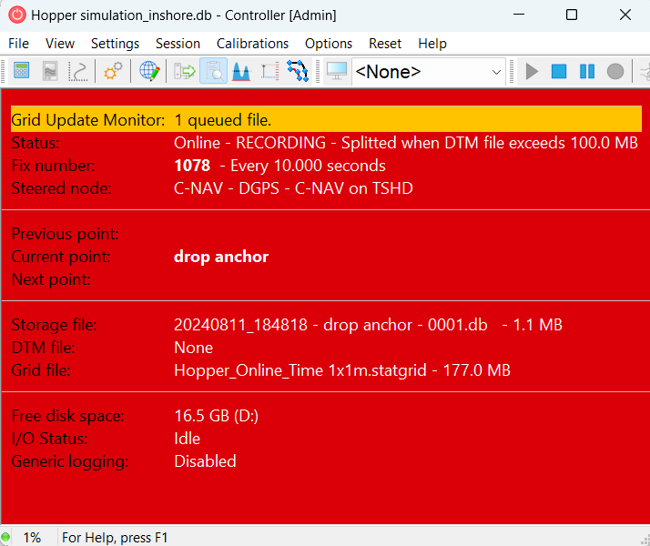
-
Click on the bar to get the UI and update the grid
-
Echosounder Settings
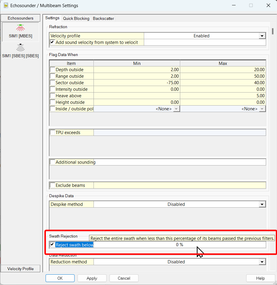
MBES Swath Rejection filter
The swath rejection filter clips all beams of a ping if less than the given percentage of its beams are still valid (i.e. not clipped/filtered/rejected) after applying any of the previous filters. This filter is always applied after the filters listed above it on this page, because their results affect the outcome of this filter.
SVP - Support Valeport .VDP format
The format name in the list has ben changed
from - Valeport 000 format (automatic detection)*
to - Valeport Data File - VDP/000 (automatic detection)*.
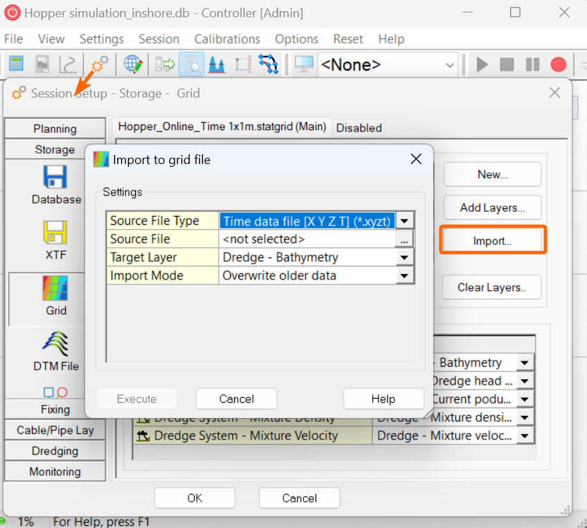
Session Setup - Storage - Static Grid - Import - *.xyzt
Grids can now be updated with predefined *.xyzt files, which can be exported by the survey manager
Displays
Navigation Display
Forward Looking Sonar (FLS) overlay
The forward looking sonar wedge can now be shown in the Navigation Display (See TDM above).
The FLS Wedge:
-
Is motion compensated
-
Transparency / Opacity can be altered
-
Color Map can be selected
-
Corrected for Sound Velocity (source can be selected in the echo sounder settings)
Survey Manager
CAD
Export - GeoJSON
We have added the export of GeoJSON format
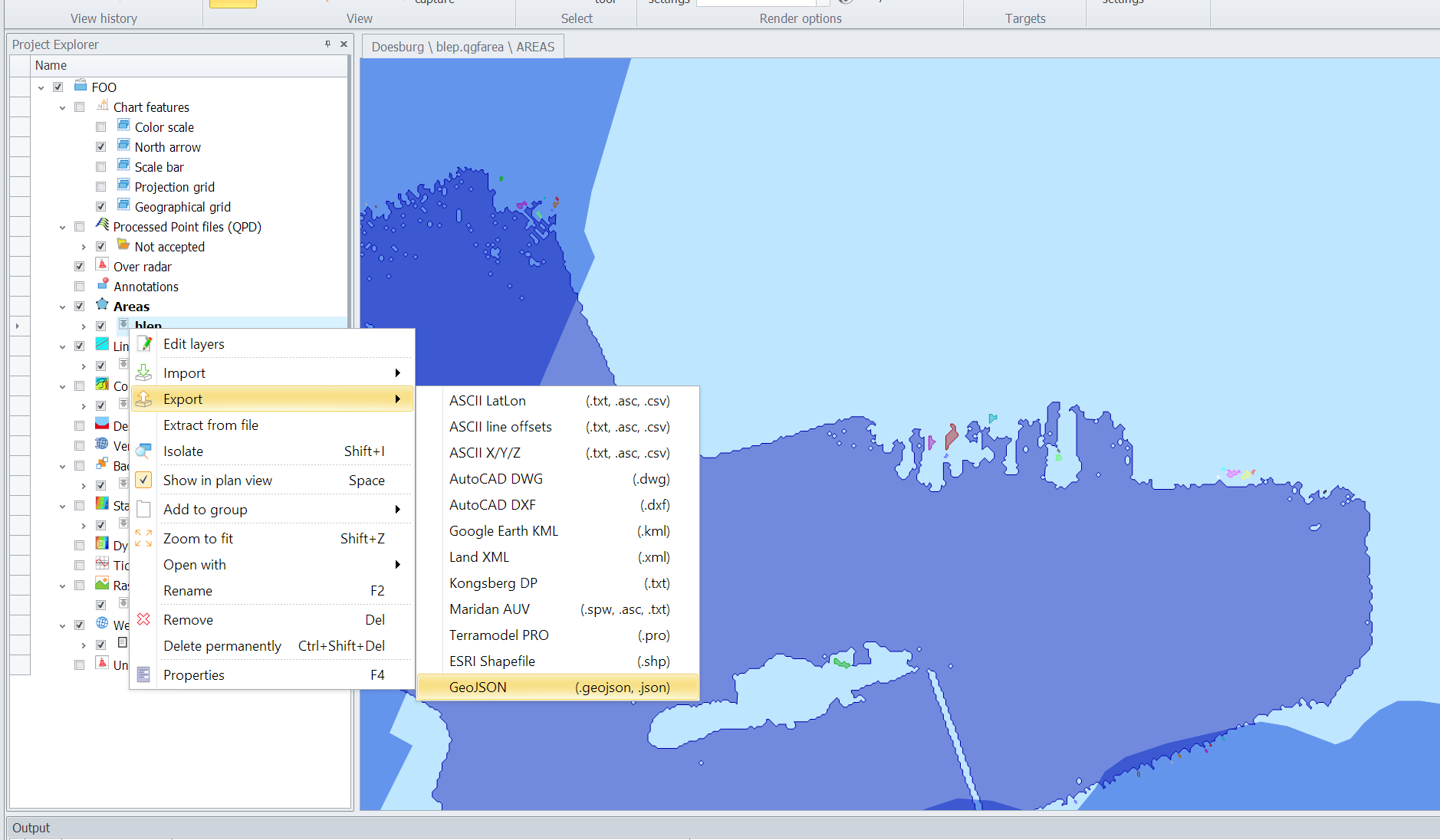
Be aware that GeoJSON is according to RFC 7946: The GeoJSON Format always containing WGS-84 coordinates (unless both parties have agreed otherwise).
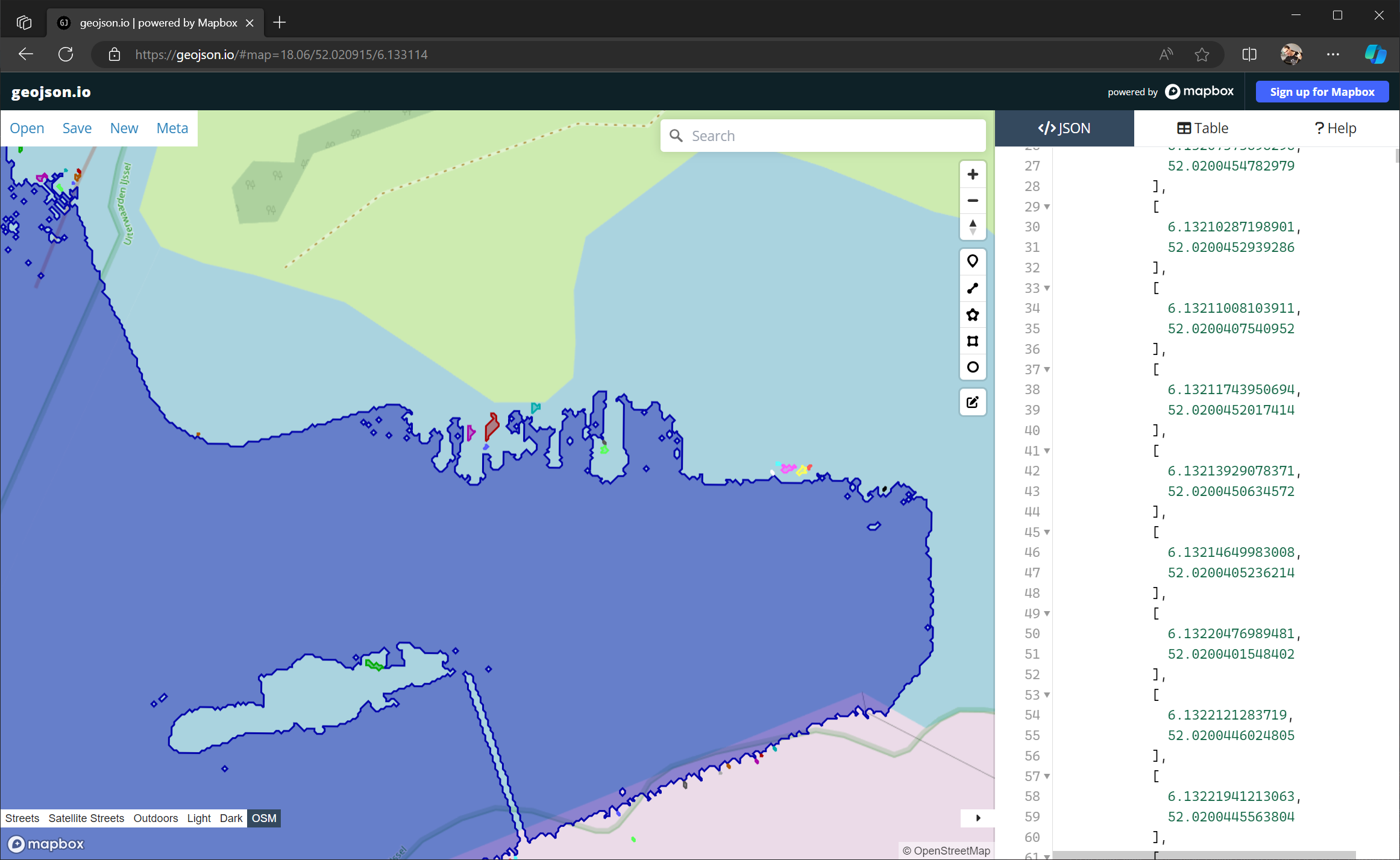
Import - GeoJSON
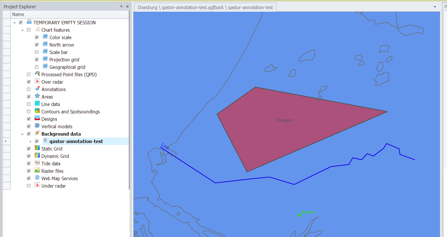
The picture above shows we also support line and fill colors (including transparency) and part of the icon set (“circle” shown here).
It must be noted that there is no single agreed-upon way to add style information to GeoJSON; We have added support for the Mapbox attributes since that’s what Qastor does.
Be aware that GeoJSON is according to RFC 7946: The GeoJSON Format always containing WGS-84 coordinates (unless both parties have agreed otherwise).
Grid - Export
Gridded ASCII - *.xyzt
We have added a default export for:
Gridded ASCII format E;N;H;T
E = Easting
N= Northing
H = Height
T = Time1970
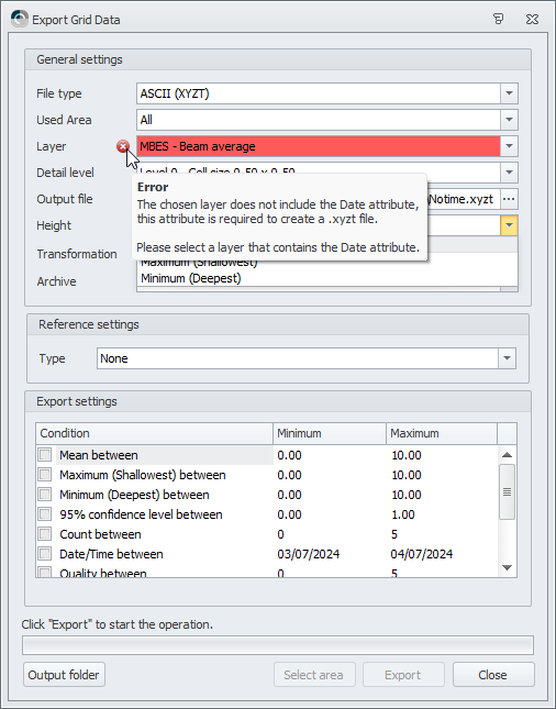
When you try to export a Grid layer without the Date/Time atribute, we will show you a warning and prevent you to export the format.
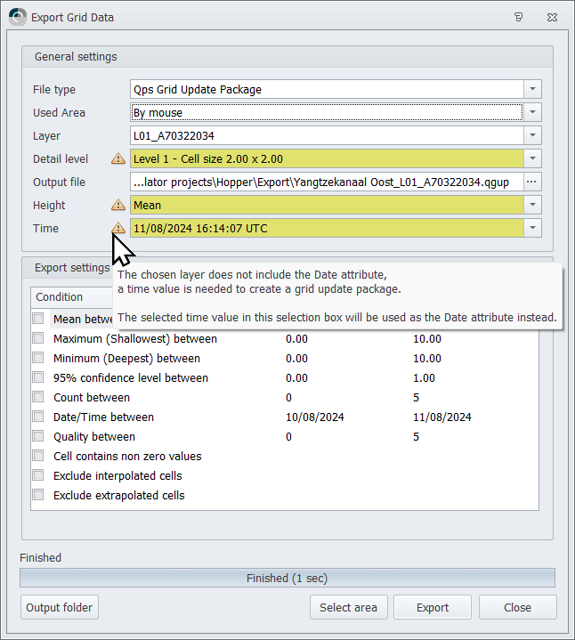
QGUP
You can now export a Qps Grid Update Package (QGUP) to you vessels that can be detected by the Grid Update Monitor while being Online with Qinsy.
When you export the file format a number of checks are in place to help the user in supplying the desired data Online.
Warnings are generated when data is missing or when the selection can cause unexpected behavior Online:
Plotting
Export - DXF
When exporting to DXF we will now export:
-
Grid as GeoTiff
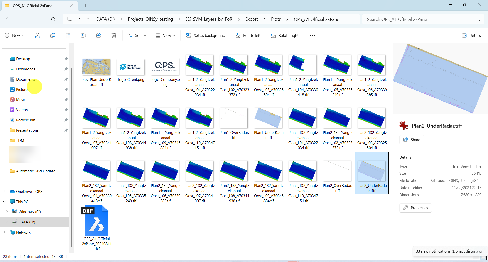
In Qinsy 9.6.0 you first had to create a GeoTiff of the Grid to be get a picture into your DXF,
We now generate a clipped GeoTiff for each enabled grid layer in each planview (viewport) -
ENC as GeoTiff
We now generate a clipped GeoTiff for the Under Rader and Over Radar layer in each planview (viewport) if the ENC is enabled -
QGFanno
Can now be exported to DXF
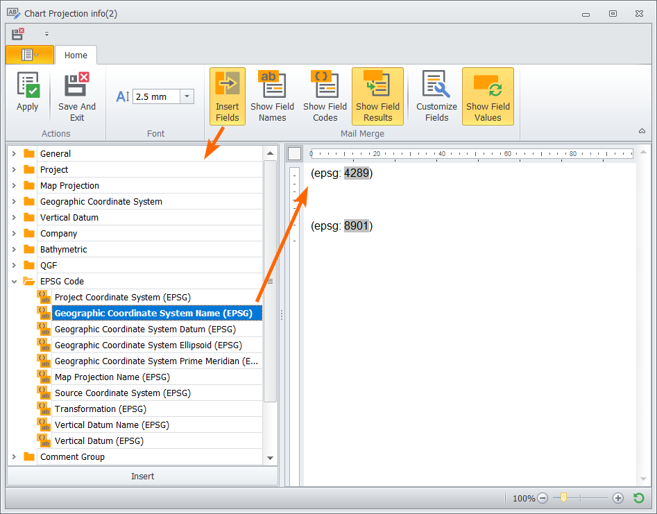
Template - Merge Fields - Logic and Names vs Results
We improved the logic for merge fields and by adding a side pane for selecting the items and now offer you to show to toggle between the Field names and Field results