
General
Color Map Legend - DPI aware
In this version we have updated the colormap legend to be DPI aware. This is solving a number of displaying issues when working with monitors with different resolution settings.
License Check
We now only shown a warning in the Console and no longer pop up warnings when a license or maintenance period is about to expire :
-
No longer any messages when opening Setup/Online/Replay
-
No messages when opening SVM:
Online we show a similar message in the Navigation Display, to make sure that people in 24/7 operations do get notified.
Drivers
INS
SBG
Reason for improvement:
Some of the supported slot values became absolute.
Solution mode needed to represent GNSS and INS status
The Improvements
The Slots Id’s have changed and are automatically upgraded by Qinsy 9.7.0 and newer versions.
You would run into problems when creating a template in Qinsy >=9.7.0 and going back to 9.6.4. The driver won’t decode due to different Slot IDs
For the new solution modes, please refer to the drivers manual:
https://qpssoftware.scrollhelp.site/dm/sbg-systems-position-12
Output
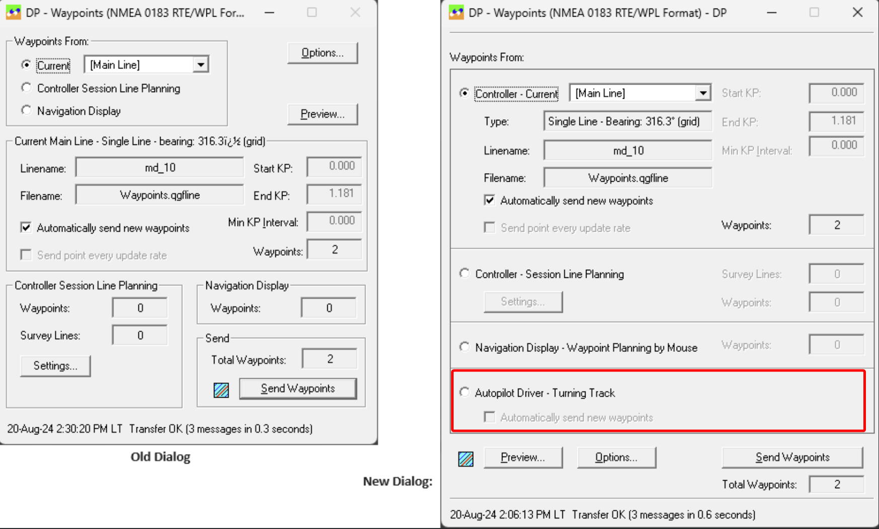
Waypoints - Option to send the AutoPilot turning track and swath track
The turning track and automatically calculated next (swath overlap) track from the https://qpssoftware.scrollhelp.site/dm/autopilot-with-turning-track-15 driver can now be outputted by several waypoint drivers.
We added a fourth option as source for the waypoints to send:
“Waypoints From: https://qpssoftware.scrollhelp.site/dm/autopilot-with-turning-track-15 “
The dialog’s user-interface has been re-arranged in order to fit the new option
Pipe / Cable Trackers
TSS-350 - Extend driver to decode and store more data
The following items can now be decoded as Miscellaneous observations.
-
LAT,
-
VRT,
-
SKEW - (Skew only available in for 'S' string)
The following items were already supported by drivers
ALT - Altitude or depth - could be decoded using Underwater Sensor
COV - Depth of Cover - already existed as Miscellaneous observation.
Renamed slot names but backwards compatible.
TSS-440 - Implement Beam 2 as a singlebeam
Based on the meeting with the client we decided to use the altimeter field directly for the SBES system instead of beam 2 of the MBES system.
The Depth of Cover is a calculation based on Vertical offset and Altitude and we are recomputing a altitude from the Vertical offset and Depth of Cover.
Manual Pipe/Cable Tracker
For a better indication of the Depth of Burial (DoB) during ploughing we added the option to add a manual Pipe/Cable Tracker driver to your setup:
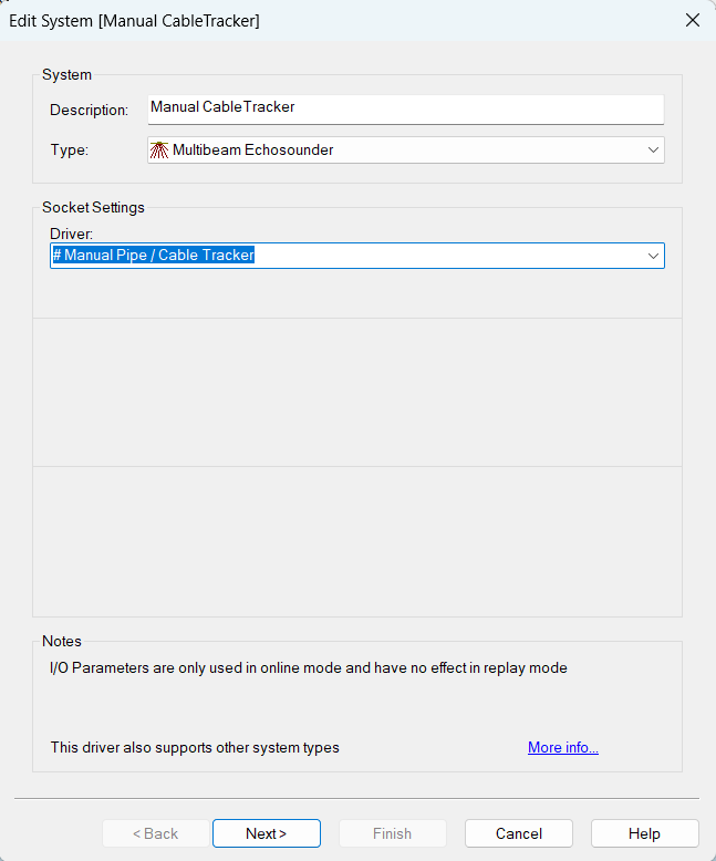
The manual observation wil be stored in the DB and the results will be stored in the QPD, which will allow you to process it in Qimera
Online
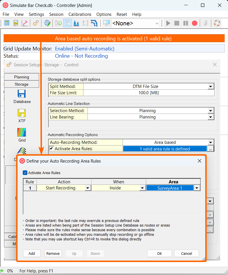
Session Setup - Storage - DB - Area Name
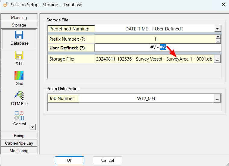
#A: Names of the areas used for Auto Recording
Allows you to automatically include the Survey Area name used during:
Session Setup - Storage - Static Grid - Bathymetry - default date and time
When creating a new grid with a layer type “Bathymetry” date and time are default enabled:
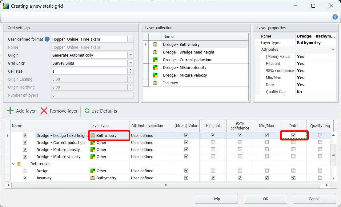
This change was done to make sure people use date and time in Grids to make it easier to update grids with files based on time. This also aims for better workflows with the new available exports:
-
*.xyzt
-
*.qgup
Adding a date and time will increase the grid file size
Displays
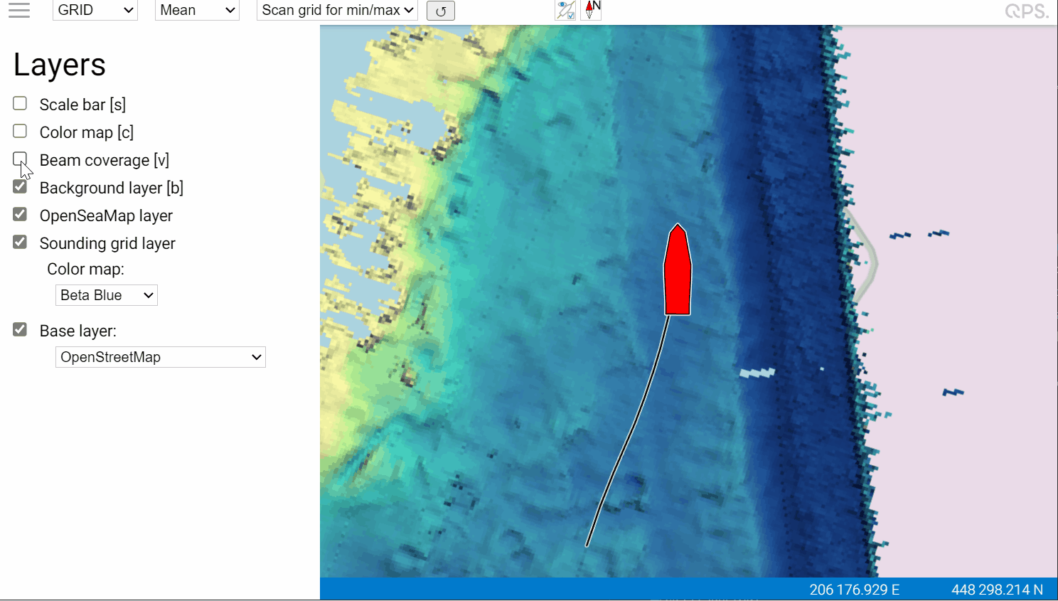
Beta Navigation Display (NavigationJS)
MBES Coverage limits
MBES Coverage limits of each head is now showing Port side red and starboard side green
The coverage limits can be turned off:
Navigation Display
AIS - Filtering
When the survey crew is boarding a vessel the AIS transponders can already be present on the vessel/barge. Because these systems are regular part of the Vessel Equipment the survey crew is not always allowed to interface to those transponders.
Instead the survey crew will install an AIS receiver. This receiver does not know the MSSI number of the Vessel/Barge and therefore the existing driver would decode this target too and show it on top of our object shape.
We added filtering of AIS target in the Navigation Display, which only effects the displaying of the targets and not the recording of the data.
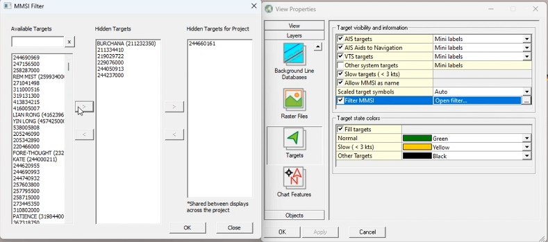
Filtering/hiding AIS targets can be done locally the display, but we also offer the option to hide the targets in all the Navigation Displays of the project.
SSS - Removed scale factor
In the past we applied a scale factor to the sidescan data. Due to changes internally this is no longer required and has therefore been removed.
You can now use the same range for your color map as used in the sidescan display.
Survey Manager
Session files
Session files were stored as binary file, but are now stored as an INI file.
CAD - Area
Highlighting selection
Highlighting an area has been improved:
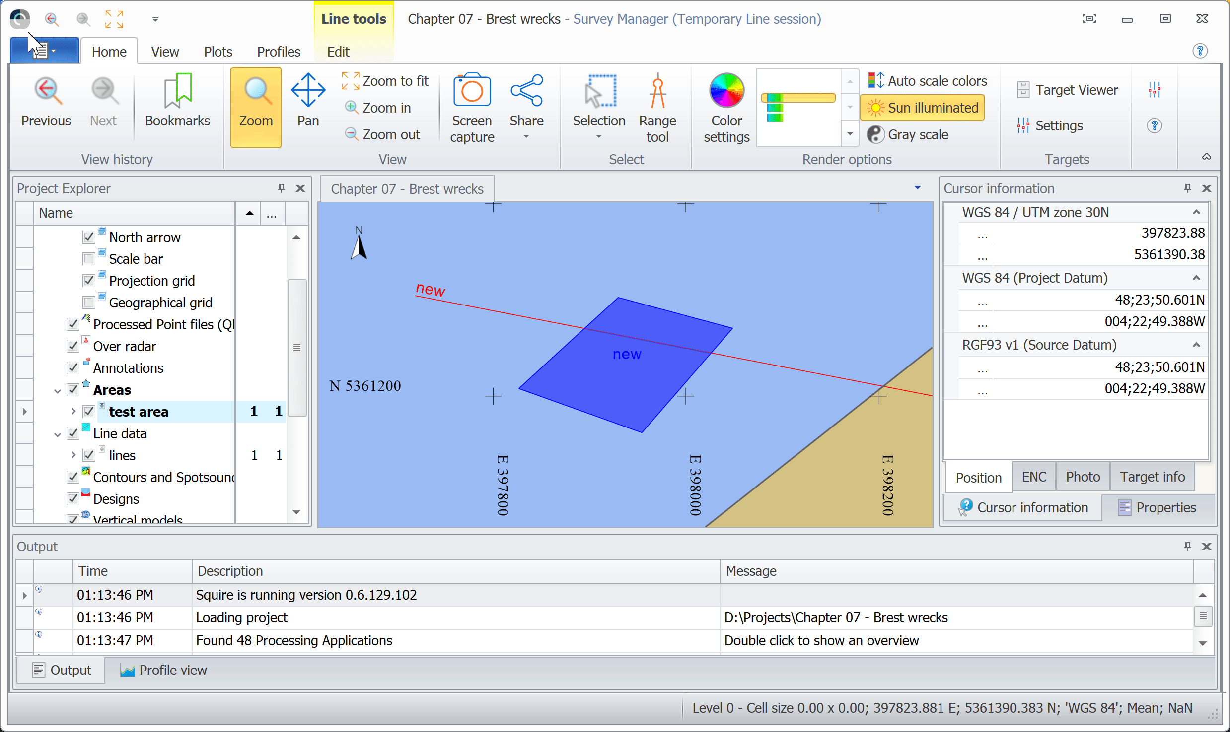
CAD - Line Planning
Active Route - Show bearing of route section
The cursor information now shows the True and Grid bearing of the active route.
Operations - Drape - Extract height from surface for multiple points
You can now select multiple:
-
Points
-
Lines
-
Polylines (Routes)
and drape them om a Grid surface. the result can be stored on a separate layer
Grid - Statistics
Qinsy is now using the same Grid Statistics API as Qimera
Plotting
Copy settings
We have improved the options to copy settings from one plot element to another.
You can either make a change to a setting and copy all the settings:
Profiles - Cross Profiles - Mirror option
For plotting we now offer a setting to mirror your profiles. This is sometimes used when working with decreasing KP’s.
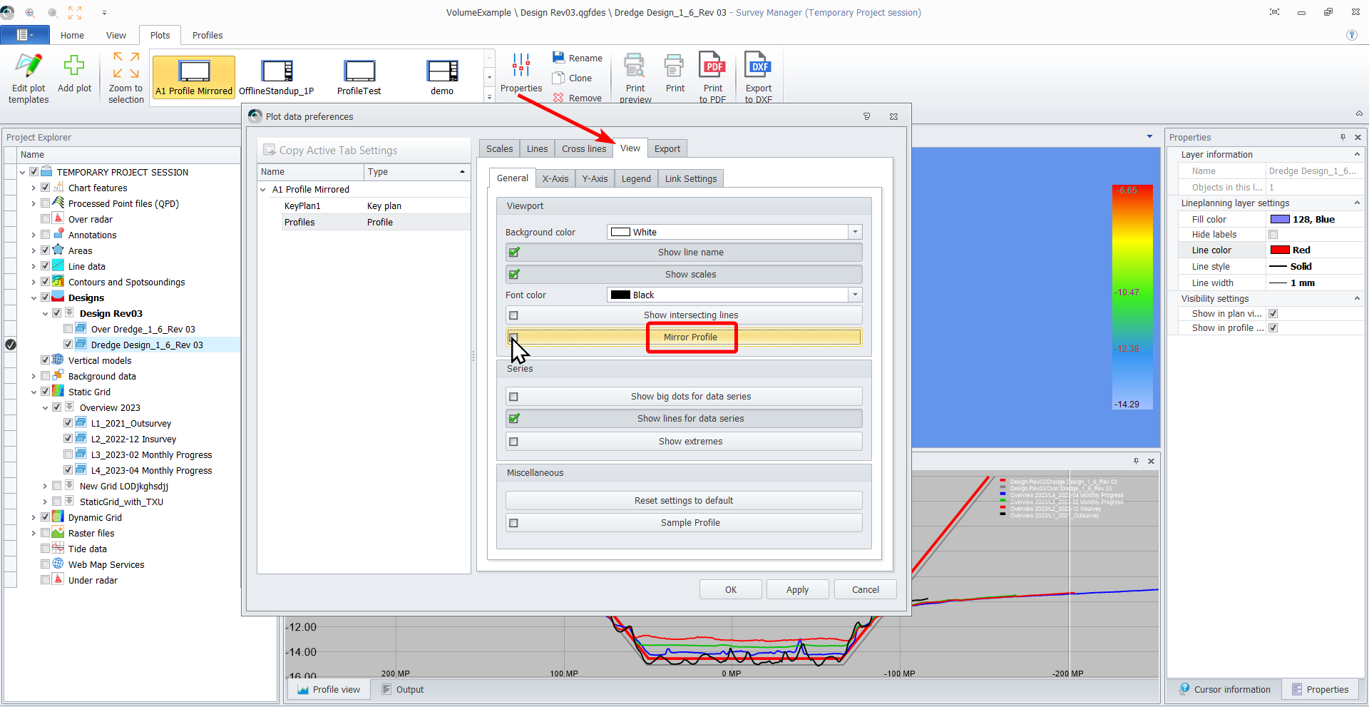
Profiles - Mirror option
Cross Profiles are normally show looking in the direction of increasing KP or MP.
When working on roads you might notice that the the hectometer signs are sometimes decreasing in the driving direction. When working on that road you might want to see the road profiles in the direction you are driving.
A similar case might be applicable when a canal/river route is increasing from inland to sea and the project is working from sea inward.
For the two above use cases we made it possible to mirror the profiles for displaying (and plotting):
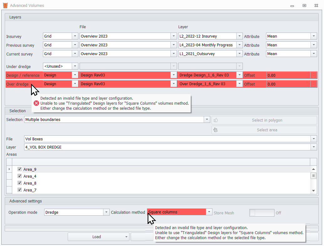
Volumes - Advanced Volumes - Input field checks
We added additional checks on the inputs fields to highlight them when the selections cannot be used in their current state.
Below an example, but their are many more scenario’s covered:
QPD
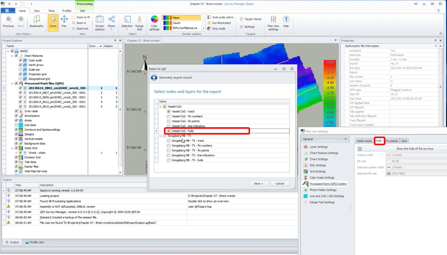
Export - Hull / Boundary / Edge to CAD/GIS
The QPD Hulls can be exported to a Background file (*.QGFback) and then be exported to other file formats like DWG/DXG/SHP/ect.
Other
In order to upgrade to .Net Core 6 and 8 the projects and libraries are upgraded to MSVC v143.