Skip table of contents

How-to Use/Setup RTK Tide

RTK Tide is a term used more often in our industry and can mean different things. This document is aimed to explain what we mean by it in Qinsy.

What is RTK Tide in Qinsy?

Click here to expand...

If you use RTK-Tide in Qinsy, you are filtering the Height of the waterline, calculated based on:

  • GNSS Height;

  • Offsets to COG;

  • HADR (Height Above Draft Reference) - Height difference between COG and Draft reference;

  • Draft;

  • Heave;

  • Squat (if used).

This calculated Height can then be used as a Tide input.

In case you would like to know more on how this is calculated exactly, please have a look at the following document: How-to Height - Tide and RTK

When might you want to use RTK Tide?

Click here to expand...

There are several situations in which you might want to use this:

  1. I want to use RTK-Tide since my GNSS is not always accurate enough
    See info box below.

  2. I want to use RTK tide and Tide as backup
    See info box below.

  3. I want to use Tide (more accurate) and want to use the filtered GNSS height as a backup

For each of the three situations, you will need to setup your Computations slightly different.
More info on this can be found here.

The following situations might be a reason to use RTK-Tide instead of just using the GNSS height directly:

  • Your GNSS height is noisy and you would like to average out the noise;

    • This could be due to bad RTK reception;

    • This could also be because the PPP correction is to noisy.

  • Your GNSS height is sometimes showing jumps which can be filtered out;

Note that you could also consider:

  • Improving the reception of you correction signal;

  • Post Processing your Positioning data;

  • Using an INS, with possible additional inputs (DVL for example), to improve position results.

When is RTK Tide not needed?

Click here to expand...

Most of the time there is not need to use this.

  • Accurate Height input
    If you GNSS/INS is working fine (no jumps) and accurate enough to meet the survey specifications. This can be by using an RTK correction, but for some surveys PPP corrections would already be sufficient.

    • Using RTK-Tide will not give you a higher precision/accuracy.

  • Tide input
    In case your GNSS is not accurate enough in Height and your Tide input is accurate enough, you can just use that. The tide values coming from a nearby tide station are then more accurate then filtering a waterlevel based on a GNSS signal that is not receiving corrections (several meters).

  • Post Processing
    In case you are post

Computation Setup

As explained above, there are several ways of using RTK Tide.
For each scenario, you will need to setup your Computations differently.

How this should be done, is shown below.

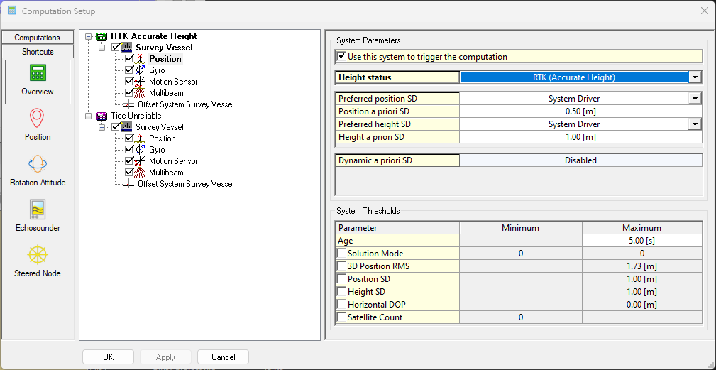
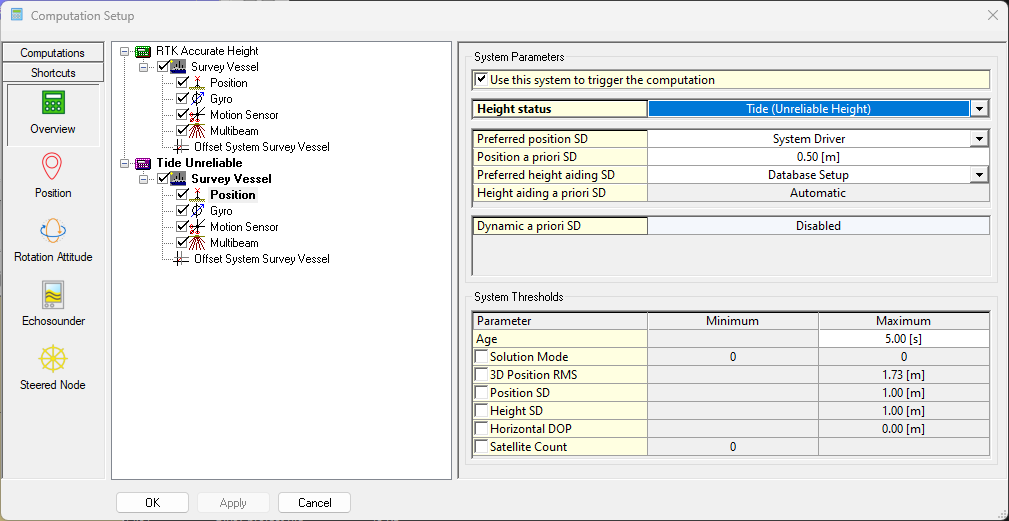
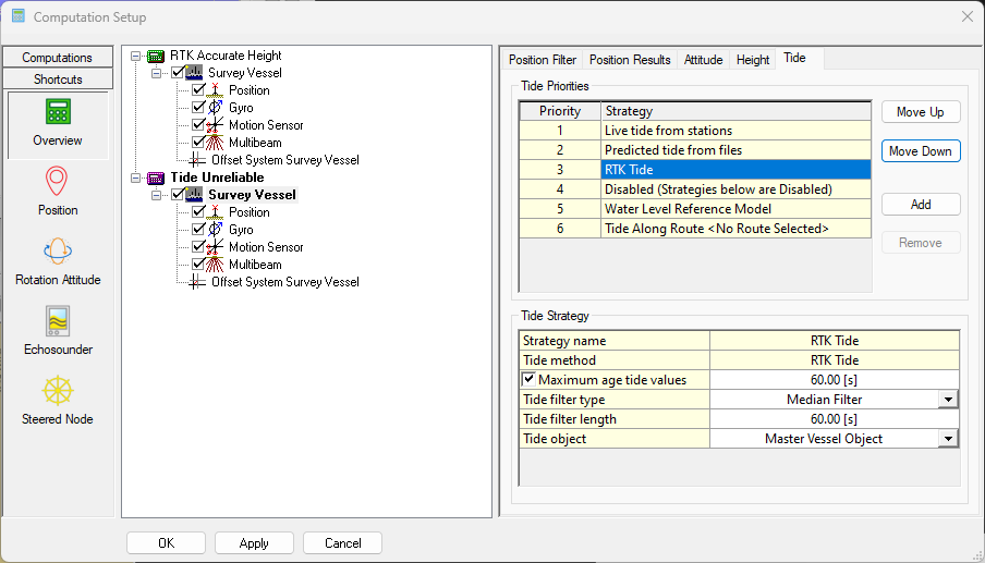
Make sure that there are at least two computations available:

  • One with Accurate Height

    image-20250103-144358.png

Make sure that this computation only has one Vessel object enabled (so no SSS, ROV, etc.).

  • And one with Unreliable Height.

    image-20250103-144415.png

Scenario 1: I want to use RTK-Tide since my GNSS is not always accurate enough

Click here to expand...
  • The GNSS of the primary computation is set to Unreliable;

  • The GNSS of one of the lower priority computations is set to Accurate;

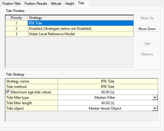
  • RTK Tide is set to the highest priority in the Tide tab:

    image-20250103-144912.png

Scenario 2: I want to use RTK tide and Tide as backup

Click here to expand...
  • The GNSS of the primary computation is set to Unreliable;

  • The GNSS of one of the lower priority computations is set to Accurate;

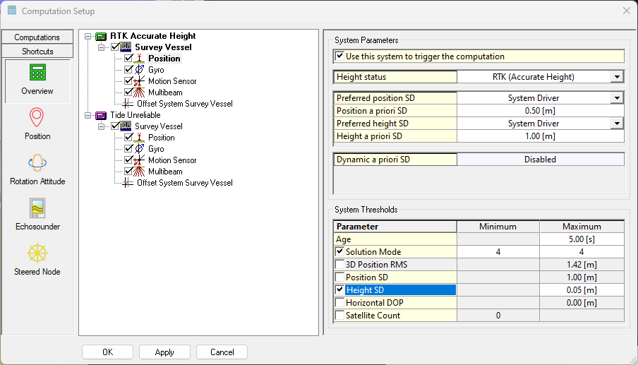
  • It is important that you set Thresholds on your GNSS system in the Accurate computation.
    This so it fails when RTK corrections for example are no longer received and then Tide can take over.

    image-20250103-151024.png

    Both a solution mode (RTK is usually 4) and Height SD are used.

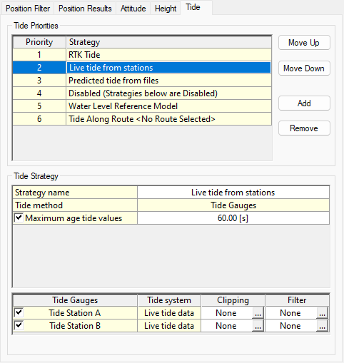
  • Setup your Tide strategies in order, below the RTK tide as shown below:

    image-20250103-150526.png

Scenario 3: I want to use Tide (more accurate) and want to use the filtered GNSS height as a backup

Click here to expand...
  • The GNSS of the primary computation is set to Unreliable;

  • The GNSS of one of the lower priority computations is set to Accurate;

  • It is important that you set Thresholds on your GNSS system in the Accurate computation.
    This so it fails when RTK corrections for example are no longer received and then Tide can take over.

    image-20250103-151024.png
  • Setup your Tide strategies in order, RTK Tide should be below the tide strategies:

    image-20250103-151439.png

RTK Tide - Staregy settings

This part explains what each setting does.

Click here to expand...
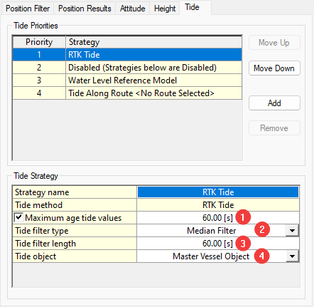
image-20250103-151950.png

Maximum age tide values

This is the time the RTK Tide will be used after the Computation fails.

1

Tide filter type

  • Median filter (suggested in case you have spikes);

  • Mean filter.

2

Tide filter length

The higher you set this value the better your filtered tide might be. Be sure to not set this to high. If you have actual tide changes they might show up as height shifts in your grid.

3

Tide object

  • Master Vessel Object;

  • Own Vessel Object.
    The Own Vessel Object option will compute RTK Tide values for each accurate object individually, whereas the Master Vessel object will only compute one single RTK Tide value.

Regardless of which tide object option is selected, only above-water objects with accurate heights will be used for the tide filter.

Info

The option RTK Tide can be used Online and also in a Replay.

Displays

Click here to expand...

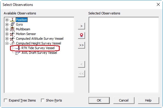
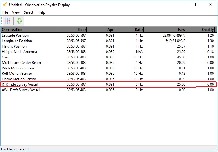
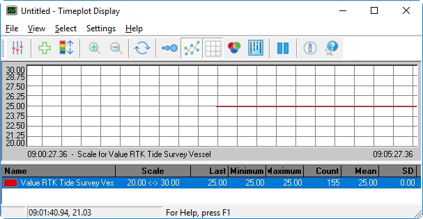
The RTK Tide will automatically be added as an Observation in the database.
This observation can be used in the same way as any other observation in Qinsy.
It can be found under Computed Height of the Object.

Alert Display

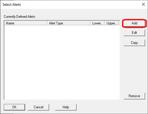
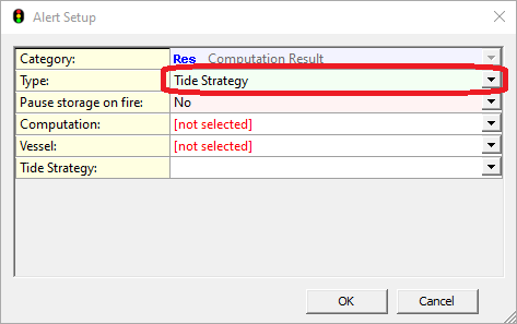
By adding an alert, it is possible to visualize in real time if the available tide strategies are working.

Select the Add alerts Button as shown below:

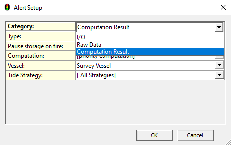
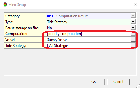
The Tide Strategies can be found under the Computation results, where you will have to select:

  • Computation: Pull down menu with list of available computations for this condition. If the priority computation is selected, the alert display is automatically updated when the steered node changes.

  • Vessel: Which Vessel to monitor the tide strategies for.

  • Tide Strategies: Choose which of the available tide strategies to select, 

Info

If the selected Tide computation is working it will display an 'OK' otherwise it will display a red 'Alarm'

Observation Physics

Timeplot

Generic Layout Editor

Click here to expand...

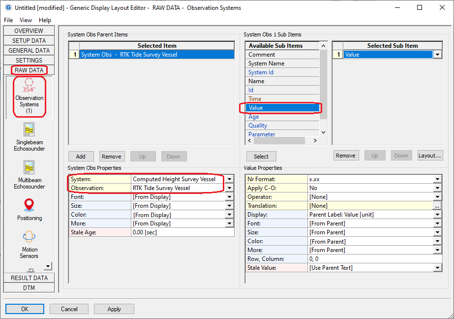
It is also possible to select the RTK Tide value using the Generic Layout Editor.
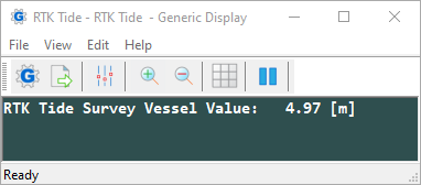
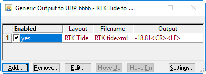
The value can be shown in a Display, in a Logfile or Export file and can be output to another system.

In the Generic Layout Editor select the RTK Tide Value under Observation Systems from Raw Data.

Info

Note that this item is the same as item Tide under Height Aiding, or as the item Tide under Tide Results.

Generic Display

Generic Output

Generic Output 

For more information on setting up a Generic output, please refer to our Drivers Manual:

  • Output Systems: Generic Output (User-defined ASCII) - 15

Generic Export

Depending on the information you want to export, you will need related source files like:

  • QPD

  • DB and Res(ults) 

Any combination is possible when available, but be aware that some RAW data are not available for export.

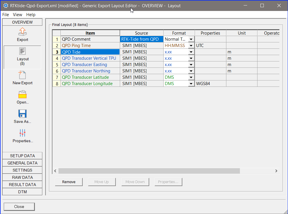
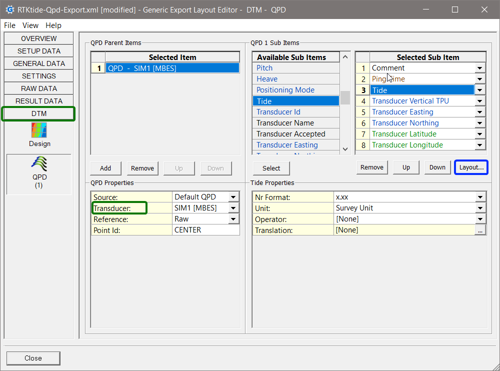
QPD Export

Help for Generic Display Layout Editor

More information on the use of the Generic Editor can be found in this part of the Knowledge Base: Generic Layout Editor.

Return to: How-to Computation Setup
JavaScript errors detected

Please note, these errors can depend on your browser setup.

If this problem persists, please contact our support.