
Height 3D -RTK- Settings
When using an accurate GNSS system, the following settings should be used in Database Setup and in the Computation Setup of the Controller.
The pictures that are displayed are only examples, settings may vary world wide.
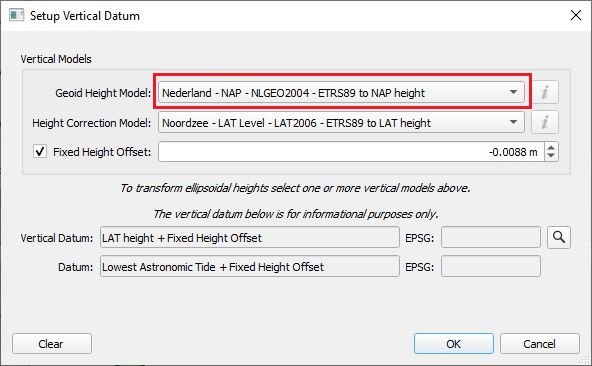
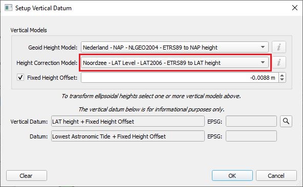
Geodetic Configuration
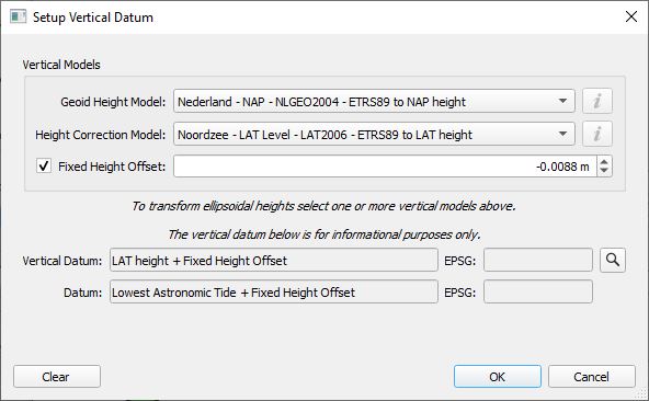
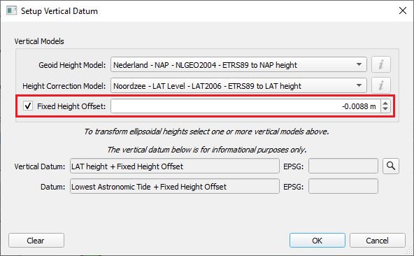
For RTK tide, we still want to set up the Chart Datum, in case we would like to define a reference plane for the published heights.
- Define your Horizontal (and vertical) Datum
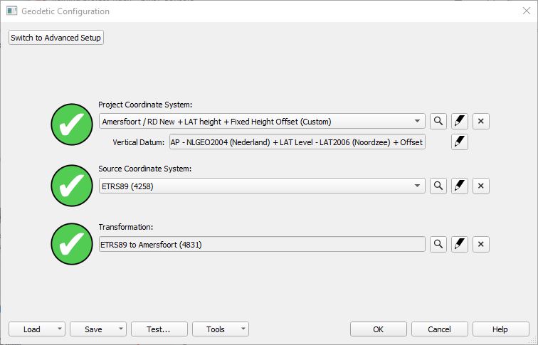
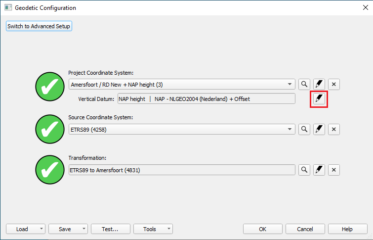
Database Setup settings
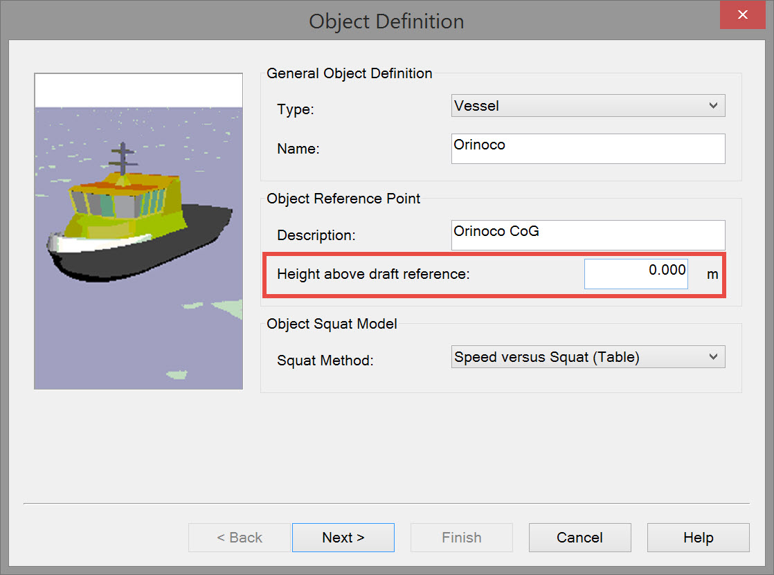
Height Above Draft Reference
HADR is used to compute the actual water level, however it is not used to determine the height.
In other words, in strict 3D accurate positioning, this value is not used in the computation and can be left at zero.
However, if working with a towed object or ROV that is providing depth relative to water level, you will need to set up a HADR and a Draft online.
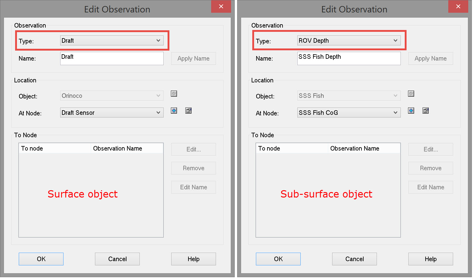
In case of using a sub sea system it is good to think about having a real live draft input and a Depth sensor on your sub-surface object:
- Define an underwater sensor system ('Draft' observation) on the surface object.
- Define an underwater sensor system ('ROV Depth' observation) on the sub-surface object.
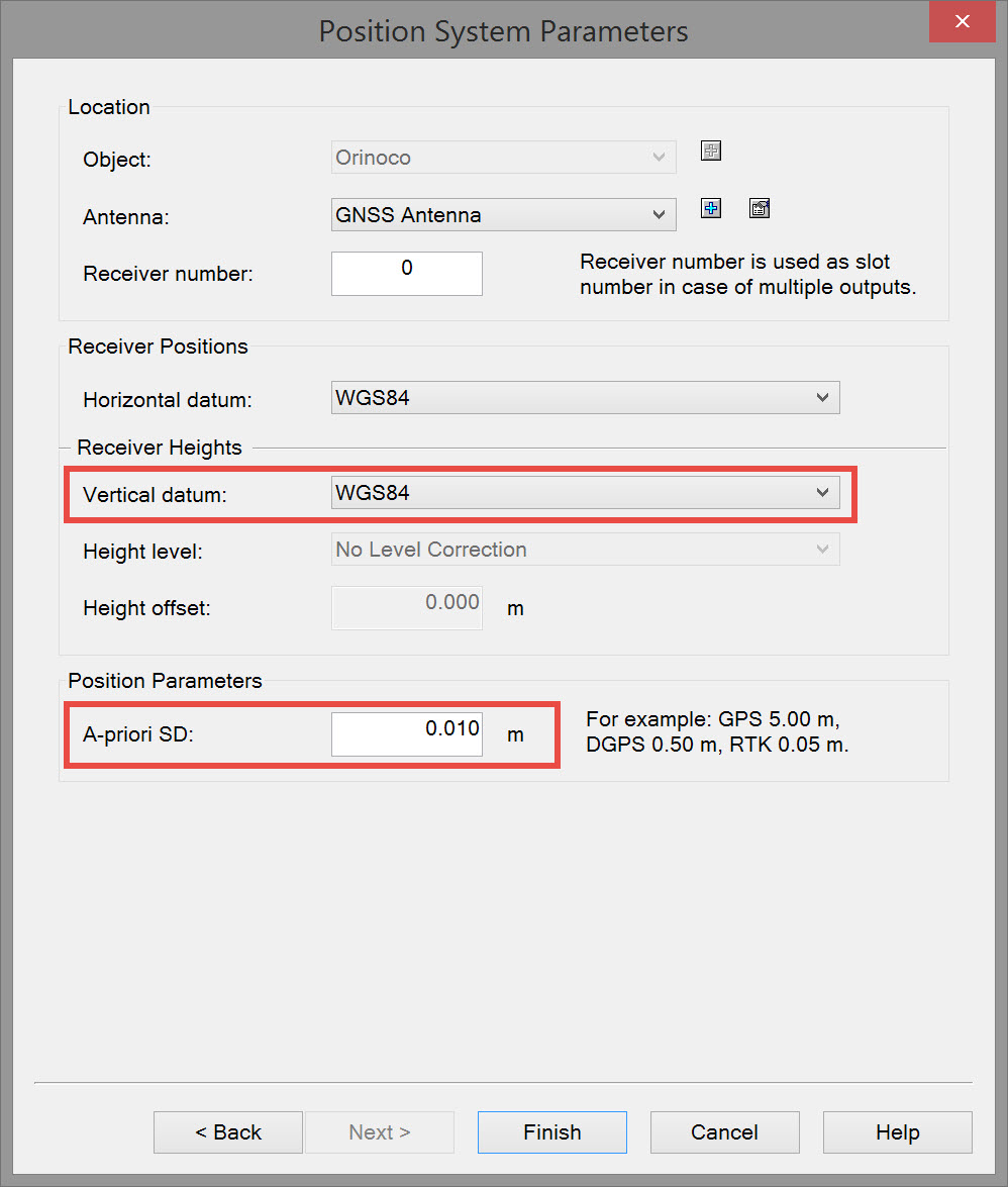
Positioning System
Define a Positioning System and the Receiver Positions/Heights in the Driver Setup.
- Make sure to check what the reference datum is for the receiver data output. It is not always WGS84.
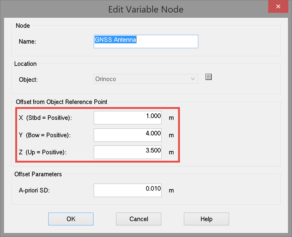
Define the exact location of the Positioning System relative to the CoG of the vessel.
- Make sure to define all other systems relative to the CoG as well.
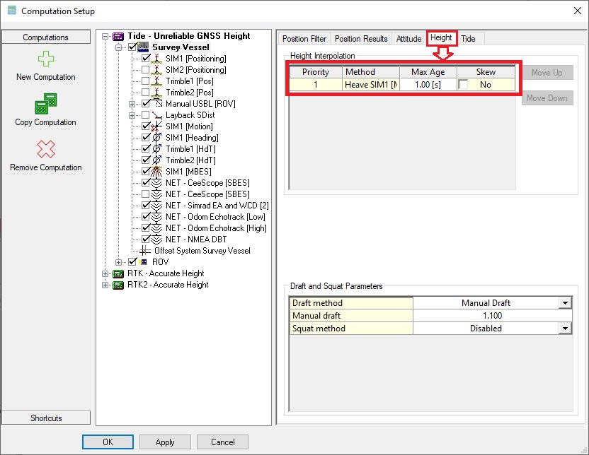
Computation Setup settings
Set the Height status of the positioning system in the Online - Settings - Computation Setup to "RTK (Accurate Height)".
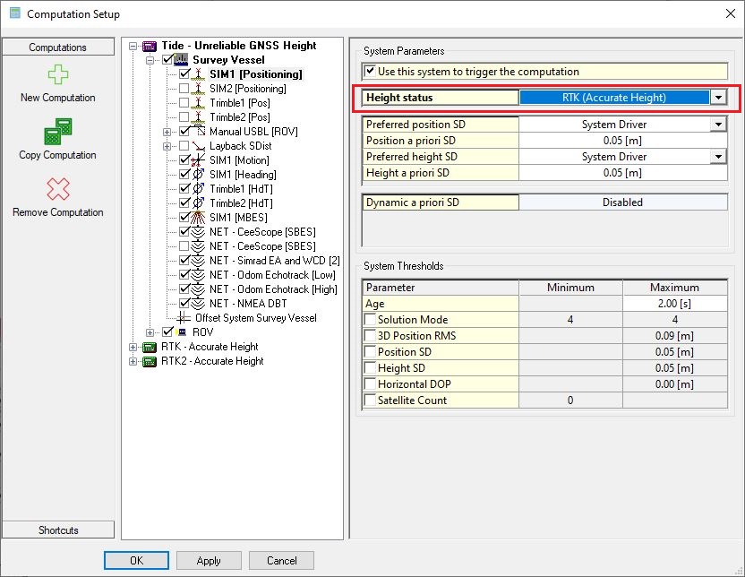
Set the correct Priority for the heave sensors on the object (only in case of a redundant system).
Return to: top of page.
Return to: How-to Height - Tide and RTK
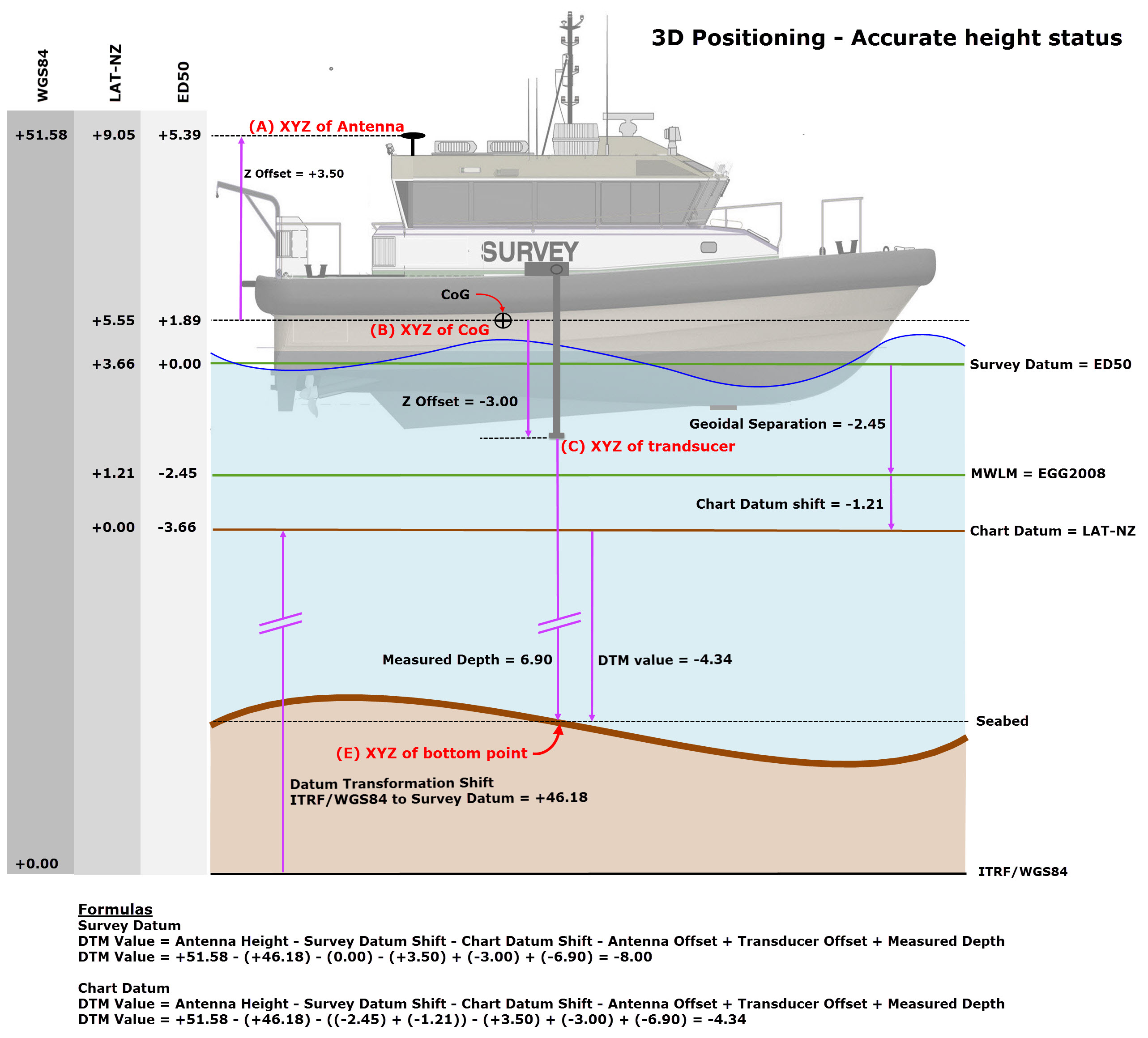
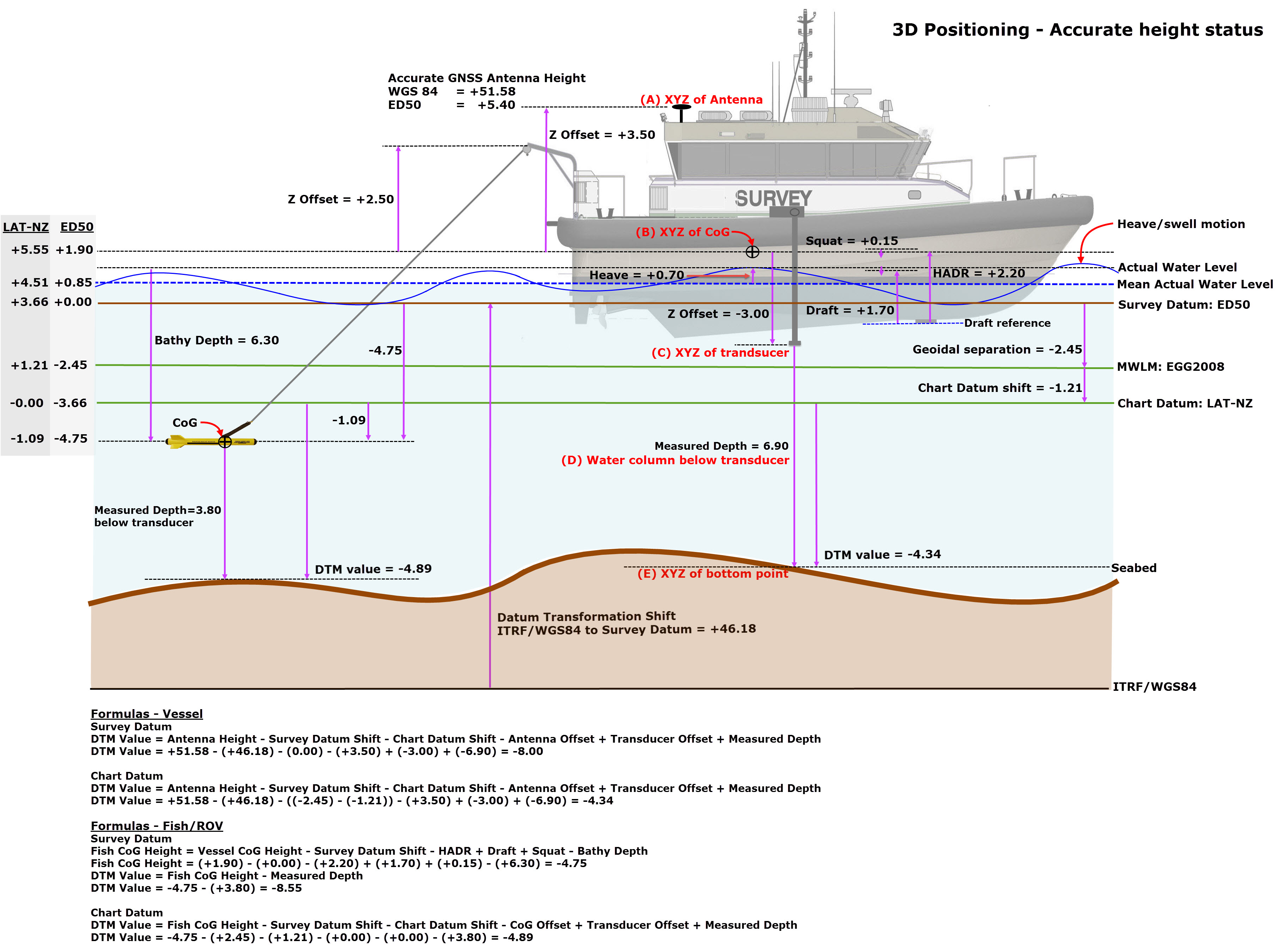
Example 3D Positioning - Accurate Height Status
Vessel Only
No height aiding is used when a vessel is positioned using an accurate positioning system, e.g. RTK.
Return to: top of page.
Return to: How-to Height - Tide and RTK
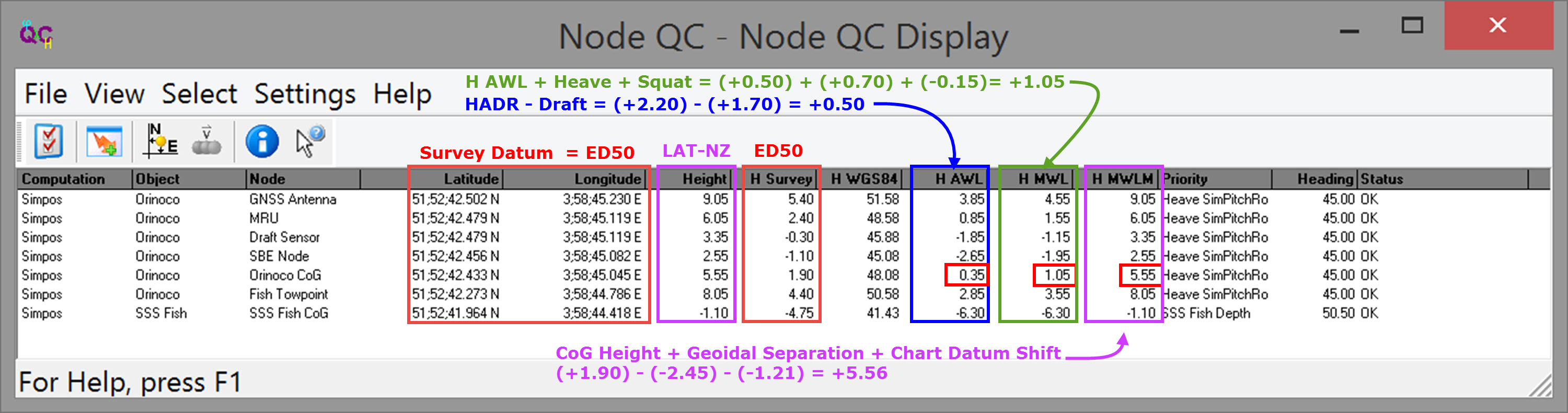
Vessel + Towed Fish
Height aiding is used when a vessel is positioned using an accurate positioning system, e.g. RTK, and a towed fish (or ROV) has a depth observation referenced to water level.
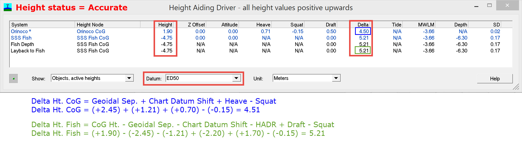
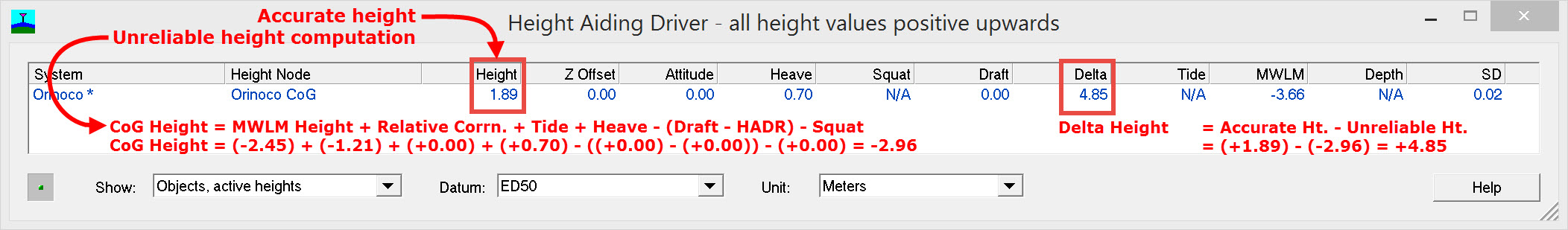
Changing the height status to Unreliable without changing any other settings gives:
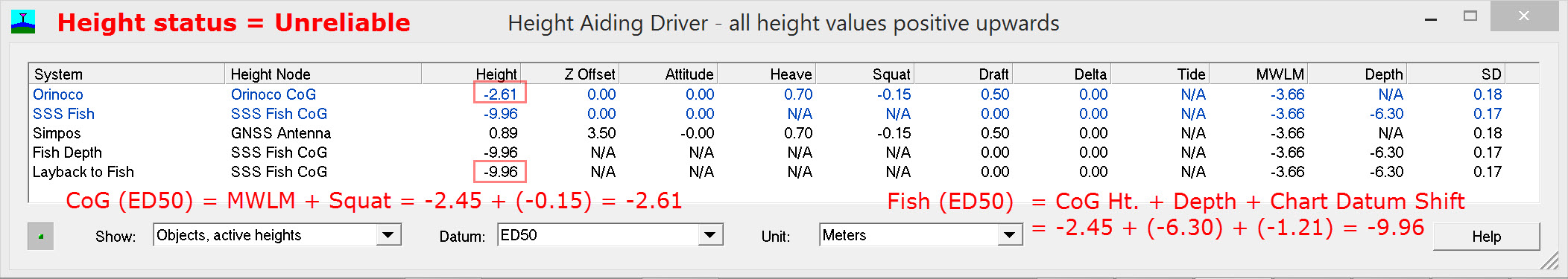
Delta Ht. CoG = Accurate Height - Unreliable Height = 1.90 - (-2.61) = +4.51 (as shown in the HAD window with Height Status = Accurate)
Delta Ht. Fish = Accurate Height - Unreliable Height = -4.75 - (-9.96) = +5.21 (as shown in the HAD window with Height Status = Accurate)
Return to top of page.
Return to How-to Height - Tide and RTK
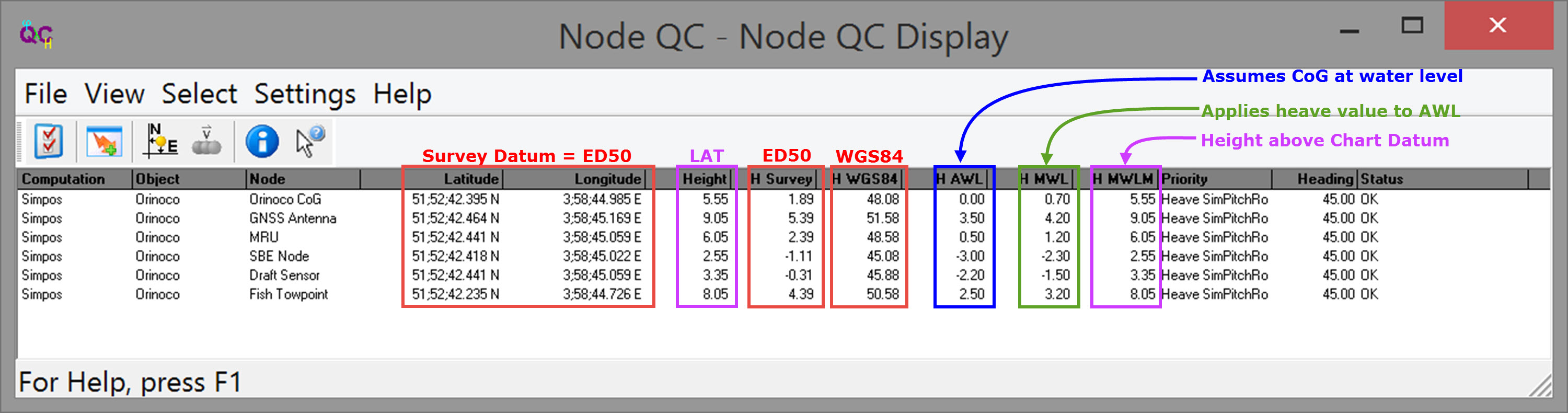
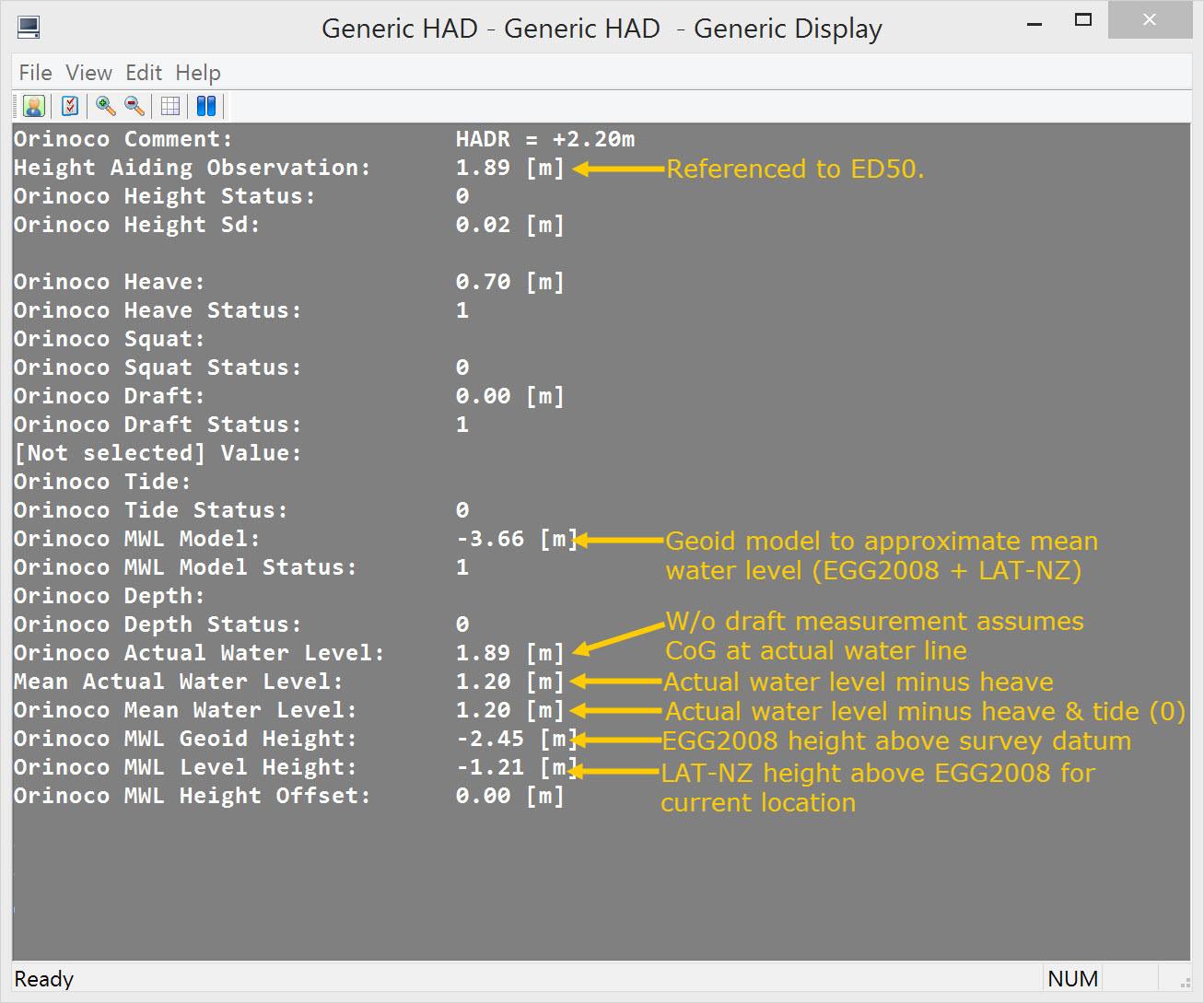
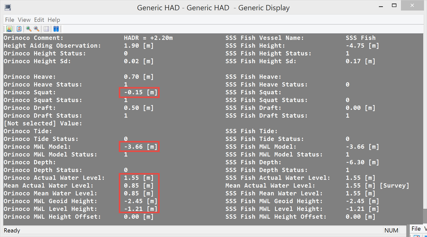
Generic Display Parameters
| Parameter | Description |
|---|---|
Comment | User-defined free text |
Time | Update time (UTC) of the height aided observation |
Vessel Name | Name of the vessel (object), as entered in Db Setup |
Height | Value in survey units of the Height Aided Observation, which is calculated by the Height Aiding driver. The Height value is by default referenced to the Vertical Datum (also known as Chart Datum), but, alternatively, either Survey Datum or datums like WGS84, ETRS or ITRF (which all use the GRS 1980 ellipsoid) may be selected. Notice that this value is the same as the height of the reference node for the selected vessel. Datum:
|
Height Status | Two possible values: one or zero. |
Height Sd | 1 Sigma (68%) A-Priori Standard deviation of the Height Aiding observation |
| Heave | Heave component of the Height Aided Observation. |
| Heave Status | Two possible values: |
Squat | Squat component of the Height Aided Observation. |
Squat Status | Two possible values: |
Draft | Draft component of the Height Aided Observation. |
Draft Status | Two possible values: |
Tide | Tide component of the Height Aided Observation. |
Tide Status | Two possible values: |
MWL Model | Mean Water Level Model component (often known as Mean Sea Level) of the Height Aided Observation. |
MWL Model Status | Two possible values: |
Depth | ROV Depth component of the Height Aided Observation. |
Depth Status | Two possible values: |
Actual Water Level | The actual water level above Survey Datum For the object's reference node the "Height above Actual Water level" value is used minus the "Height above Survey/WGS84/Vertical Datum" value. |
| Mean Actual Water Level | The Actual Water Level (see above) minus the heave of the object, so i.e. the actual water level without the swell influence. Datum:
|
| Mean Water Level | The Actual Water Level (see above) minus the heave of the object (swell) and minus the tide. Datum:
|
MWL Geoid Height | The current geoid height above survey datum, i.e. geoidal separation.
|
MWL Level Height | The current level height above geoid datum.
|
MWL Height Offset | The height offset above level datum.
|
Return to: top of page.
Return to: How-to Height - Tide and RTK