
Height 2D -Tide- Settings
When using an unreliable GNSS system, the following settings should be considered in Database Setup and in the Computation Setup of the Controller.
The pictures that are displayed are only examples, settings may vary world wide.
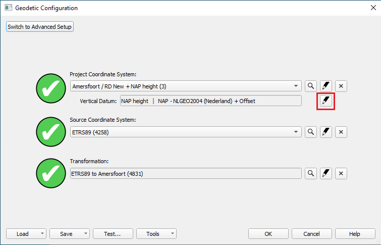
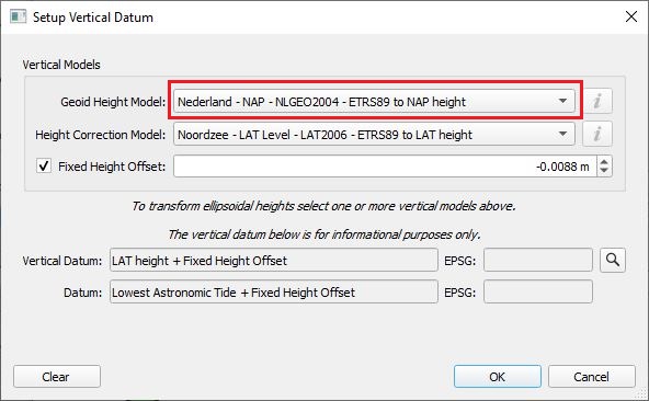
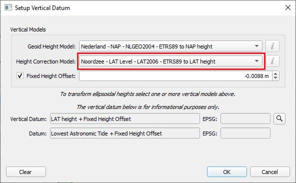
Geodetic Configuration
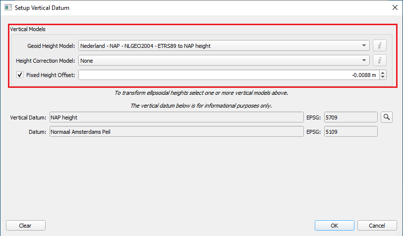
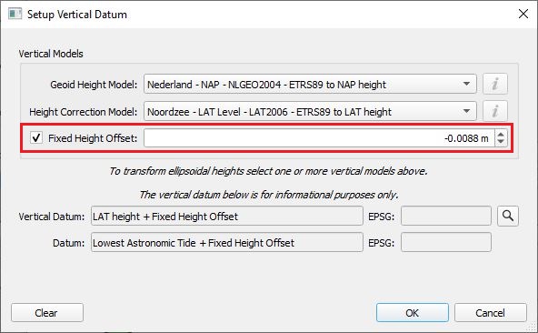
Define the Vertical datum in the Geodetic Set-up wizard:
- Define your Geoid Height model and, if necessary, a height correction model and/or Height offset.
REMINDER: these settings are both used for height aiding in the computation of position and used to determine the reference plane of the published heights.
Database Setup settings
Define the Height above draft reference (HADR) in the Object Definition wizard.
HADR is used in determining the height aiding observation and in computing the actual water level.
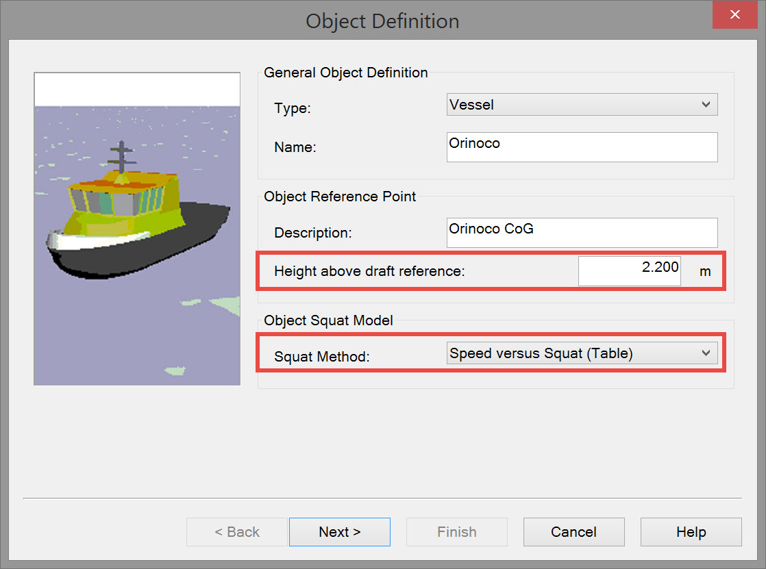
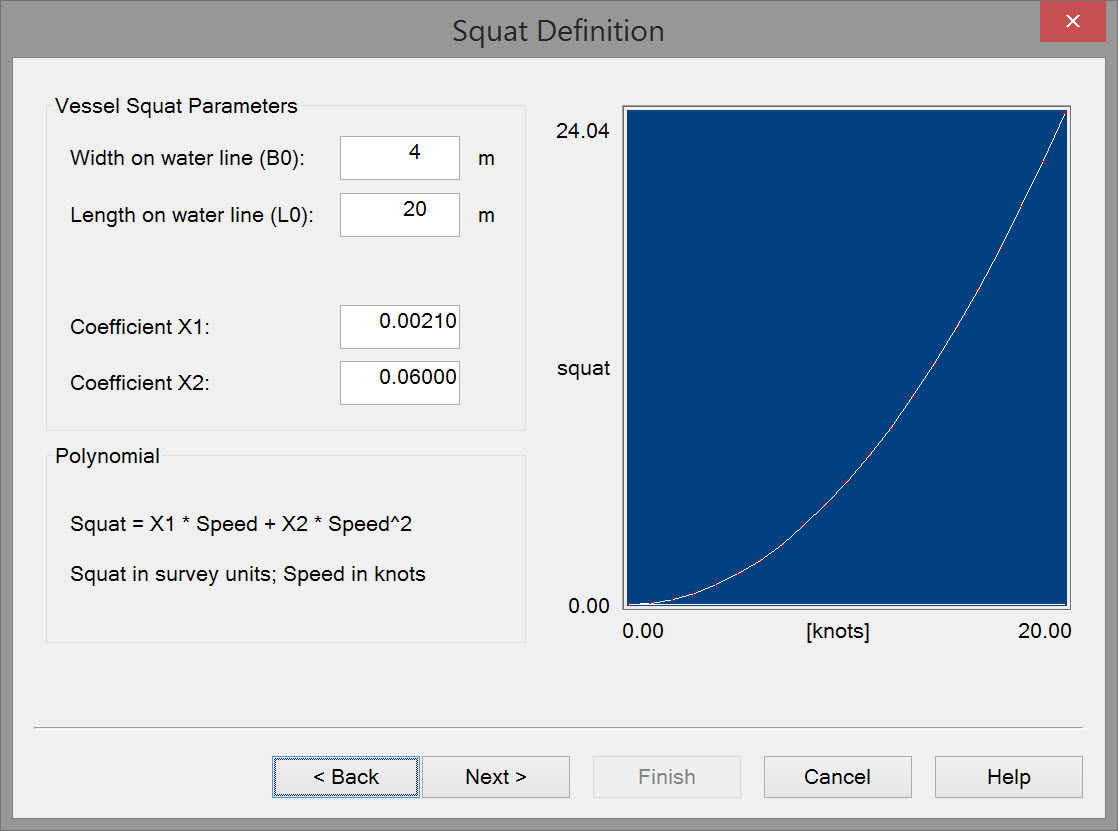
Squat
Define a Squat Method in Object Definition wizard (optional, not always necessary or available).
Squat is used in determining the height aiding observation and in computing the actual water level.
Not in Qimera
Qimera does not currently support the following Qinsy Squat methods:
- Froude
- Barras
- Polynomial
A Speed vs Squat table defined in the Qinsy Database Setup will transfer to Qimera successfully.
Positioning System
Define a Positioning System and the Receiver Positions/Heights in the Driver Setup.
- Make sure to check what the reference datum is for the receiver data output. It is not always WGS84.
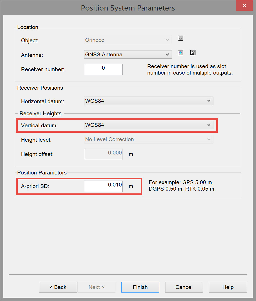
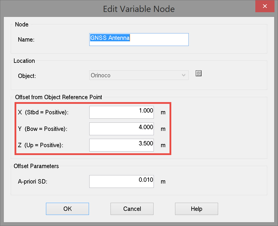
Define the exact location of the Positioning System relative to the CoG of the vessel.
- Make sure to define all other systems relative to the CoG as well.
Tide
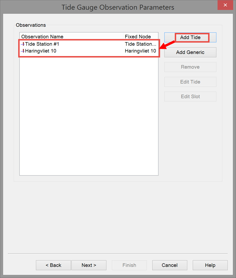
Define a (number of) Tide Gauge(s) in the Database Setup - System.
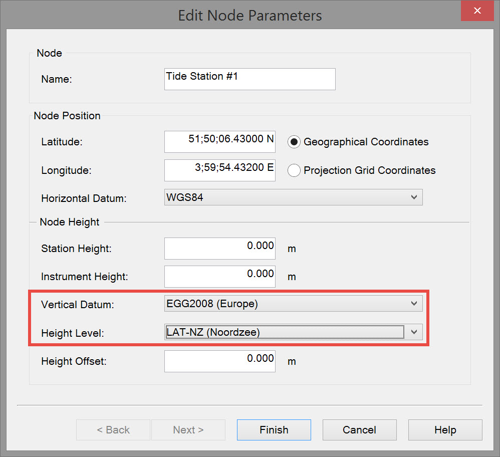
Ensure the correct vertical datum is selected as the reference for tide observations.
- For example, if a tide station outputs water level relative to LAT, then the LAT model should be selected as Vertical Datum for the fixed tide station node which is connected to the tide observation.
- If a tide station outputs the water level relative to a local datum, then this local datum must be selected as Vertical Datum for the tide station node which is connected to the observation.
In the example EGG2008 (Europe) is selected as the Vertical datum, and the relative height correction model is LAT-NZ (Noordzee). This means tide observation values are referenced to LAT-NZ.
Computation Setup settings
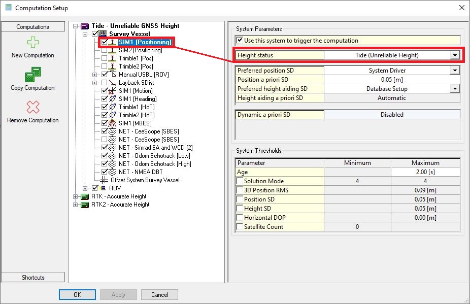
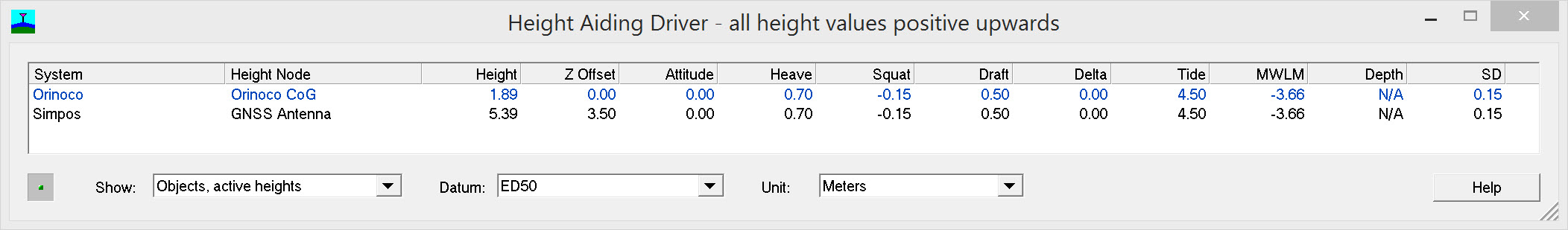
Set the Height status of the positioning system in the Online - Settings - Computation Setup to "Tide (Unreliable Height)".
- The Height Aiding Observation will be used in the positioning computation in place of the height component of the (GNSS) positioning system.
Height Components
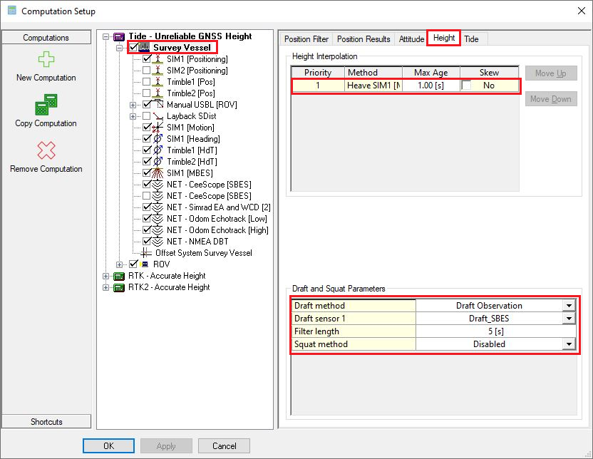
Heave, Draft & Squat
Set the correct Priority for the heave sensors on the object (only in case of a redundant system).
Enter the Manual draft of the vessel if no draft sensor is available. Otherwise enable the draft sensor.
Change of draft
The draft can change and should be adjusted Online whenever this is the case.
Enable and set the Squat method if one was defined in Database Setup.
Tide
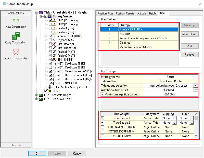
Enable and set the correct Tide strategies and Priority in which they should be calculated and used.
In this example there are 5 tide priorities, where RTK tide calculated by the main object has priority. In case the RTK tide fails, it will fall through to Tide Along Route.
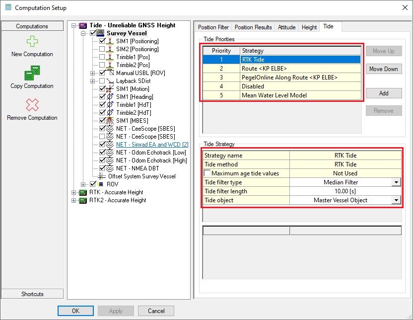
Based on the created method, change your Tide strategy accordingly.
Return to: top of page.
Return to: How-to Height - Tide and RTK.
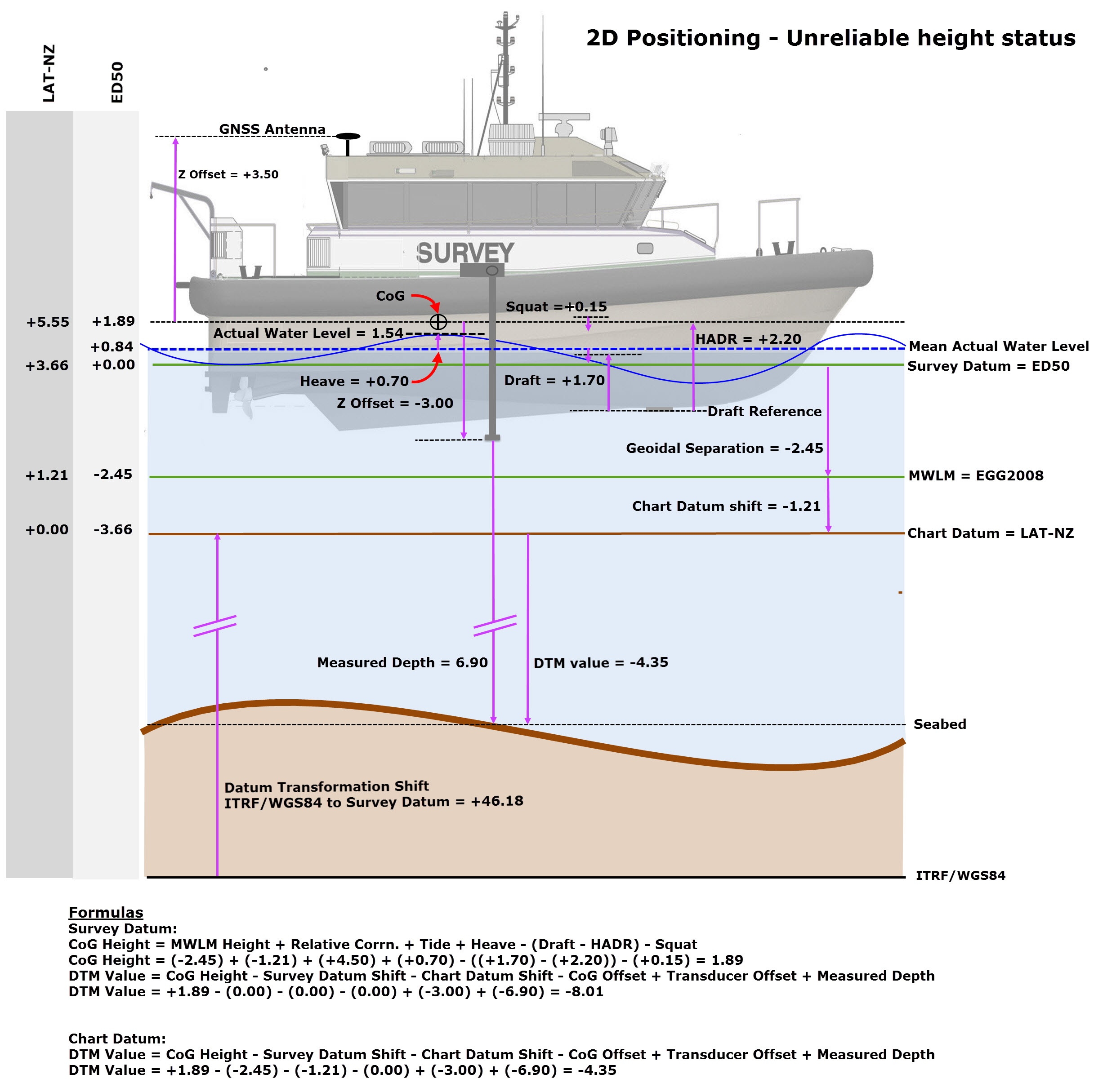
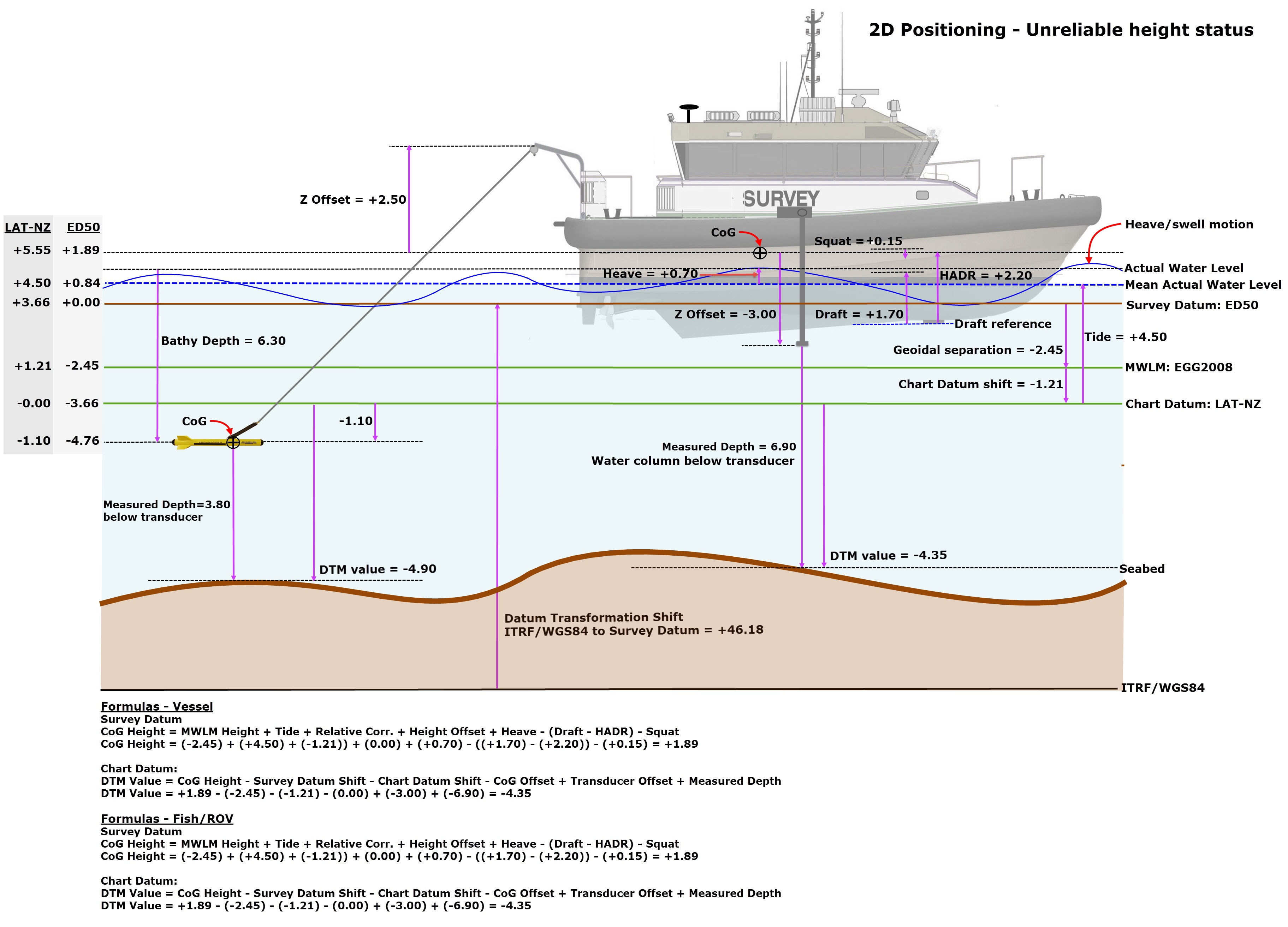
Example 2D Positioning - Unreliable Height Status
Vessel Only

Return to: top of page.
Return to: How-to Height - Tide and RTK.
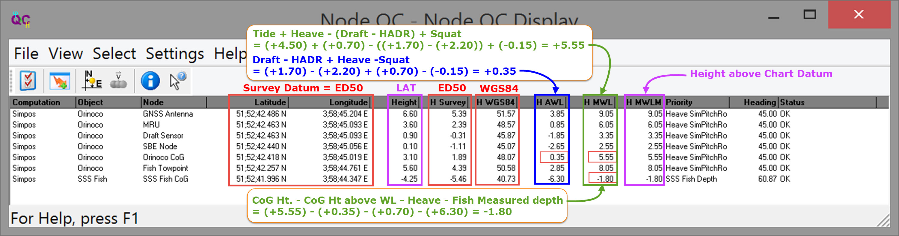
Vessel + Towed Fish
| Description | Computation |
|---|---|
| When the height component of position is not used in the computation, the vessel CoG is initially assumed to lie at the water line. | Ht. CoG = 0.00 |
| When draft is measured the CoG Height above water line is determined. | Ht. CoG = 0.00 - (Draft - HADR) Ht. CoG = 0.00 - ((+1.70) - (+2.20)) Ht. CoG = +0.50 |
| Squat affects the CoG Ht. value. In this case squat lowers the CoG by 0.15. | Ht. CoG = +0.50 - Squat Ht. CoG = +0.50 - 0.15 = +0.35 |
| Water level includes a Heave component to yield the CoG Ht. above mean water level. | Ht. CoG = +0.35 + Heave Ht. CoG = +0.35 + (+0.70) = +1.05 |
| CoG Ht. must be referenced to a vertical datum, in this case to LAT - NZ (Noordzee), by adding the measured tide value. | Ht. CoG = +1.05 + Tide Ht. CoG = +1.05 + (+4.50) = +5.55 |
| To compute the height of Actual Water Level (AWL) relative to LAT - NZ, subtract the CoG Ht. above water level. | Ht. CoG = +5.55 - Ht. CoG wrt Water Level Ht. CoG = +5.55 - (+0.35) = +5.20 |
| To compute Mean Actual Water Level (MAWL) relative to LAT - NZ subtract Heave from AWL. | Ht. CoG = +5.20 - Heave Ht. CoG = +5.20 - (+0.70) = +4.50 |
| To compute Fish Ht. relative to AWL, subtract the measured fish depth. | Ht. CoG = +5.20 - Fish Depth Ht. CoG = +5.20 - (+6.30) = -1.10 |
| To compute Fish Ht. relative to AWL, subtract the measured fish depth. | Ht. CoG = +4.50 - Fish Depth Ht. CoG = +4.50 - (+6.30) = -1.80 |

Return to: top of page.
Return to: How-to Height - Tide and RTK.
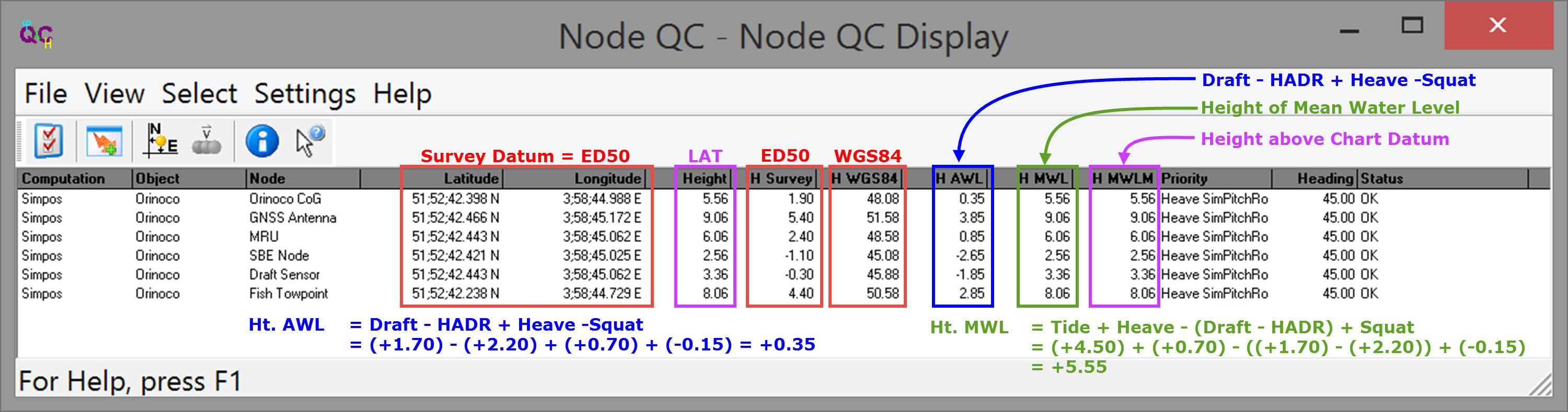
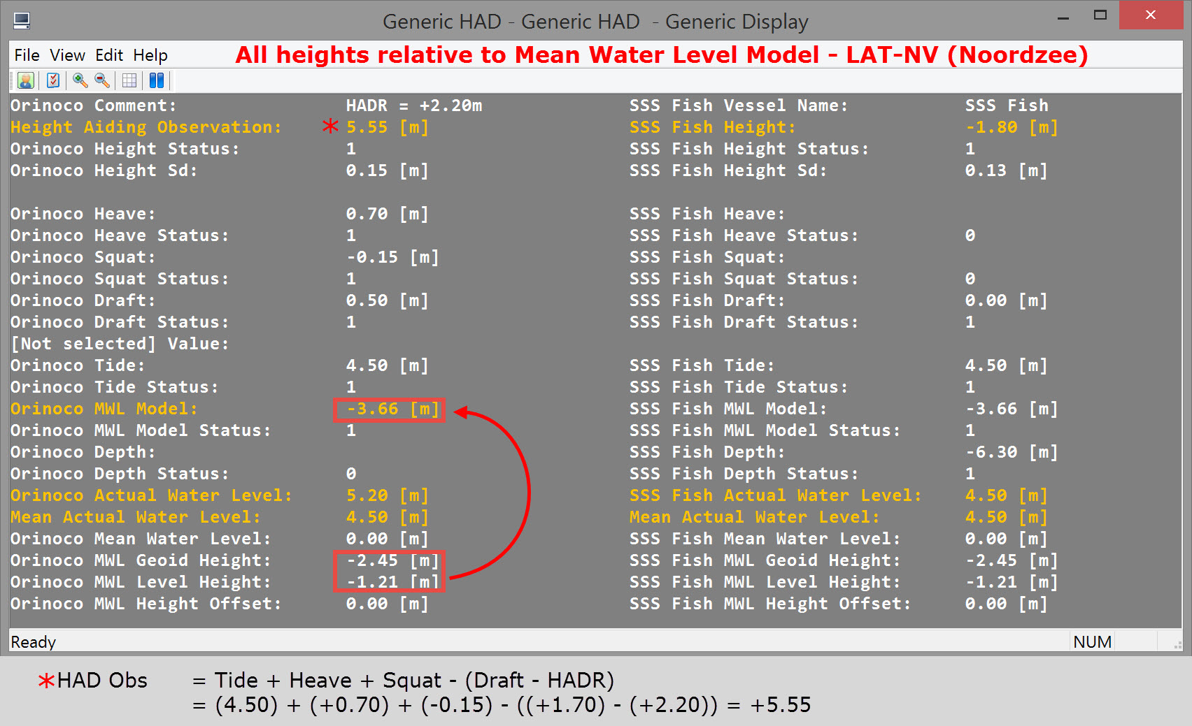
Generic Display Parameters
| Parameter | Description |
|---|---|
Comment | User-defined free text |
Time | Update time (UTC) of the height aided observation |
Vessel Name | Name of the vessel (object), as entered in Db Setup |
Height | Value in survey units of the Height Aided Observation, which is calculated by the Height Aiding driver. The Height value is by default referenced to the Vertical Datum (also known as Chart Datum), but, alternatively, either Survey Datum or datums like WGS84, ETRS or ITRF (which all use the GRS 1980 ellipsoid) may be selected. Note that this value is the same as the height of the reference node for the selected vessel. Datum:
|
Height Status | Two possible values: one or zero. |
Height Sd | 1 Sigma (68%) A-Priori Standard deviation of the Height Aiding observation |
| Heave | Heave component of the Height Aided Observation. |
| Heave Status | Two possible values: |
Squat | Squat component of the Height Aided Observation. |
Squat Status | Two possible values: |
Draft | Draft component of the Height Aided Observation. |
Draft Status | Two possible values: |
Tide | Tide component of the Height Aided Observation. Note that this item is the same as item Tide under Tide Results |
Tide Status | Two possible values: Note that this item is the same as item Tide Status under Tide Results |
MWL Model | Mean Water Level Model component (often known as Mean Sea Level) of the Height Aided Observation. |
MWL Model Status | Two possible values: |
Depth | ROV Depth component of the Height Aided Observation. |
Depth Status | Two possible values: |
Actual Water Level | The actual water level above Survey Datum For the object's reference node the "Height above Actual Water level" value is used minus the "Height above Survey/WGS84/Vertical Datum" value. |
| Mean Actual Water Level | The Actual Water Level (see above) minus the heave of the object, so i.e. the actual water level without the swell influence. Datum:
|
| Mean Water Level | The Actual Water Level (see above) minus the heave of the object (swell) and minus the tide. Datum:
|
MWL Geoid Height | The current geoid height above survey datum, i.e. geoidal separation..
|
MWL Level Height | The current level height above geoid datum.
|
MWL Height Offset | The height offset above level datum.
|
Return to: top of page.
Return to: How-to Height - Tide and RTK.