
Description
Driver needs a full duplex serial interface with an SMD DVECS Control System, in order to communicate with an SMD ROV.
Whenever the driver receives a request from the DVECS to send waypoints, it will return waypoints to the DVECS immediately.
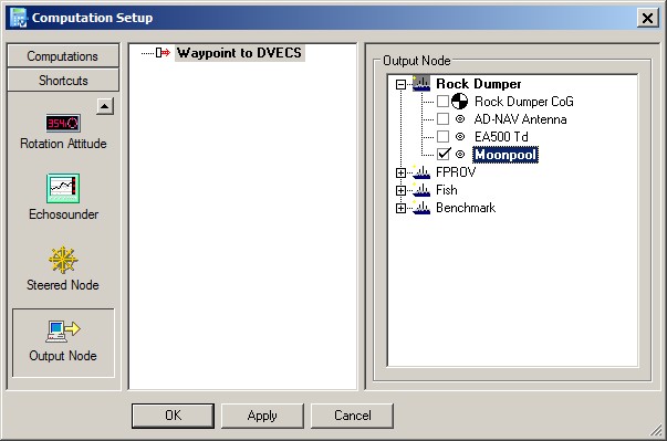
These waypoints will contain the co-ordinates of the current mainline, or of the current position of the selected output node. This output node is selected in the Controller's Computation Setup.
Driver Information
|
Driver |
SMD DVECS - Waypoint Request Code from FPROV Waypoints to FPROV - SMD DVECS (WPX) |
Interface Type |
Serial |
Driver Class Type |
Terminated <LF> |
|---|---|---|---|---|---|
|
No |
Input / Output |
Input and output |
Executable |
DrvQPSTerminated.exe SMD_DVECS |
|
|
Related Systems |
|||||
|
Related Pages |
|
||||
Database Setup
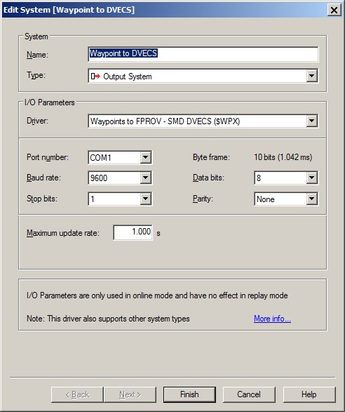
Add a new Auxiliary System to the database template, type "Output System", and select driver "Waypoints to FPROV - SMD DVECS ($WPX)".
Fill in the correct I/O parameters in order to communicate with the SMD Control system. Notice that the Maximum update rate only affects the incoming request messages from the FPROV.
This means that when you leave it to the default 1 sec, the FPROV can not request waypoint messages more than 1 time per second.
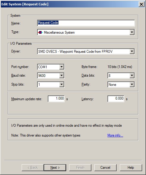
There is a possibility to keep record (e.g. for debugging purposes) of the number of requests coming from the SMD Control System. The request code (0 or 1) will be stored as the time of each request.
In order to do so, add a new Auxiliary System to the database template, type "Miscellaneous System", and select driver "SMD DVECS - Waypoint Request Code from FPROV".
Fill in the same I/O parameters, and go to the next wizard page.
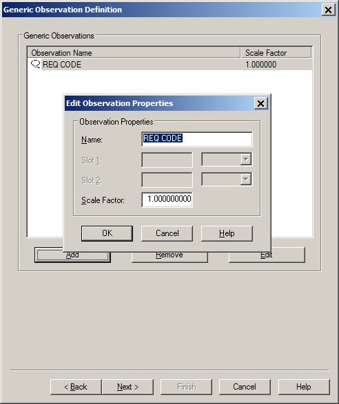
Add a new observation and call it e.g. "REQ_CODE".
Online
There is no user-interface for this driver, except for the output node selection in the Controller's Computation Setup.
This selected output node will be used as 'target' position after receiving a request code 0 (zero).
Drivers IO Notes
The following command line parameters are supported:
-
WGS84
The geographical waypoint position in the $WPX message will be on WGS84, instead of local datum.
(Not in combination with the GRID commandline parameter) -
GRID
The waypoint position in the $WPX message will be in grid Easting/Northing co-ordinates, instead of geographical latitude/longitude.
(Not in combination with the WGS84 commandline parameter)