Update to ASP.NET Core 8.0 & .NET runtime 8.0
Parts of Qinsy were dependent on .NET runtime 6.0 & ASP.NET Core 6.0.
The last security update from Microsoft was done on . This means that it might become an IT security risk at some point.
This was therefor updated to version 8.0.
System - Dredging Sensor - Network - IHC Dredging (Binary) - Decode Trim a Miscellaneous observation
The Trim value, decoded via the IHC Dredging (Binary) format, can now be decoded in Qinsy as Miscellaneous observation.
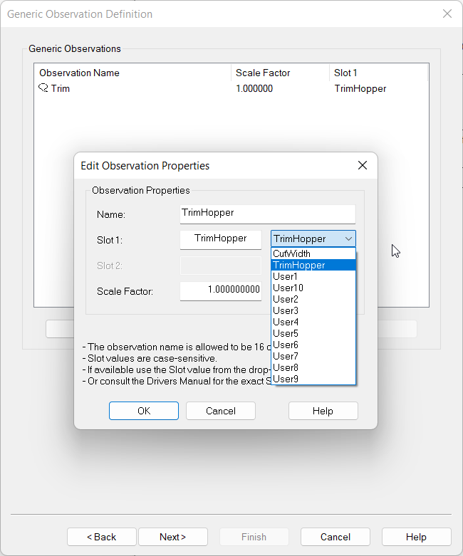
In case you would like to us it as a Pitch observation, you will need to convert it to an angle by the following formula:
-
angle = trim / Vessel length
This can be done in a Generic output driver, which can then be looped back into Qinsy so you can decode it as a Pitch.
System - MBES - Kongsberg - KMALL - EM2042 - Add Model entry to apply correct offsets
A new model has been added in the KMALL driver for the EM2042:

By selecting this, you can select the Transducer Reference Point as node in Qinsy.
This means that you don’t need to figure out the exact Tx and Rx offsets to the transducers inside the unit.
So the during the Dimensional Control survey you only need to measure the Transducer Reference point.
-
More info on this can be found in the Drivers Manual
Kongsberg KMALL (UDP multicast) - 20
Online - Session Setup - Storage - Static Grid - Grid Update Monitor - Automatic - Suppress QGUP warnings and only report in Survey Log
If a problem occurred during the import of a QGUP file, while it was running in Automatic mode, a popup dialog would show up.
In Automatic mode there should not be a need for a user to interfere, but is should be logged.
Therefore we now made the following changes:
-
Survey Log will now log warnings generated by the grid update monitor;
-
Controller will not show dialogs when in automatic mode.
Survey Manager - Plan View - Reference line - Add option to define line color, width and style
In order to improve visibility of the Active Reference line in the Survey Manager, it is now possible to change the appearance:
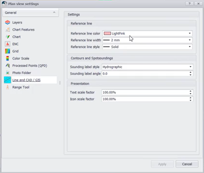
These settings also work for Plotting:
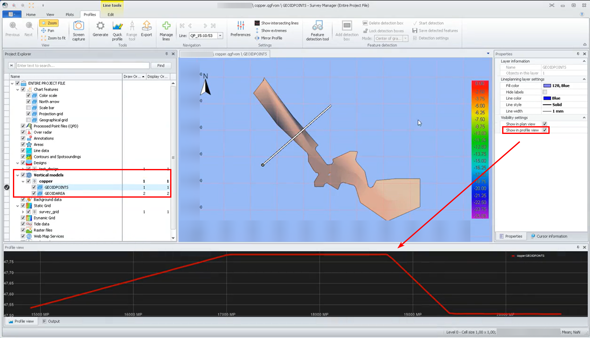
Survey Manager - QGF - Vertical Offset Model - Enable 'Show in Profile View' by default after creating a VOM file
When creating a QGFVOM model in the Survey Manager, you always needed to enable “Show in Profile View”, before you could check the model height using the Profile View.
As of this version, this has now been enabled by Default:
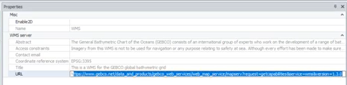
Survey Manager - Raster Images - Show URL of WMS layer in properties
It is now possible to review the URL of the added WMS layer in the Properties (right side pane).