
Reproject Coordinate System Dialog
How to Start
-
Scene Objects Dock → Right-Click on Object → Operations → Reproject Coordinate System
-
Scene Objects Dock → Operations → Reproject Coordinate System
What it Does
The Reprojection dialog can be used to change an image from one projection to another, such as from Lat/Lon to UTM. The first step in the process is to select what operation to perform using the drop down list at the top of the dialog. Depending on which operation you select, you may then have to enter some additional information about the image.
General Description
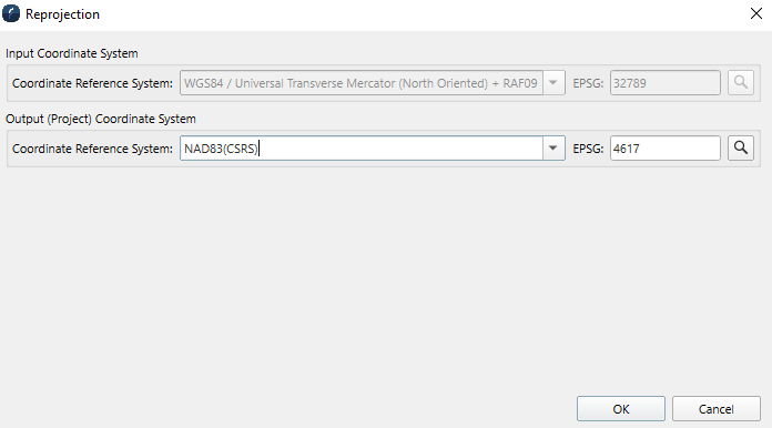
The selected object can be reprojected in to a different coordinate system than the original import.
Note that layers in a multilayer surface cannot be individually reprojected. Only the parent item can be reprojected, thus every layer will be reprojected to the selected CRS in that case.
Coordinate Reference System
This field contains the coordinate system the object will be changed to.
EPSG
Stands for the European Petroleum Survey Group. These codes are a set of geodetic parameters used to represent projected, unprojected and local coordinate system definitions. More information can be found here http://www.epsg.org/