Fledermaus Merge Dialog (Surfaces, Scalars, and Geoimages)

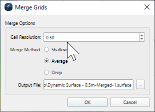
Merge Dialog - Surface object version

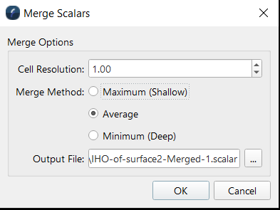
Merge Dialog - Scalar object version

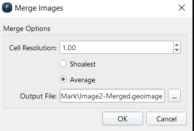
Merge Dialog - GeoImage object version
How to Start
- Scene Objects Dock → Right-Click on two Objects of the same type (Surface, Scalar, or GeoImage) → Operations → Merge
- Scene Objects Dock → Operations → Merge
What it Does
The merge operation takes two or more files of the same type and creates one file using the date from the input files.
General Description
All of the data from the input objects will be preserved, expect if there is overlapping data. In this case there are a few options for merging methods, how we decide what data to write out if there is overlapping data.
Surface Merge Methods
Shallow - Takes the shoalest depth and writes that to the output file.
Average - Averages depths and writes the average to the output file.
Deep - Takes the deepest value and writes that to the output file.
Scalar Merge Methods
Maximum (Shallow) - takes the largest value and writes that to the output file.
Average - Averages values and writes the average to the output file.
Minimum (Deep) - Takes the smallest value and writes that to the output file.
GeoImage Merge Methods
Shoalest - Takes the color value from the shoalest image and writes that to the output file.
Average - Blends the colors to create a new color and writes that to the output file.
