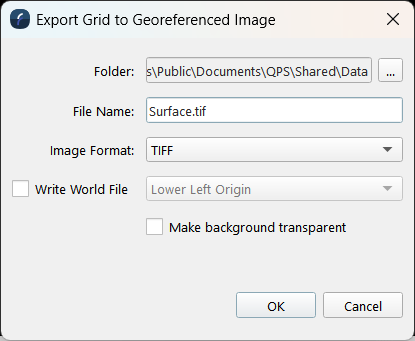
Export to Image Dialog
How to Start
-
Scene Objects Dock → Right-Click on Object → Exports → Export to Image
-
Scene Objects Dock → Exports → Export to Image
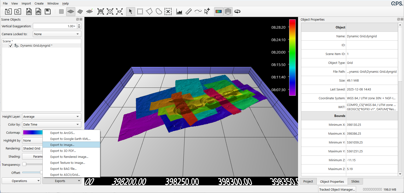
Export to Image Dialog from Export Menu
What it Does
This dialog is used to save a georeferenced image file (TIFF, JPEG, PNG, BMP, TFW), of the surface.
This dialog saves an image of the specified surface as seen in the Fledermaus display.
This exact pixel export only contains the colors as displayed in the workarea. These colors may be directly referenced to the colormap. This is useful to reference heights accurately by color since there would be no color shifts caused by the presence of shadows.
General Description
Choose the image type by selecting the file format from the Format drop down.
To write a TIFF World File*, the check box must be selected to allow the user to choose the origin. The origin options include: Lower Left Origin, or ESRI Upper Left Origin.
When exporting the image of the surface as seen in the Fledermaus, the size of the image will be at the same resolution as the surface.
*Note that TFW file's with the ESRI Upper Left Origin, are compatible with most major GIS packages. TIFF files will be written as GeoTIFFs with full georeferencing information.
Output Example
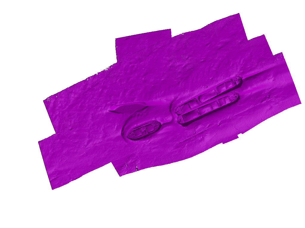
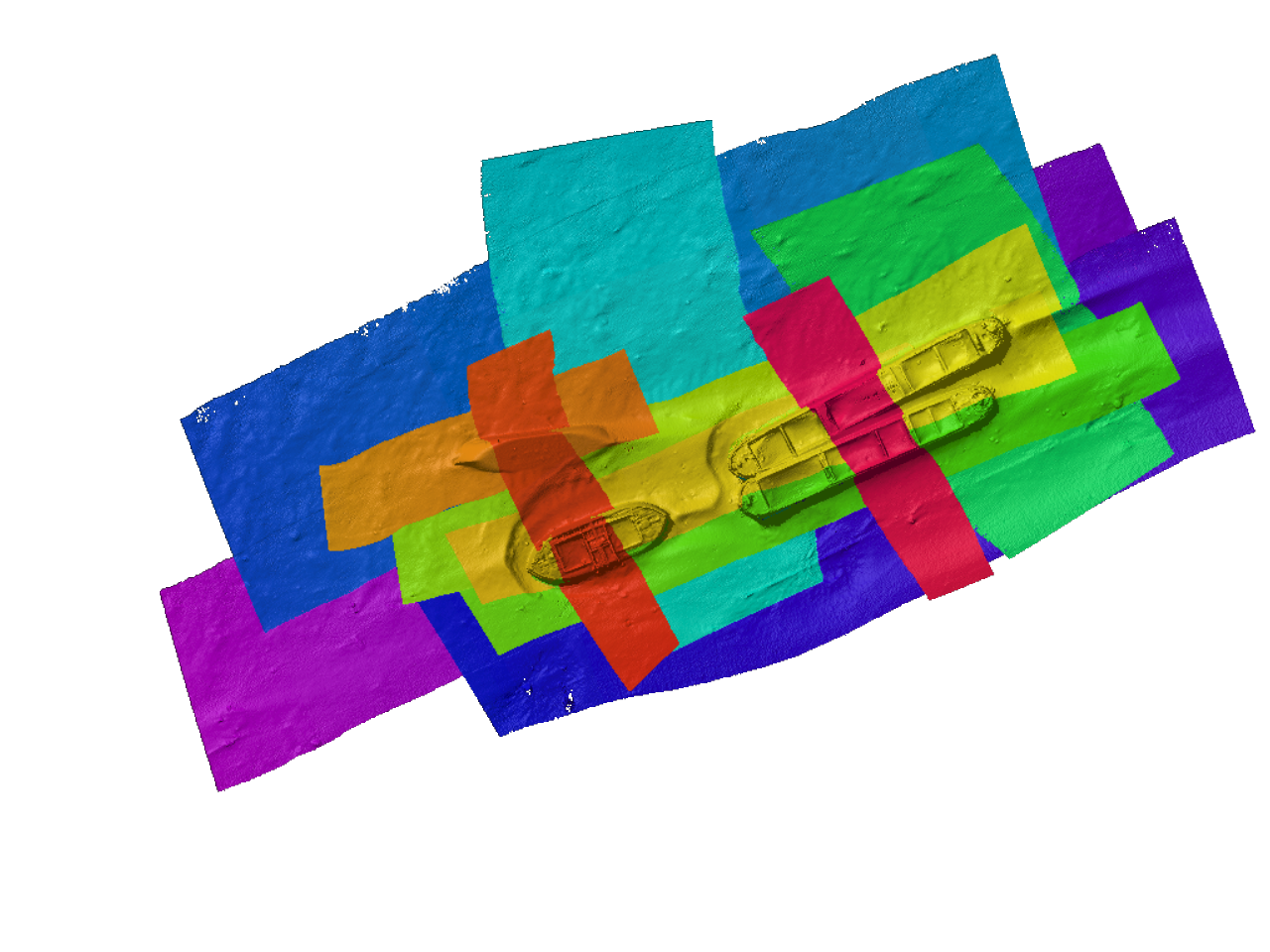
Exact Pixel Export: As Seen in Fledermaus Display: