Qinsy 9.4.4 - New Functionality
On this page:
Newly added Transformations
This transformation will be part of the new Geodetic Resources 3.1 installer, which can be used in combination with Qinsy 9.4.4:
RDNAPTRANS 2018
RDNAPTRANS™ is the official coordinate transformation between European ETRS89 coordinates and Dutch coordinates in RD and NAP.
This was determined by the partnership of Kadaster, Rijkswaterstaat and Dienst der Hydrografie, working together under the name Nederlandse Samenwerking Geodetische Infrastructuur (NSGI).
More info can be found in the Release Notes of the Geodetic Resources 3.1 installer.
Newly added Geoid Models
These models will be part of the new Geodetic Resources 3.1 installer, which can be used in combination with Qinsy 9.4.4.
The following models are part of that installer:
Vertical Datum | Vertical Model | Country |
|---|---|---|
NAP height | NLGEO2018 | The Netherlands (onshore) |
LAT height & MSL height | NLLAT2018 | The Netherlands (offshore) |
Ostend height | hBG18 | Belgium (onshore) |
NGF-IGN69 height | RAF20 | France (onshore) |
NN2000 height | HREF2018B | Norway (onshore) |
NAVD88 height | GEOID18 | United Stated of America (CONUS) |
PRVD02 height | GEOID18 | Puerto Rico (onshore) |
VIVD09 height | GEOID18 | US Virgin Islands (onshore) |
More info can be found in the Release Notes of the Geodetic Resources 3.1 installer.
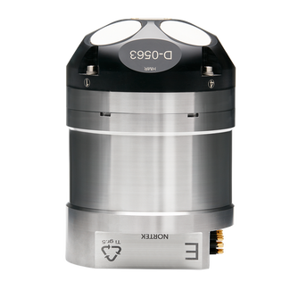
Drivers - DVL and ADCP - Nortek DVL500
Added support for the Nortek DVL500 system to decode ADCP and DVL data.


The new driver supports the following formats:
DF3
DF21
DF22
For more information on what is decoded and how to set it up with Qinsy, please have a look at the Drivers manual: Nortek DVL 500
Interface types:
Serial
Network TCP
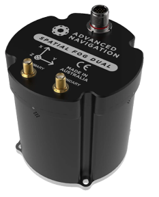
Drivers - INS - Advanced Navigation Spatial FOG INS
Added support for the Spatial FOG Dual to decode Position and Attitude data.
The driver support the ANPP format.
For more information on what is decoded and how to set it up with Qinsy, please have a look at the Drivers manual: Advanced Navigation Spatial ANPP
Interface type:
Serial
