Qinsy 9.2.0 - Improvements
On this page:
Project setup
Default Project Location
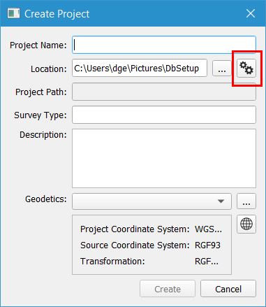
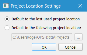
To help users in their data management an option has been added to set a folder location as the default for when new projects are created.
It is also possible to continue using the behavior that the last project location will be used.
The settings can be accessed through a 'settings' button which gives the following options:
Previous geodetic settings pre-selected for project
When creating a new project the geodetic settings will be pre-selected with the settings from the previous project.
This will help the users that work in one area all the time and need to use the same geodetic settings.
Users that change geodetic settings need to take care to be sure to select the correct settings.
Geodetics
Several changes were made to the New Project dialog and the Geodetic configuration dialog based on user feedback on the new interfaces that were launched with Qinsy version 9.0.0.
Terminology has been improved in various dialogs, with the primary aim being to enhance clarity and reduce use of acronyms.
Care has been taken to use terminology that is most commonly used and in some areas tool-tips have been added with further explanation.
The behavior and layout of various dialogs has been improved for a cleaner and simpler user experience and workflow.
All changes combined give an improved user experience. In addition a number of bug fixes have been made.
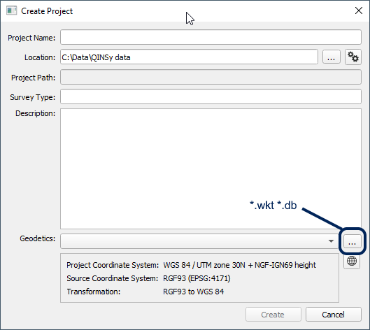
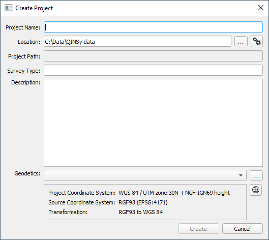
Starting with the project creation dialog, the previously used acronym CRS has been dropped in favor of full text Project Coordinate System:
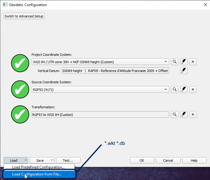
Moving to the Geodetic Configuration dialog, there are several minor improvements as well.
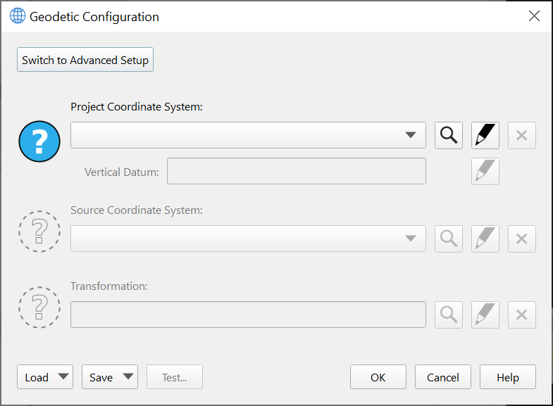
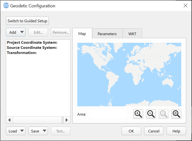
In particular, it is much clearer now that the Guided Setup and Advanced Setup options are mutually exclusive workflows: the Detailed Overview tab has been removed in favor of having to specifically click a button to switch to an Advanced setup.
Acronyms have been removed and clearer terminology has been used to make it clear what is required from the user.
A Help button has been added that will launch a web browser with the manual for the Geodetic User Interface:
The Advanced Configuration has improved as well, largely with a review of terminology to ensure consistency and clarity, and also removing acronyms in favor of full text to help users with limited geodetic knowledge.
Action buttons are at the top left to guide the user to the logical first step to take when entering this mode:
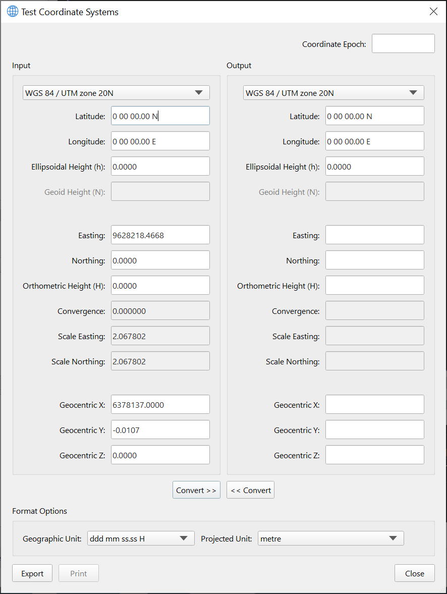
Lastly, the layout of the Test dialog has been improved as well to make it easier to compare geodetic test points with the current configuration, transform, vertical offsets, etc.
We have used standard geodetic terms like "Ellipsoidal Height", "Geoid Height" and "Orthometric Height", along with the usual symbolic terms for these (h, N and H, respectively).
As with the other dialogs, acronyms have been removed as much as possible.
The vertical layout makes it easy to visually scan and compare between Input and Output systems; the previous layout of this dialog made it difficult to visually compare results between the Input and Output systems.
Database Setup improvement
For setting up a template database a number of improvements have been made in the setup process.
These improvements make for a much better user experience and enable a faster workflow.
Vessel shape
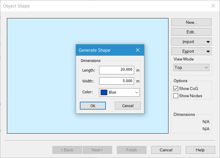
In the Object Shape Definition wizard a Generate Shape option is shown where length and width can be entered.
This is a quick way of creating a simple shape. It is still possible to cancel and configure a user defined shape through the options on the right:
System types alphabetical
Depending on the license the list of system types could be very long. The list used to be somewhat arbitrarily sorted on most used systems.
Now the list is alphabetical whereby the 4 most used system types are repeated at the top.
Driver selection by search
Driver selection could be tough sometimes as the list of available drivers is very long.
There is now functionality that the driver list can be searched.
The search is very straight forward: Start typing in the search term and a shortlist will be shown that is dynamically updated.
Predefined setting for System
Setting up a system requires selecting a driver and also other settings such as port number, slot number and sign convention.
These other settings are now filled with the default values that are known for the selected system.
This is very convenient and saves time by not having to search in manuals or driver documentation. More importantly, this also reduces error during setup.
Note that not all drivers have defaults and that defaults can be different from what that particular instrument actually is set up for.
The following movie shows all improvements: DriverSearch Video .mp4
Online - Drivers - Autopilot
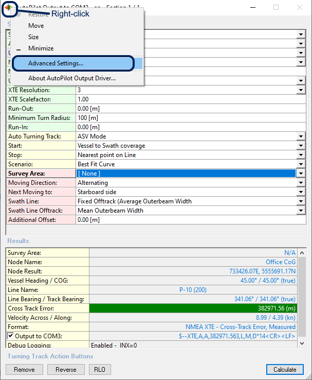
The user can now select which echosounder system (sbe, mbe, mtx, laser) to use for the swath width coverage calculation.
All available echosounder systems are enabled by default.
The setting to disable the system can be found under Advanced Settings (upper left corner icon).
Option to use a counter in the database name
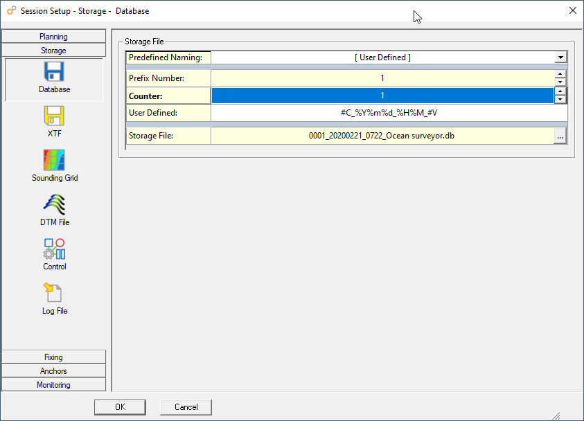
A new naming option has been added that uses a counter. This can be useful for processing flows that depend on specific filenames and do not want to use the prefix/suffix option.
A counter will always increase when a new file is made irrespective of why a new file is started. It is important to know that when a counter is used the suffix is no longer automatically added.
For the user defined counter the option #C is used. There is also a new predefined naming that uses a counter.
Note that without a suffix it might be more difficult to find lines that belong together but were split on file size.
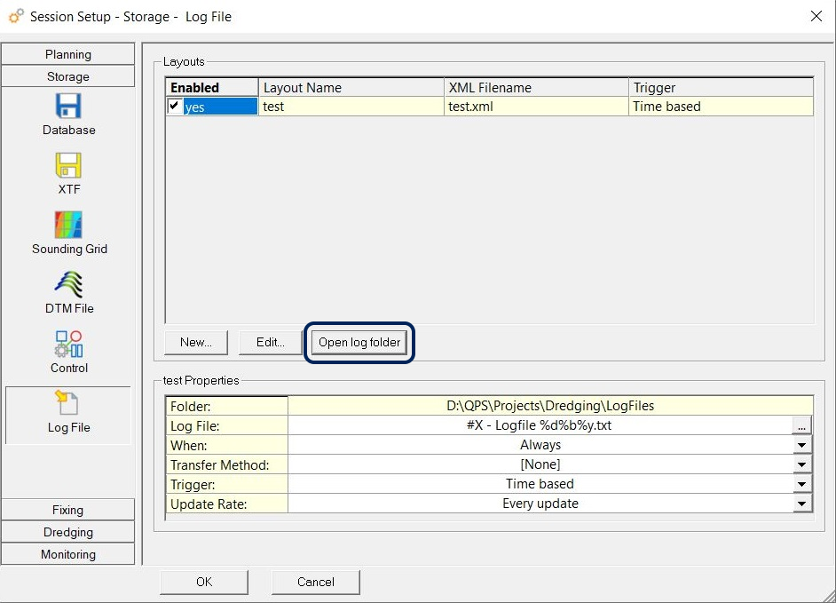
Option to open log folder
Clicking on this button will open the log file folder in Windows Explorer:
Survey Manager - Drawing improvements
Line style attributes
In the Survey Manager the line style attributes can be set to their own style or to the layer style.
This applies to the attributes of line color, line width and line style.
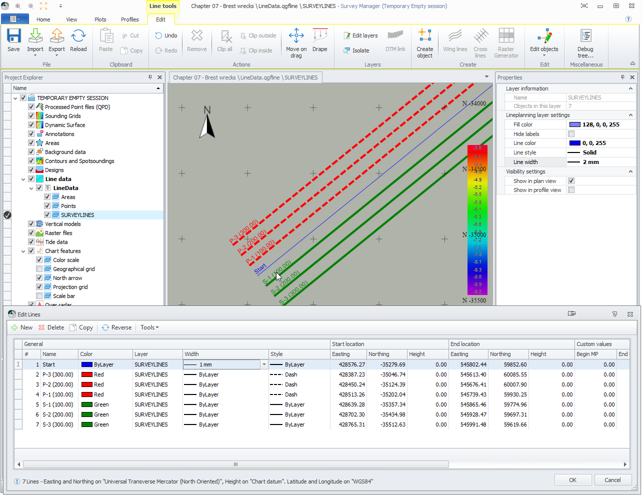
The line style attributes are also used online in the Navigation Display.
DXF and DWG support improvements
The DXF and DWG support uses an updated engine that supports recent versions of CAD formats.
Dredgeview imports removed
The import of Dredgeview formats has been removed in favor of improving DXF and DWG support.
See previous item.
Contours and Spotsoundings
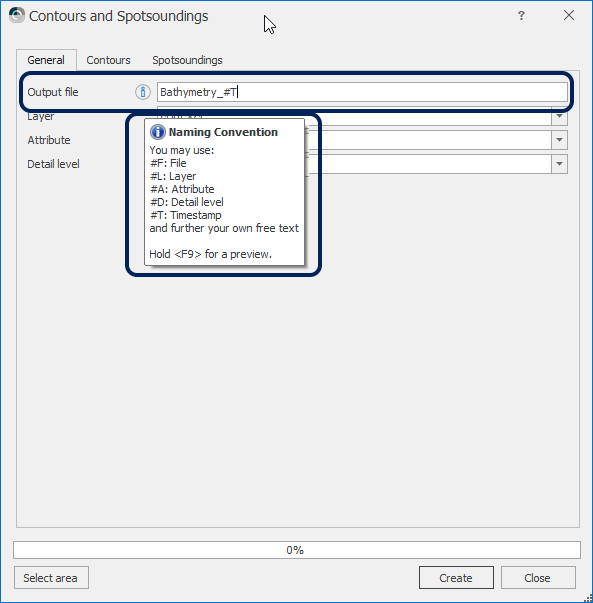
Option to alter default naming before saving/creation
It is now possible to enter a name when saving a file.
The name can make use of tags so that a uniform naming is used.
Volumes
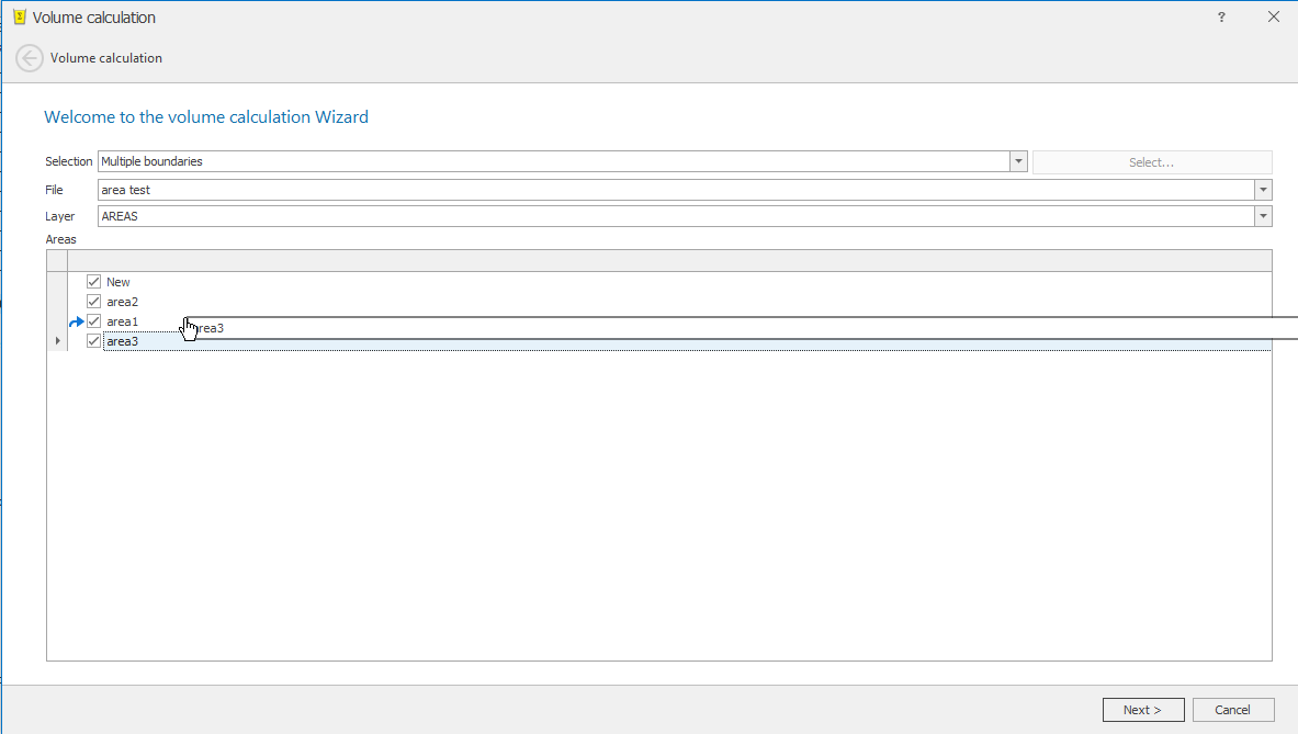
It is possible to change the order of the areas which are used in a volume calculation in the Survey Manager.
This works by drag and drop.
Select the area that needs to be moved and drag it to the right location.
Improvements as listed in the Feedback project

