On this page:
Console
The menu layout
The Tools menu has been removed and its items have been relocated to the other menus.
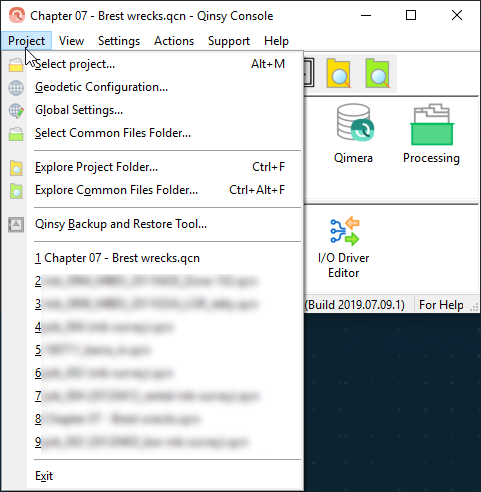
The File menu has been renamed to Project menu and the related functions can be found here, to make it clearer to users that these are now project related (Geodetic Configuration).
The Settings related to the Console have been moved to the Settings menu.
The Support menu only shows support related items.
These changes put the menu more in line with our other applications and will be further aligned in next release(s):
Version number and build date
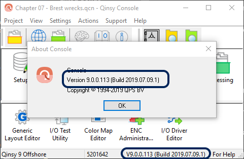
The version number and build date are now clearly shown in the About option and in the taskbar.
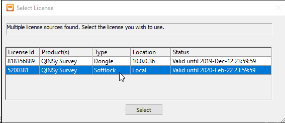
License Manager - Select Dongle screen is uniform across products
The dongle selection dialog is now similar to the dialog in other QPS products:
Global Settings - Setting for normal or high-resolution storage
In previous versions a high resolution QPD could be stored depending on an add-on on the license. The add-on has been discontinued so the option needs to be available in another location.
The option has been added to the Global Settings dialog. The data stored in the QPD can be at millimeter level when the option 'high resolution' is selected.
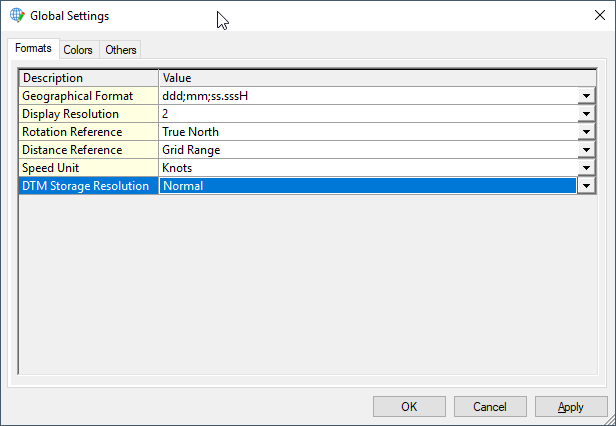
Note: High resolution means that footprints up to 32 meters from the transducer are stored in millimeters which is usually not needed for hydrographic work. This setting does not affect accuracy of calculations.
Tide Manager → Tide Prediction and Monitoring
Renamed to Tide Prediction and Monitoring
The utility Tide Manager has been renamed to avoid confusion.
Export - Add Export to Qinsy Online Tide File (UTC)
We added an additional export option: Qinsy Online Tide File (UTC), which can be used online.
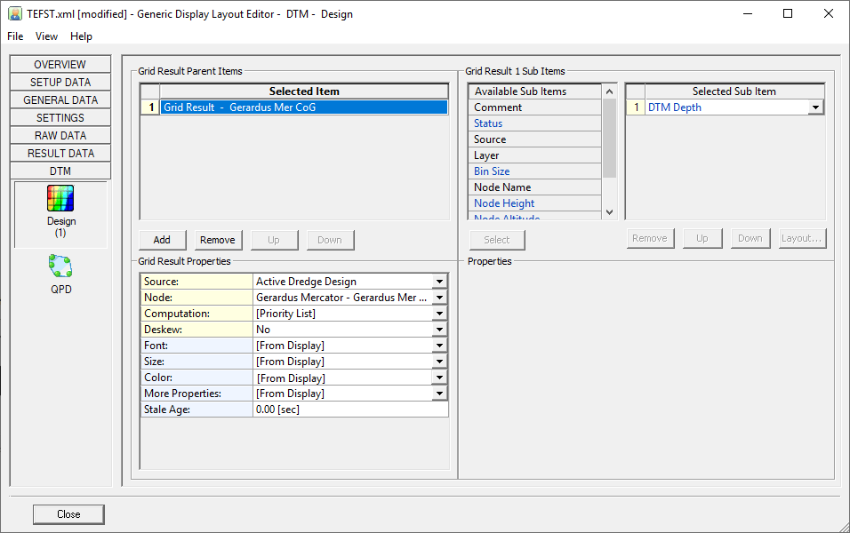
Generic Layout Editor
Design height of a certain node
It is now possible to output the height of a dredge design at a node position.
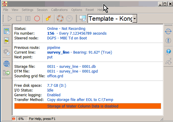
Controller
Menu structure has been changed
Global Settings moved to File menu Calibrations menu moved to the main menu Options menu slightly modified
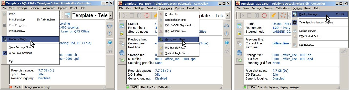
Layout changes
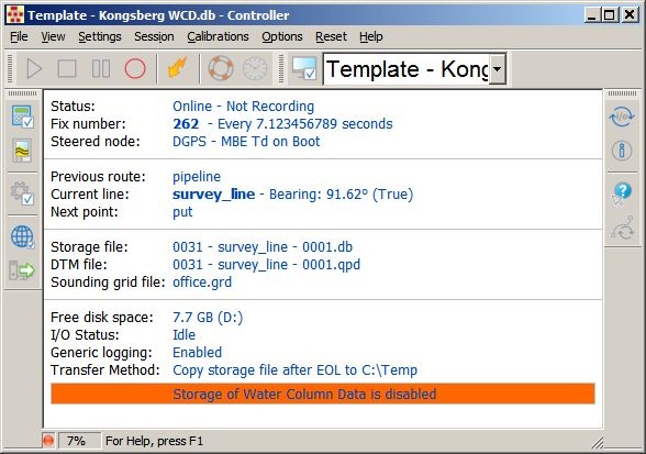
The following improvements have been added:
-
CPU Usage percentage in status bar
-
Drive behind Free disk space information
-
DTM file and Sounding grid file row will be hidden automatically when your setup has no SBE/MBE defined
-
Show if WCD storage is on or off
Font size
Change the font size by either using the mouse wheel or by using the pull-down menu View-Layout-Font Size or by using the right-mouse popup menu:
(click to watch the movie)
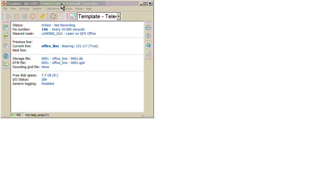
Generic Layout options
The content of the Controller is fixed and shows information that is sometimes of no interest.
There is now a choice of which information to show in the information area of the Controller.
This is either a predefined layout or a Generic layout:
(click to watch the full movie)
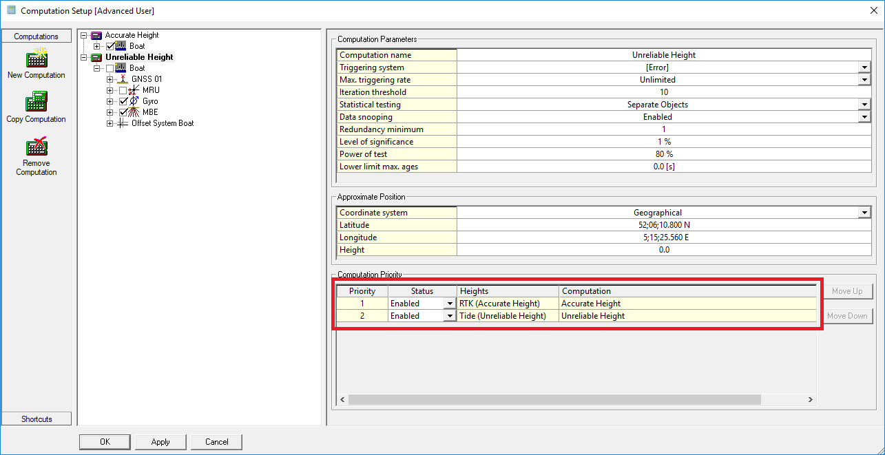
Online - Computation - Accurate/Unreliable height - Renamed to RTK (Accurate Height) / Tide (Unreliable Height)
The option Accurate/Unreliable height has been renamed to RTK (Accurate Height) / Tide (Unreliable Height) to better reflect what this option is used for:
Session Setup - Storage - Database - Storage file naming
The storage file naming was overly complex with options that were not used.
The user interface has been redesigned. Options such as adding a date in the file name have been added.
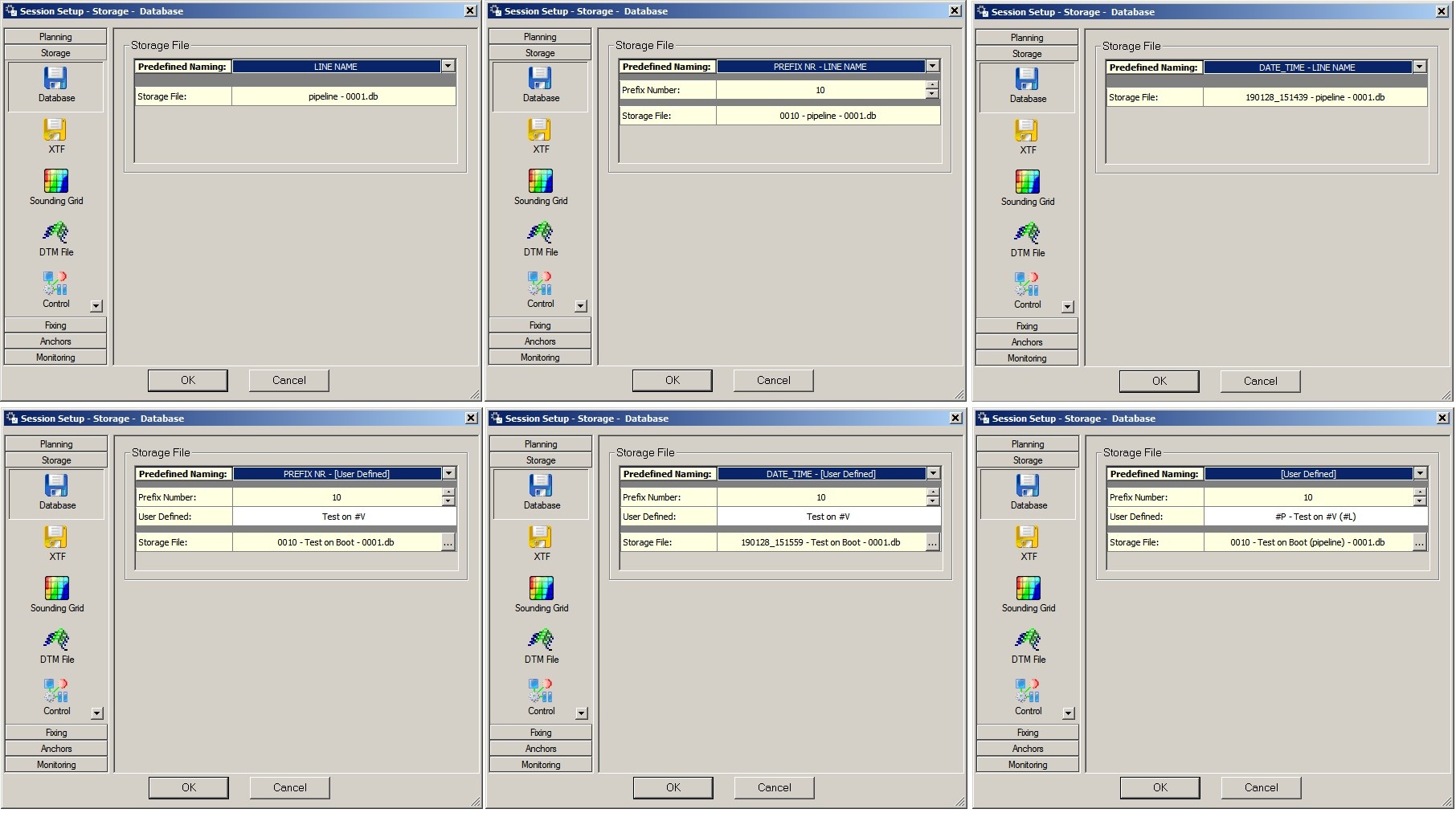
Note that the explanation about possible format specifiers will pop up as a tooltip.
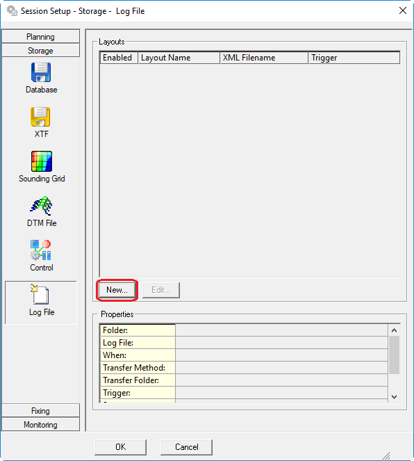
Online - Session Setup - Storage - Logfile - added "New..."button
Displays
Hide Time Synchronization Display
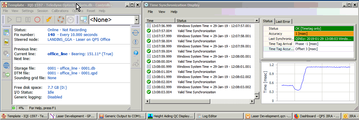
There are several options:
-
Use Toolbar button to Hide/Show the display
-
Use the Option pull-down menu to Hide/Show the display
-
Use the Display Manager to Hide/Show the display
-
Use the File/Exit or Close button in the display itself to hide the display
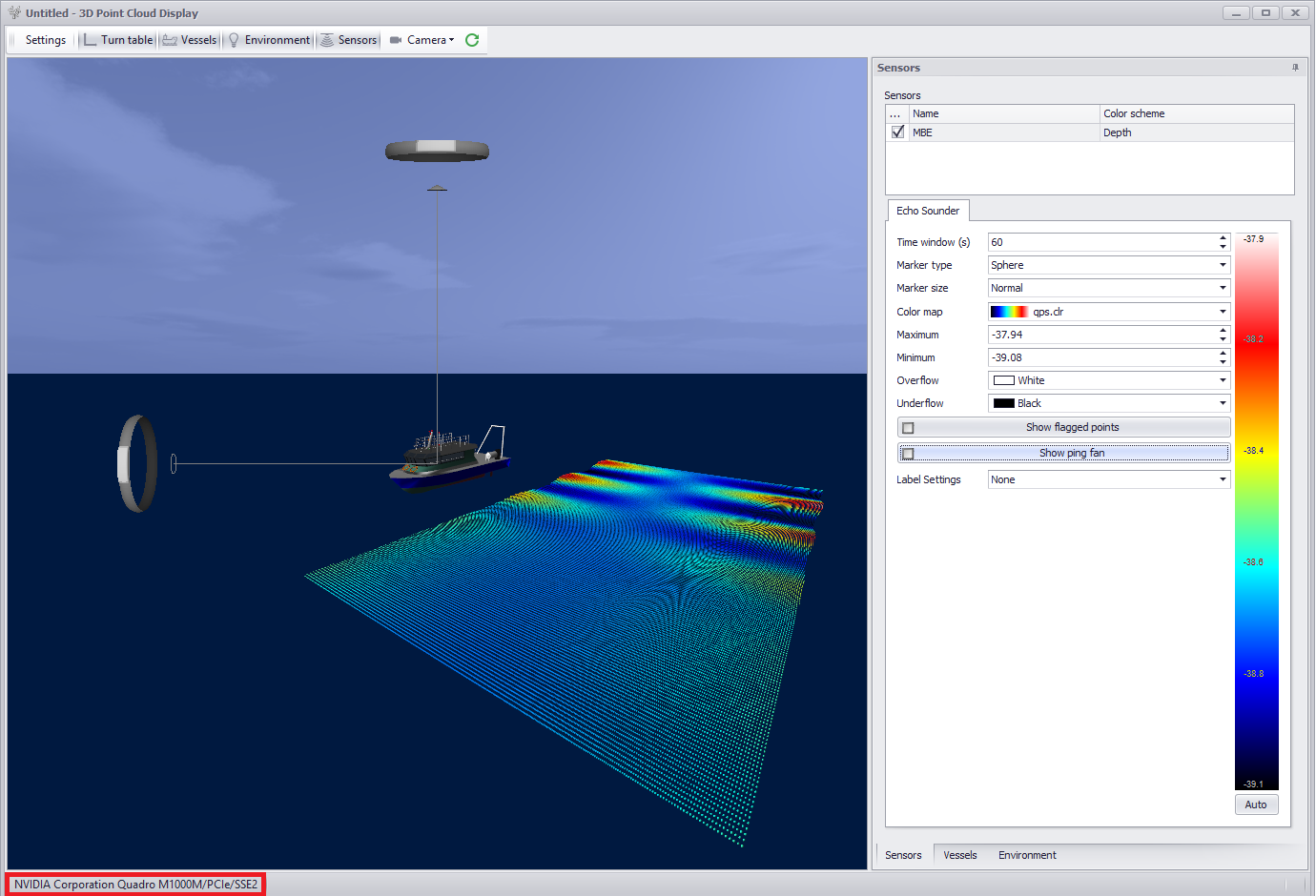
The 3D Point Cloud Display using the best graphics card
We are now capable of choosing an nVidia card above an Intel.
Unfortunately, we have not been able to find a solution to do the same for the AMD cards in a .NET environment.
The used card is shown in the display:
Generic Display - The numeric items did not align when showing a list of items, making it difficult to read
An alignment function has been added and is the default setting when setting up a new display:
(click to enlarge)
Generic Display - Display an item in a color based on the actual value of the item
Based on the value of an item a color can be defined.
The example below also shows the color change in combination with the translate option which gives a more meaningful view:
Survey Manager
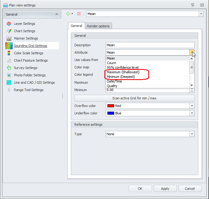
Sounding Grid - Added Shallowest / Deepest to attribute labels Min / Max
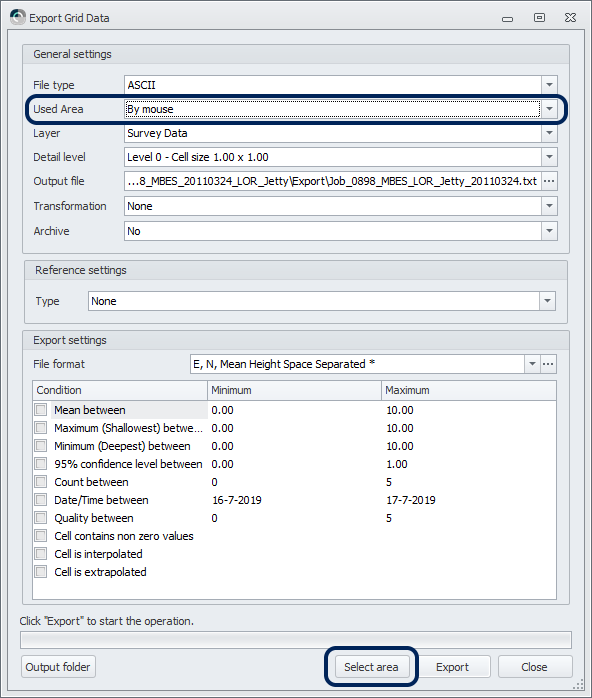
Sounding Grid - Export - ASCII - Added area selection to GUI
Sounding Grid - Export - GeoTiff - Added possibility to set transparency for empty cells
This option is only available for the export of the 32 bit version.
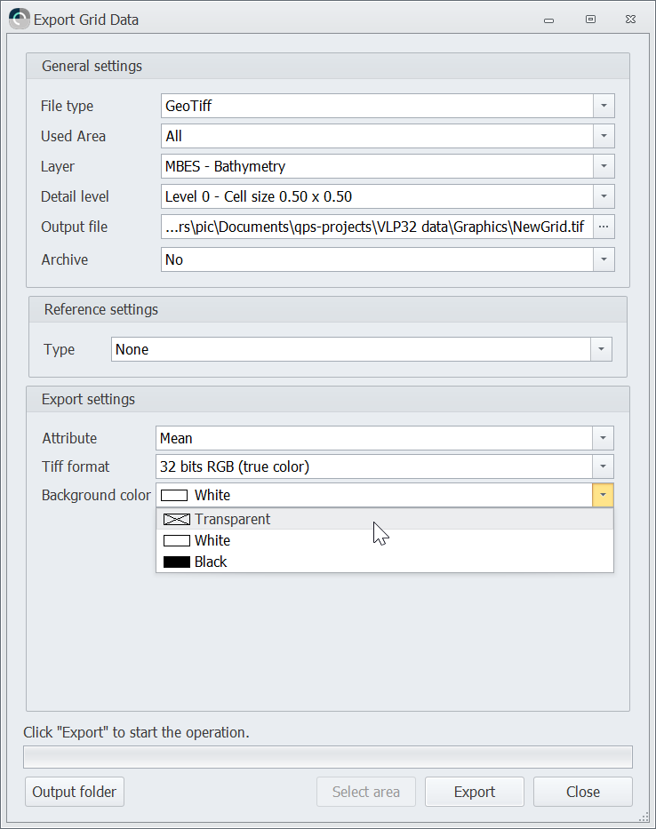
You can select the 'empty cell' color for the creation of the tiff file when the empty cell color is different by default.
Sounding Grid - Contours and Soundings - Create spotsoundings with a decimal dot
The decimal dot indicates the exact location of the value.

Setup
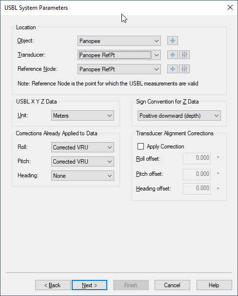
USBL - Changed GUI - Transducer Alignment Corrections