
Improvements
Below is a list of the important issues that have been resolved and functionality that has been implemented in this release. This list is not exhaustive.
DRIVERS
-
Drivers - INS - Halliburton SAS - Option to output position in user selectable datum FQI-326
-
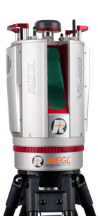
Drivers - Laser - RIEGL VZ-400i FQI-382
The QINSy Laser driver now supports the RIEGL VZ-400i, an ultra High Performance 3D Laser Scanner which is the successor of their successful VZ-400 terrestrial laser scanner.This scanner in combination with QINSy can be used in profiler (2D) or in radar (3D) mode. Please see the drivers
documentation
for all the details.
-
Drivers - MBES - Kongsberg - Add support for KMALL format
FQI-479
-
The driver released in 8.18.3 only supports a single head.
Dual Head support and Extra Detection improvements is being worked on.
-
-
Drivers - Output - DP-Waypoints - Missing user defined system name in UI FQI-410
-
Drivers - Surface Navigation - Kongsberg - RADius - Add Network version FQI-357
-
Drivers - Underwater sensor - Digiquartz driver - Add ini driver FQI-370
If you have user defined drivers for systems created with our I/O Driver Editor and want them to be added to the QINSy Installation, please create a support ticket and add:
-
I/O Test Utility log file of the output format from the system
-
Documentation:
-
Format description
-
How to configure the system (this can be used for our Drivers Manual / Equipment Space (Note: The Equipment space is under construction))
-
Picture of the setup / system
-
Drivers - USBL - Target object - Clone (inherit) attitude from parent object FQI-268
-
OFFLINE / REPLAY
-
Offline - WCD Inspector - Make button available with QINSy Singlebeam FQI-425
PM.NET
-
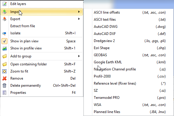
PM.NET - CAD - Line Planning - Import - Add extensions to 'Import of Planned Line Files' FQI-427
-
PM.NET - Sounding Grid - Contours and Soundings - Use the layer selected in Project Explorer FQI-416
-
PM.NET - Sounding Grid - New - Geographical - Origin Mode always manual FQI-463
Automatic mode was not working properly for creating Geoid Model grids, therefore the user needed to define the origin manually to prevent horizontal shifts.