
It is possible to enter additional mainlines for other objects to follow such as an ROV or a touch down point on a pipe laying barge or for sailing along a curved river.
For example with an ROV one might not be interested in its offset from the mainline that is used by the survey vessel, but rather in the offset from a desired line.
Or, when sailing along a river axis, the route along the tidal stations should be selected: 'Just' calculating the closest horizontal distance for tide interpolation is not enough, because a river can be curved.
In all displays where lines can be selected, additional mainlines can be selected too:
Navigation Display, Alpha Numerical Display, Generic Display and Profile Display.
When a different additional mainline is needed, the line must be selected here in the Additional Mainlines menu.
This will change the additional mainline in all the used displays at the same time.
When a new additional mainline is needed you can create the route using the Waypoint Planning option in the Navigation Display.
For example a quick way to create a new additional mainline along a river (for tide interpolation purposes) just click along the tide stations which will be passed.
|
Additional Mainlines |
|
|---|---|
|
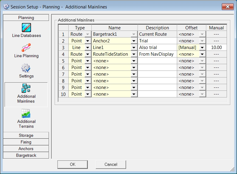
Type |
Select a Type from the pull down menu: choose between Point, Line or Route. |
|
Name |
Select an existing name from the pulldown menu.
|
|
Description |
This description is for the user only and will not appear in the display. |
|
Offset |
If needed, select Manual or (in specific cases) a special observation.
|
|
Manual |
Enter a value for the lines where a Manual Offset was selected.
|
Return to: Planning