A list with 10 entries. The first one is always the Controller's mainline. The other 9 are the additional mainlines. The actual mainline/additional mainline selection (POINT, LINE, ROUTE) is done in the Controller's Session Setup, Planning.
Sub Item
Description
Value Type
Properties
Name
Name of the current mainline.
text
Type
"Point" if current mainline is a POINT, "Single Line" if current mainline is a LINE and "Route" if current mainline is a ROUTE.
text
Description
When Parent Item Line is set to [Mainline], then this Line Description will be "Current Point", "Current Line", or "Current Route", dependent on the type of the current mainline. Otherwise it will be the user-defined description of the additional mainline, as entered by the user in the Controller Session Setup, Planning, Additional Mainlines.
text
Line Index
A number between 1 and 10, indicating the selected Line of the Parent item property. So 1 means Parent Item is [Mainline], 2 means it is [2nd Mainline] and so on.
int
SOL Easting
Depends on the type of the selected mainline:
POINT Value will be easting co-ordinate of the Point
LINE Value will be the start-of-line easting co-ordinate of the Line
ROUTE Value will be the start-of-line easting co-ordinate of the very first section of the Route.
int
SOL Northing
Depends on the type of the selected mainline:
POINT Value will be northing co-ordinate of the Point
LINE Value will be the start-of-line northing co-ordinate of the Line
ROUTE Value will be the start-of-line northing co-ordinate of the very first section of the Route.
int
EOL Easting
Depends on the type of the selected mainline:
POINT Value will be easting co-ordinate of the Point. So it is the same as the SOL Easting
LINE Value will be the end-of-line easting co-ordinate of the Line
ROUTE Value will be the end-of-line easting co-ordinate for the very last section of the Route.
int
EOL Northing
Depends on the type of the selected mainline:
POINT Value will be northing co-ordinate of the Point. So it is the same as the SOL Northing
LINE Value will be the end-of-line northing co-ordinate of the Line
ROUTE Value will be the end-of-line northing co-ordinate for the very last section of the Route.
int
SOL Latitude
Depends on the type of the selected mainline:
POINT Value will be latitude co-ordinate of the Point
LINE Value will be the start-of-line latitude of the Line
ROUTE Value will be the start-of-line latitude for the very first section of the Route
int
Datum
Survey Datum (Default)
WGS84
SOL Longitude
Depends on the type of the selected mainline:
POINT Value will be longitude co-ordinate of the Point
LINE Value will be the start-of-line longitude of the Line
ROUTE Value will be the start-of-line longitude for the very first section of the Route.
int
Datum
Survey Datum (Default)
WGS84
EOL Latitude
Depends on the type of the selected mainline:
POINT Value will be latitude co-ordinate of the Point. So it is the same as the SOL Latitude
LINE Value will be the end-of-line latitude of the Line
ROUTE Value will be the end-of-line latitude for the very last section of the Route.
int
Datum
Survey Datum (Default)
WGS84
EOL Longitude
Depends on the type of the selected mainline:
POINT Value will be longitude co-ordinate of the Point. So it is the same as the SOL Longitude
LINE Value will be the end-of-line longitude of the Line
ROUTE Value will be the end-of-line longitude for the very last section of the Route.
int
Datum
Survey Datum (Default)
WGS84
Length
Depends on the type of the selected mainline:
POINT Value will be empty
LINE Value will be the length of the entire Line Value will be empty when the line is curved i.c.w the reference set to True
ROUTE Value will be the length of the entire Route Value will be empty when at least one of the sections is curved i.c.w the reference set to True.
int
Reference
Grid (Default)
True
SOL Bearing
Depends on the type of the selected mainline:
POINT Value will empty
LINE Value will be the bearing between the SOL co-ordinate and the EOL co-ordinate of the Line. A possible radius value (i.e. curved line) is not taken into account.
ROUTE Value will be the bearing between the SOL co-ordinate and the EOL co-ordinate of the Route. Possible curved sections are not taken into account.
int
Reference
Grid (Default)
True
Radius
Depends on the type of the selected mainline:
POINT Value will be the Radius1 value (in survey units) that defines a possible circle around the point.
LINE The values that defines the curve for the line. A straight line has a radius of zero, a +tive radius means the line bends to starboard, and -tive means it bends to port.
ROUTE Value will be the radius value for the current section of the current Steered Node (as defined in the Controller). A straight section has a radius of zero, a +tive radius means the line bends to starboard, and -tive means it bends to port.
int
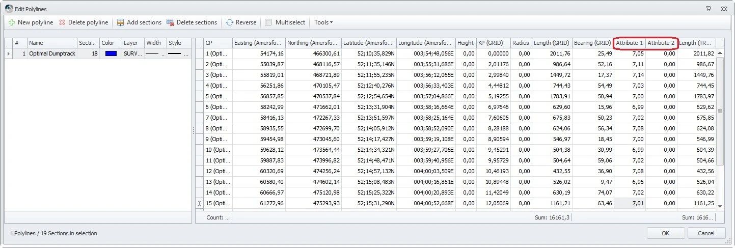
Attribute1
Attribute2
This will be the attribute1 value for a POINT or LINE or for the current section of a ROUTE.
Note that using the Survey Manager you may define two additional fields next to the co-ordinate values for a POINT, LINE or ROUTE section: Attribute1 and Attribute2.
It depends on your survey application whether a user needs this extra information, e.g. vertical seismic surveys, or particular dredging operations.
When the selected mainline is a:
POINT The value will always be visible
LINE The value will always be visible, even if the current steered node is before SOL or after EOL
ROUTE A value is always visible: it will be taken for the closest section (as determined for the current steered node) .
double
Current Section
The current (i.e. closest) section index for the selected mainline as calculated by the Controller for the Steered Node.
- When the selected mainline is a POINT it will be 0 (zero and always 1 when the selected mainline is a LINE.
- When the steered node position is before SOL for a ROUTE then the value will always be 1.
- When the steered node position is after EOL for a ROUTE then it will be the index of the last section: the same as the number of sections.
int
JavaScript errors detected
Please note, these errors can depend on your browser setup.
If this problem persists, please contact our support.