Qinsy - Survey Manager
This page will cover several frequently asked questions related to the Survey Manager.
Raster (GeoTiffs, ECW, Mosaics)
Raster related questions.
| Subject | Question | Answer |
|---|---|---|
| Geotiff | Why is my Geotiff not showing in the Survey Manager even though I can load it into the Navigation Display? | Survey Manager looks at the geodetic settings in the file. It might be that the coordinates in the file are correct for the project's geodetic settings, but the header of the file contains other geodetic settings. In this case try to change the geodetic settings with the software with which you originally created the geotiff. |
QPD - Import/Export
QPD related questions regarding import and export.
| Subject | Question | Answer |
|---|---|---|
| Laser | Does Qinsy export data to Cyclone (Leica)? | Yes, Qinsy can export Laser data to the Cyclone *.pts file format from the Survey Manager. The first line contains a value indicating the number of points to follow. All other lines contain the point data in the format 'East North Height Quality', all space-character separated. |
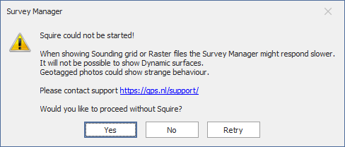
Squire
The Qinsy 9 Survey Manager uses a program called Squire.
| Subject | Question | Answer |
|---|---|---|
| Squire not started | Why do I get the following pop-up? | This means that a process that visualizes several file types in the Survey Manager is not started or the SVM is not able to connect to it. |