
How-to Monitor Dynamic Moon Pool Area
A Dynamic Moon Pool Area can be used specifically for tracking the whereabouts of an ROV relative to the moon pool it was lowered through.
To avoid breakage of umbilicals you can monitor whether the ROV stays within a predefined area relative to your vessel.
A Dynamic Moon Pool Area is a dynamic area that will change depending on the working depth.
The Area will increase in size when the vertical distance between vessel and ROV increases. The definition of the area is in text file format.
To be able to use this option, a second object, for example an ROV, needs to be present in the Database Setup.
Page contents:
General
In the Controller - Settings - Session Setup the parameters for Monitoring Areas can be set:
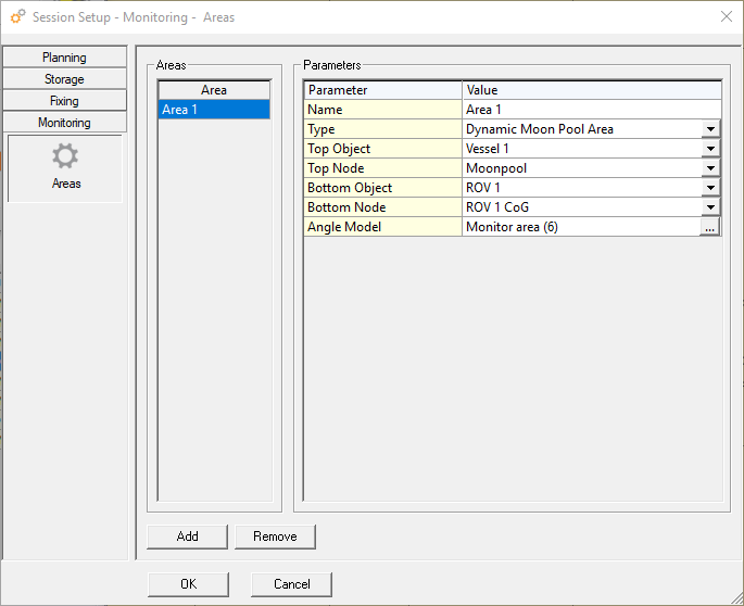
The Area list will be empty at start-up; use the Add button to create a new monitor area.
Enter the following settings:
- A Name for the area
- Select the Type of the area
- Select which Object is at the top, probably your vessel
- Select a Node on the top object which will be used in the calculation
- Select the bottom Object, probably the fall pipe ROV
- Select the Node on the bottom object which will be used in the calculation
- Browse for a pre-defined Angle Model, containing the points and angles of the bottom node relative to the top node
Press OK to start the calculation.
Angle Model
- The monitor area is defined as a compass table that is referenced to the vessel heading. Starting at 0 and then for every 5 degrees a vertical angle is given.
- The monitor area is calculated by connecting the points that are calculated using the angles from the compass tables and the height difference between the reference node on the vessel (a node in the moon pool) and the reference node on the ROV.
- The angle model is a straight forward text file. In the text file the bearing and vertical angle are defined.
- The last point in the file needs to be repeated to close the area.
Example of an Angle Model file
Bearing,Angle
0,15
45,20
135,20
225,20
315,20
360,15
In which the Bearing is the bearing of the vessel and the Angle is the angle of the ROV compared to the vertical.
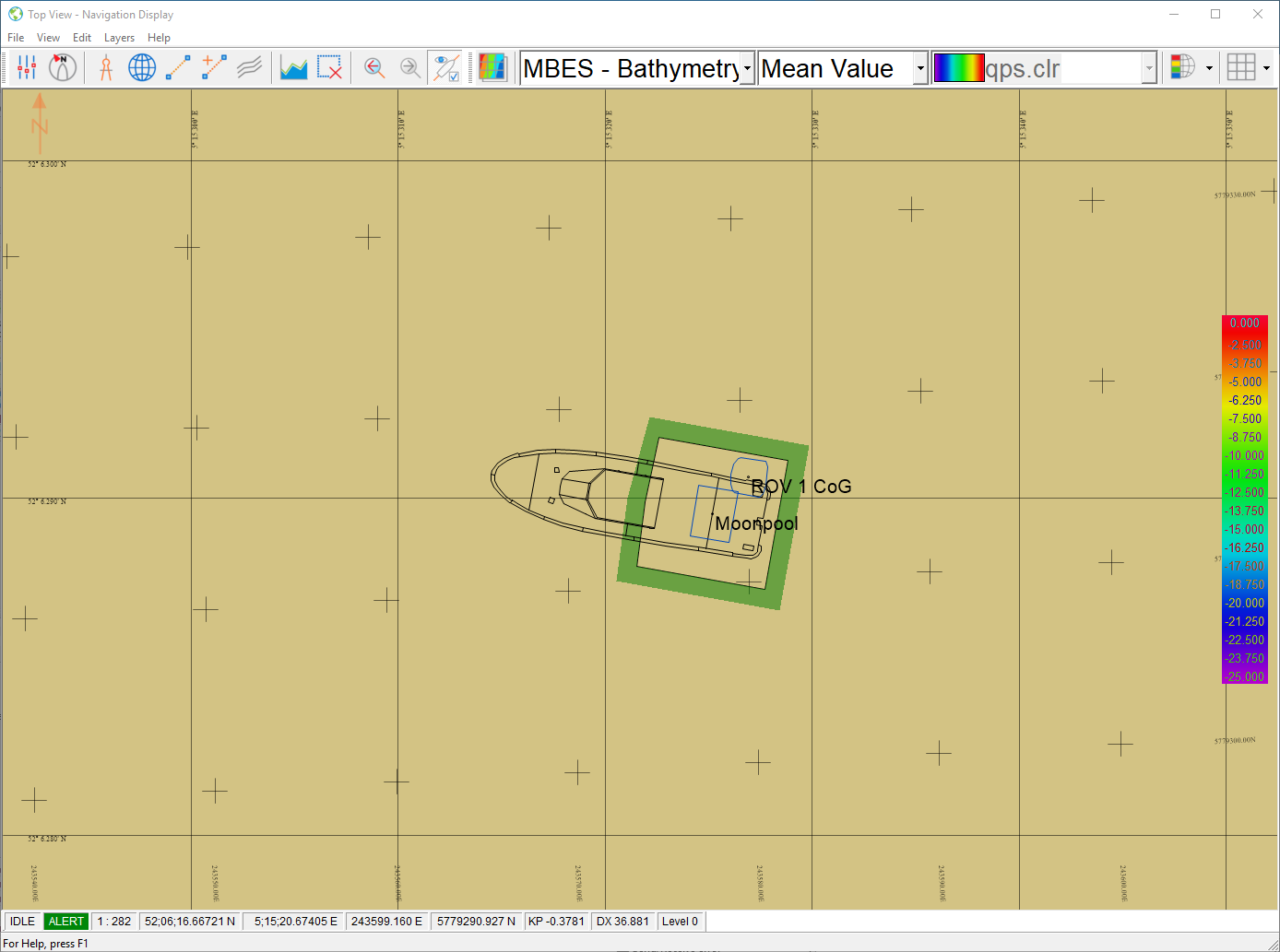
The shape of the defined area is connected to the vessel or its node and will move along with it in the Navigation Display.
Example files: SB work area.txt and Full circle.txt
Navigation Display
The dynamic model is always shown in the Navigation Display.
When the Bottom Object is inside the model then the border is shown in green.
When the Bottom Object is outside the model the color changes to red.
When there is an error then the color is orange.
Alert Display
An alert can be added for the model.
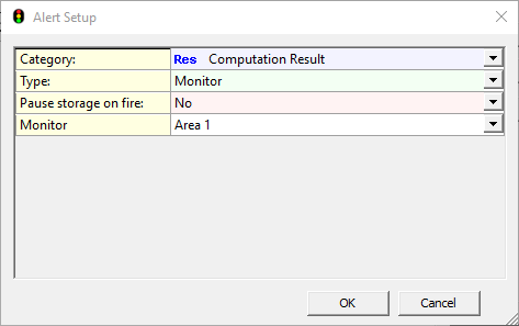
The Category is a Computation Result.
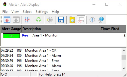
When the Bottom Node is inside the monitoring area the alert is green.
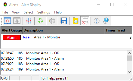
When the Bottom Node is outside the monitoring area the alert is red.
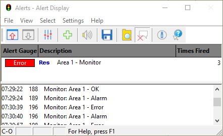
When the Bottom Node is in error for any reason the alert shows that there is an error.