Qimera 2.0.0 - New Functionality
New Project Dialog
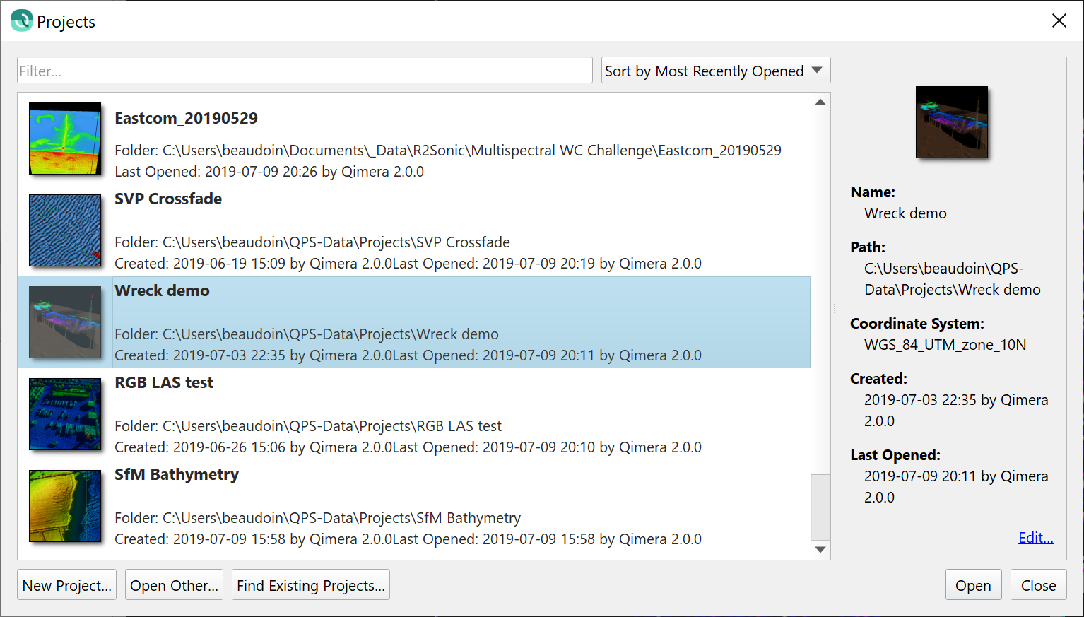
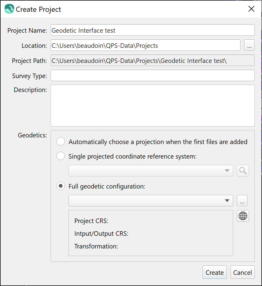
The new project dialog has had a refresh and is now common between Qinsy and Qimera, with functionality merged from the previously used dialogs in both applications.
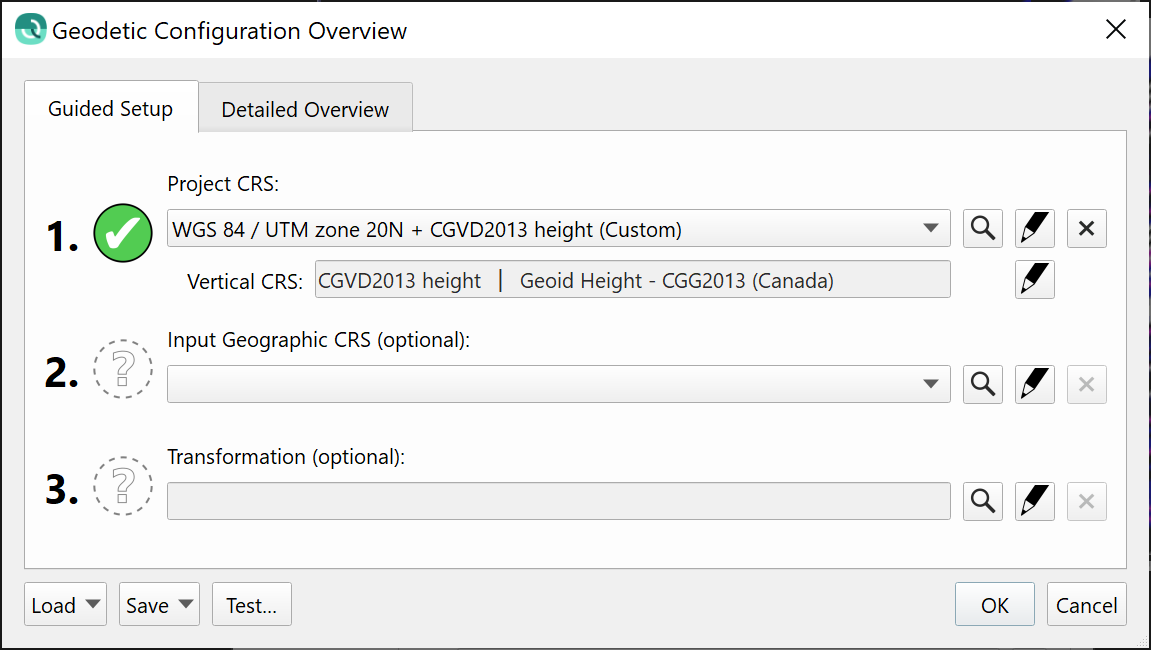
New Geodetic Configuration Interface
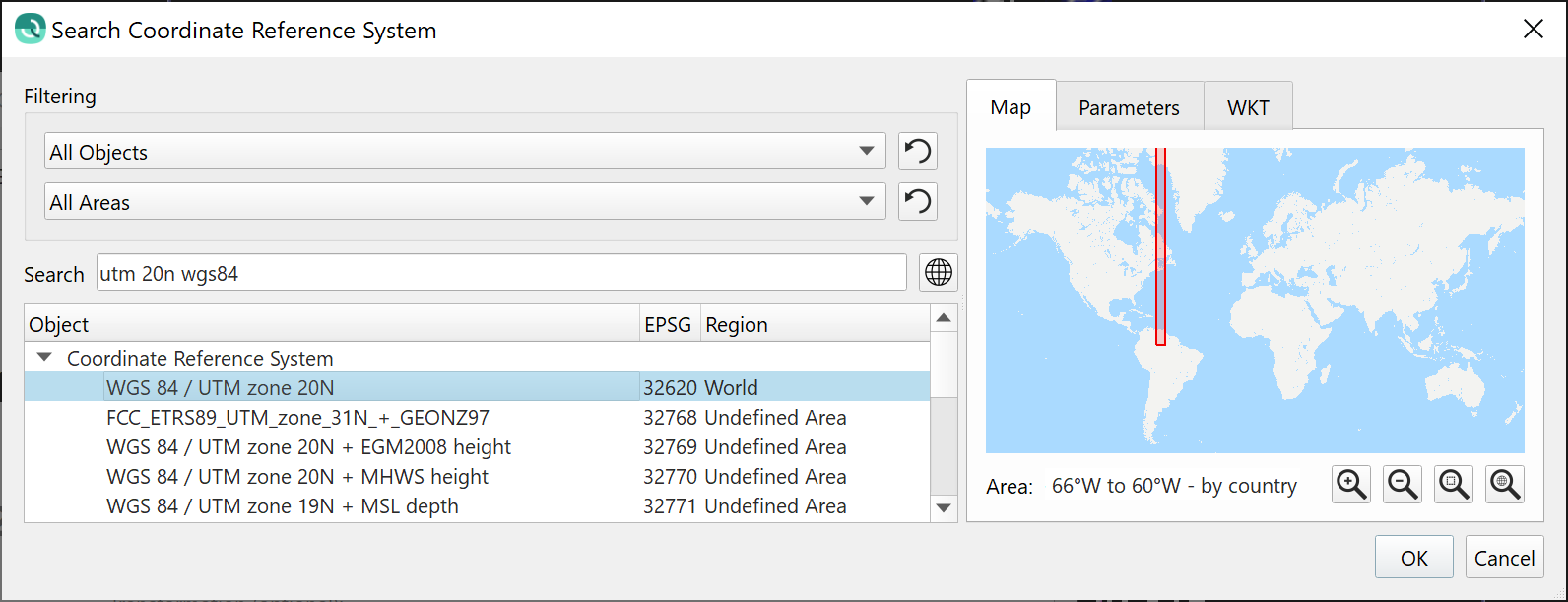
There is a new geodetic configuration interface that brings the full power of Qinsy's geodetic configuration abilities to Qimera. The new interface is shared with Qinsy and marks a major improvement for both applications. For example, Qimera users can now specify vertical separation models, create complex custom geodetic transformations between coordinate frames, create construction grids and more. Qinsy users can now search by EPSG code and use a Guided Workflow to configure simple setups quickly or complex setups intuitively.
Integrated 3D Editor into Slice Editor
You will be able to simultaneously run the 2D Slice Editor and the 3D Editor. Combined with the point plot in the main 4D Scene, this gives a complete picture to data reviewers.
SVP Crossfade
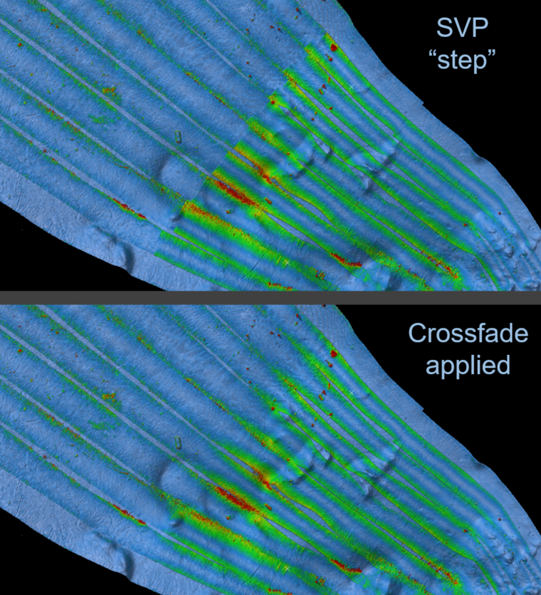
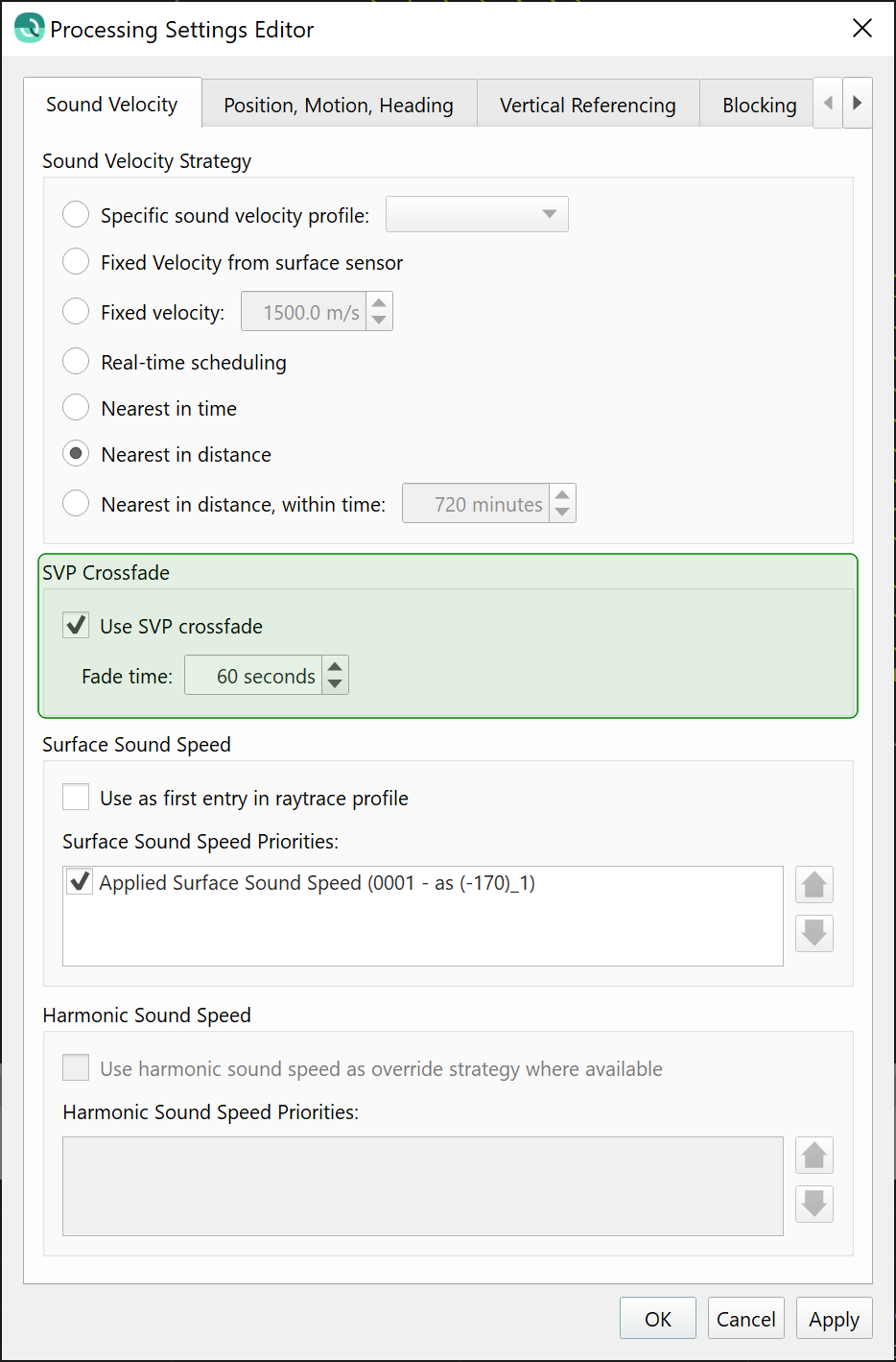
You can apply a "crossfade" to help smooth out the transitions between SVP casts when using time/distance based SVP lookup strategies. The fade time will set the time interval over which the ray trace slowly switches from one SVP to another, avoiding the ugly seam that can occur when you suddenly switch between SVPs in the span of one ping.
R2Sonic TruePix as Water Column imagery
Qinsy users will now be able to view R2Sonic TruePix data in our Water Column viewer, along with full water column point digitization capability: extract the least depth over a wreck, hunt for hydrocarbon seeps or even monitor suspended sediment during dredging. Shown below is imagery of a bubble plume and fish in Halifax, Nova Scotia. This feature requires recording of the magnitude and angle data, which can be configured in the R2Sonic driver in Qinsy.
Classification and RGB support for LIDAR data
LIDAR users will find support for RGB and Classification for LAS files. You can color by RGB or classification in the Scene and Slice Editor. You'll also find new custom filters in our Filters Tollbar to Accept/Reject by Classification and to Set Classification, both of which can be done directly off a surface. The classification data can be unloaded back to the original source LAS files, or you can export the classification to new LAS/LAZ or ASCII files.
Isolated Cluster Removal Filter
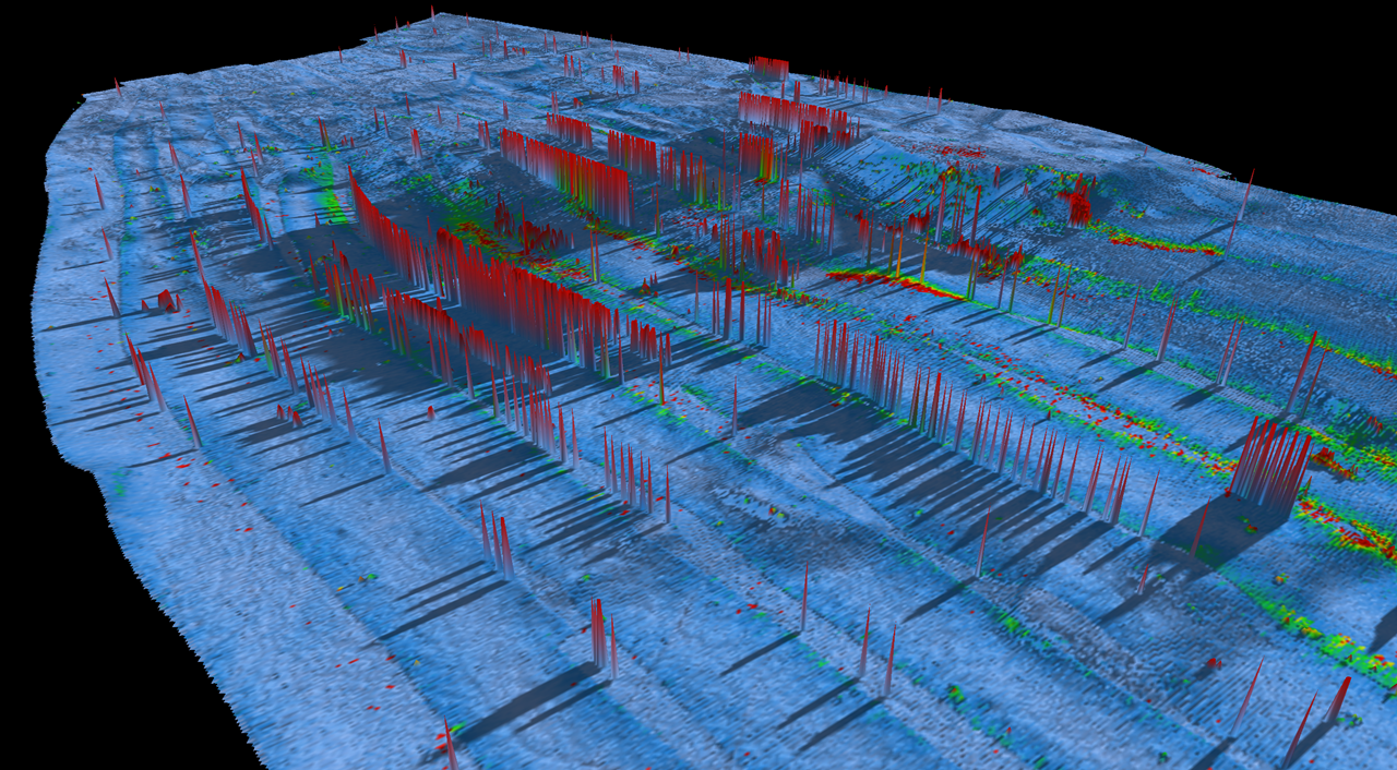
There is a new filter in our filter toolbar that identifies different clusters of data based on the separation distance between groups of point clusters. We use this to identify the largest cluster, the seafloor, and then flag all other point clusters for removal.
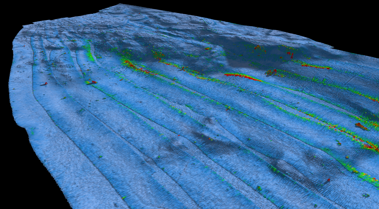
Structure from Motion Bathymetry Refraction Corrector
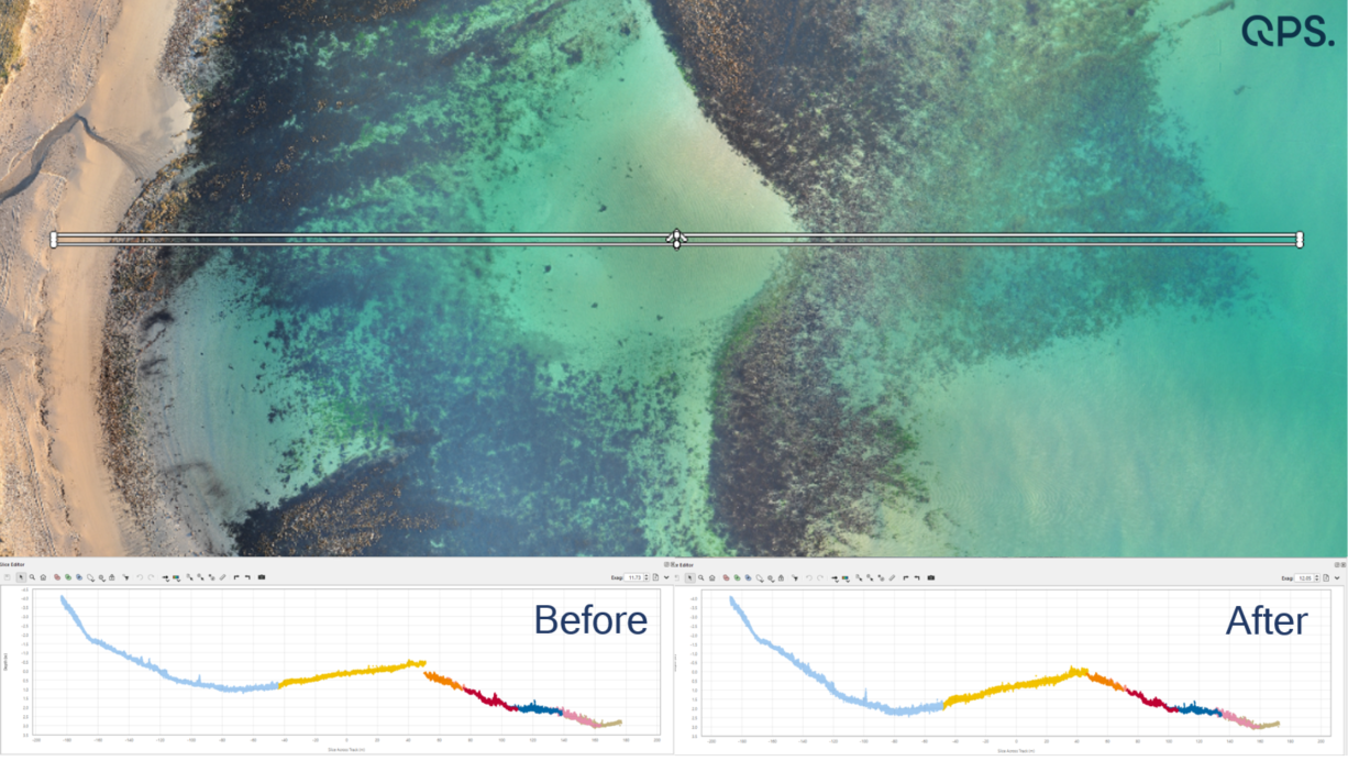
There is a new add-on that allows you to perform refraction corrections for bathymetric points derived through Structure from Motion (SfM) from UAVs. This allows you to get topography and bathymetry in one pass with Qimera. (image credit to 4D Ocean)
