
How-to Vertical Referencing
This How-to describes the process for setting and adjusting the vertical referencing of data.
On this page:
Setup
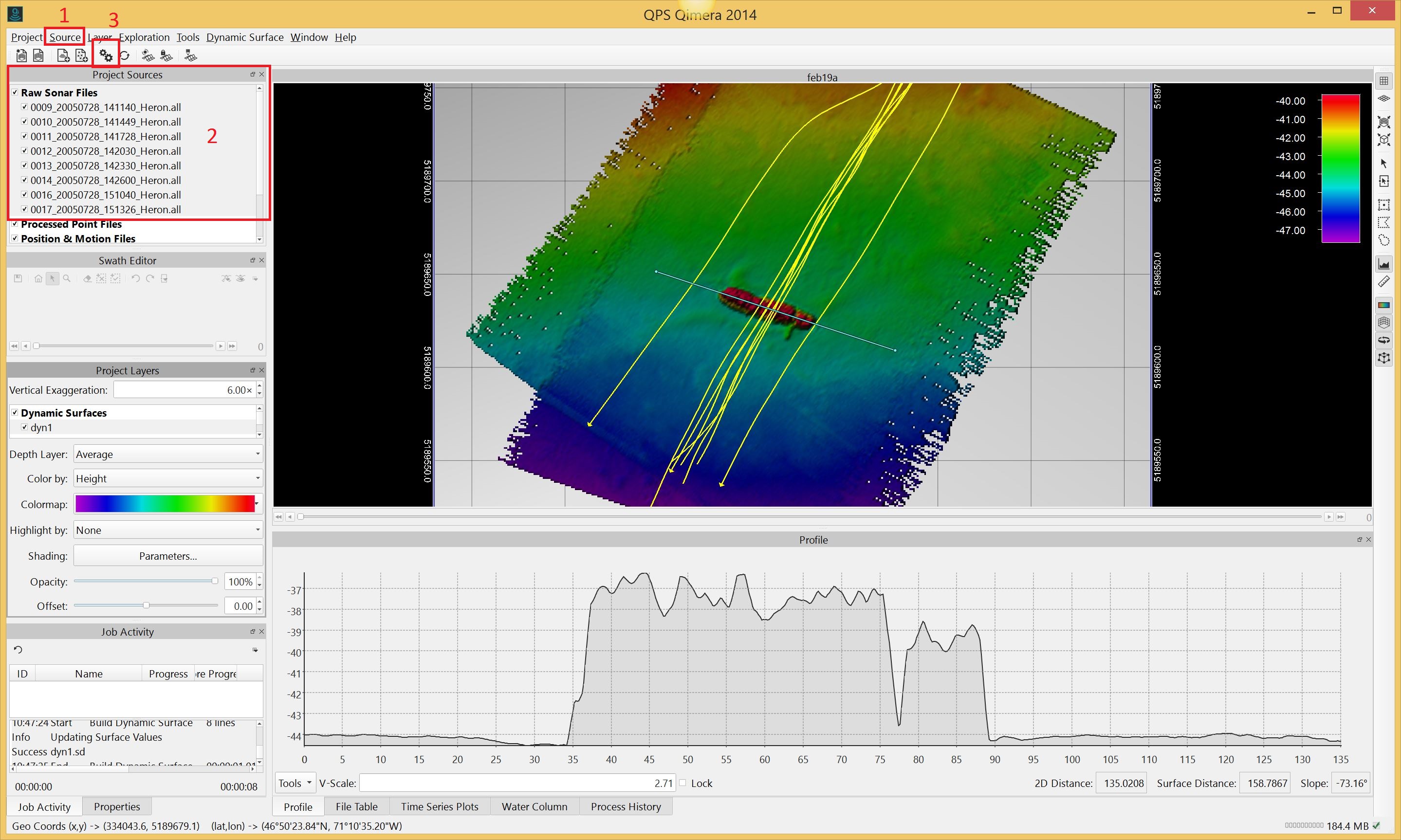
- Ensure that the files you want to adjust are loaded into the project.
- Load any tide, sbet, ASCII or binary nav files that are applicable. Use the 'Source' pull-down menu (1) for this.
- Select the lines (files) that need vertical reference adjustment.
You can highlight individual lines or click on 'Raw Sonar Files' in the Project Sources window (2) to highlight all files. - Click on the 'Processing Settings' button (3).
The Processing Settings Editor window will pop up.
Click on the Vertical Referencing tab.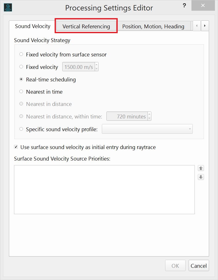
Vertical Referencing Options Overview
The Vertical Referencing options are laid out as seen below:
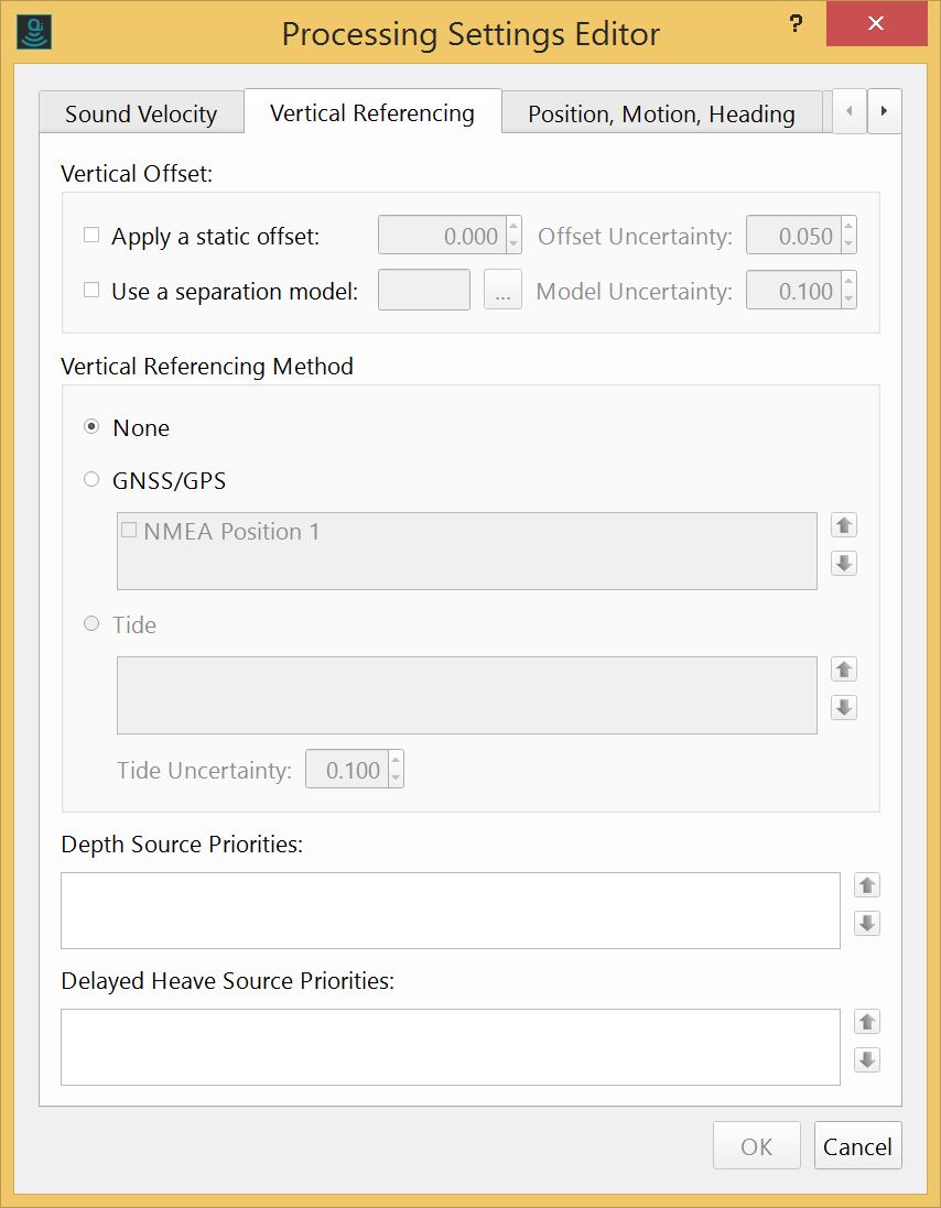
The Vertical Offset section allows setting static offsets and the use of a separation model. There is an adjustable uncertainty associated with each.
The Vertical Referencing Method section allows for the selection of either GNSS/GPS or Tides as your referencing source. The arrows at the right side of each box allow for the adjustment of the source priorities.
The Depth Sources Priorities box allows for prioritization of depth sources that are available. An example of this would be a depth sensor attached to an AUV/ROV.
If a depth source is available and applied, heave (from the motion sensor) and vessel squat are not applied.
The Delayed Heave Source Priorities box allows prioritization of any delayed heave sources that are available.
Details
Within the Vertical Referencing Method box shown below, there are two options for vertical referencing sources GNSS/GPS and Tide. Only one can be active at any time.
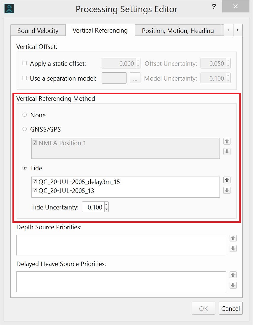
Within each of the methods there can be multiple sources. If the box beside each is ticked it will be applied to the MBES data. They are applied in order of their position in the list. If there is a gap or lack of overlap in the first, the second will be used, etc.
If the box is left unchecked, it will not be applied at all.
Once the OK button is pressed you will be prompted to reprocess affected files (at the top of the geographic window. This will apply the vertical referencing sources to the data and the dynamic surface (if you have one built) will be automatically regenerated.