Coordinate System Setup

On this page:
Coordinate System Setup
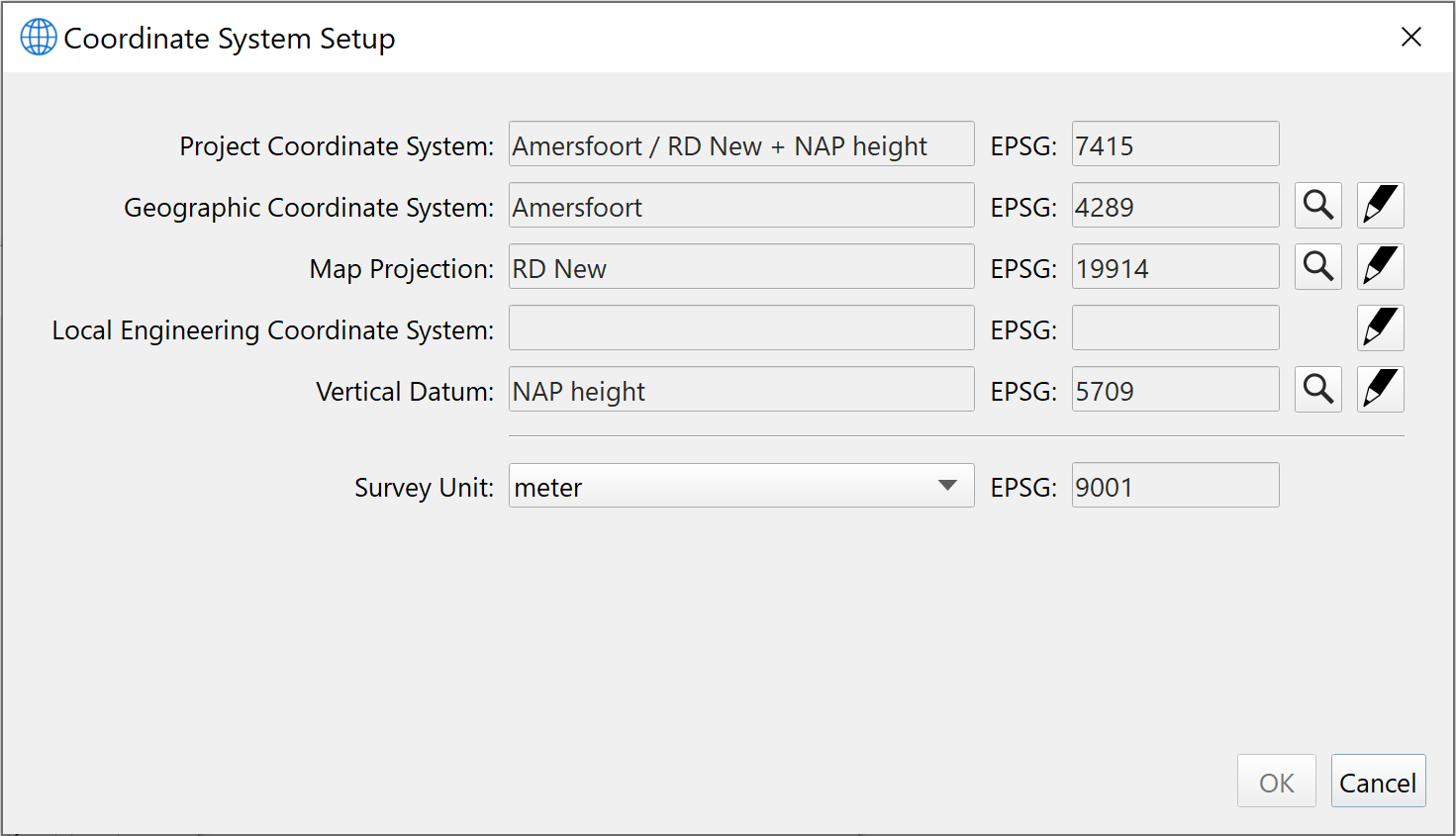
This dialog is used to set up a coordinate system. You can create a coordinate system from scratch or edit an existing one in order to create a custom coordinate system.
You can create a Geographic, Projected or Compound coordinate system. There is an implied sequence for using this dialog which is why some components are not enabled until you fill in certain parts.
Each component of the Coordinate System consists of a Name and EPSG field and has either a Search 

Using the search button brings up the Search Dialog for that particular geodetic type. Using the Setup button will bring up the Setup dialog specific to that geodetic type.
Project Coordinate System
The Project Coordinate System is the full name of the coordinate system and the associated EPSG code. This widget is read only.
The construction of this name is automated by the GUI and is not editable.
It is composed by joining the following: Geographic Coordinate System Name, "/", Map Projection Name, "+", Vertical Coordinate System Name, "+", Engineering Coordinate System Name.
If you create a custom coordinate system or edit an existing coordinate system, the EPSG code will initially be blank until you save your work and the coordinate system has been added to your local catalog.
Geographic Coordinate System
The Geographic Coordinate System is the name of the geographic coordinate system used in the composite coordinate system. This widget and the associated EPSG code is read only.
Click on the Search button to bring up the Search Dialog for Geographic Coordinate Systems.
Click on the Setup button to go to Geographic Coordinate System Setup.
Map Projection
The Map Projection is the name of the projection grid used in the Projected Coordinate System. This widget and the associated EPSG code is read only.
Click on the Search button to bring up the Search Dialog for Map Projections.
Click on the Setup button to go to Map Projection Setup.
Local Engineering Coordinate System
The Local Engineering Coordinate System is the name of the local engineering grid used in the Project Coordinate System. This widget and the associated EPSG code is read only. Click on the Setup button to go to Local Engineering Coordinate System Setup.
Vertical Datum
The Vertical Datum is the name of the vertical coordinate system used in the Project Coordinate System. This widget and the associated EPSG code is read only.
Click on the Search button to bring up the Search Dialog for Vertical Coordinate Systems.
Click on the Setup button to go to Vertical Datum Setup.
Survey Unit
The Survey Unit indicates the "length" unit of the underlying map projection. This setting is linked to the projection that you have chosen and is therefore grayed out.
If you would like to use another unit then you can either choose another projection or edit the projection (
