
How to Start
Import → Import Image from Web Mapping Service
What It Does
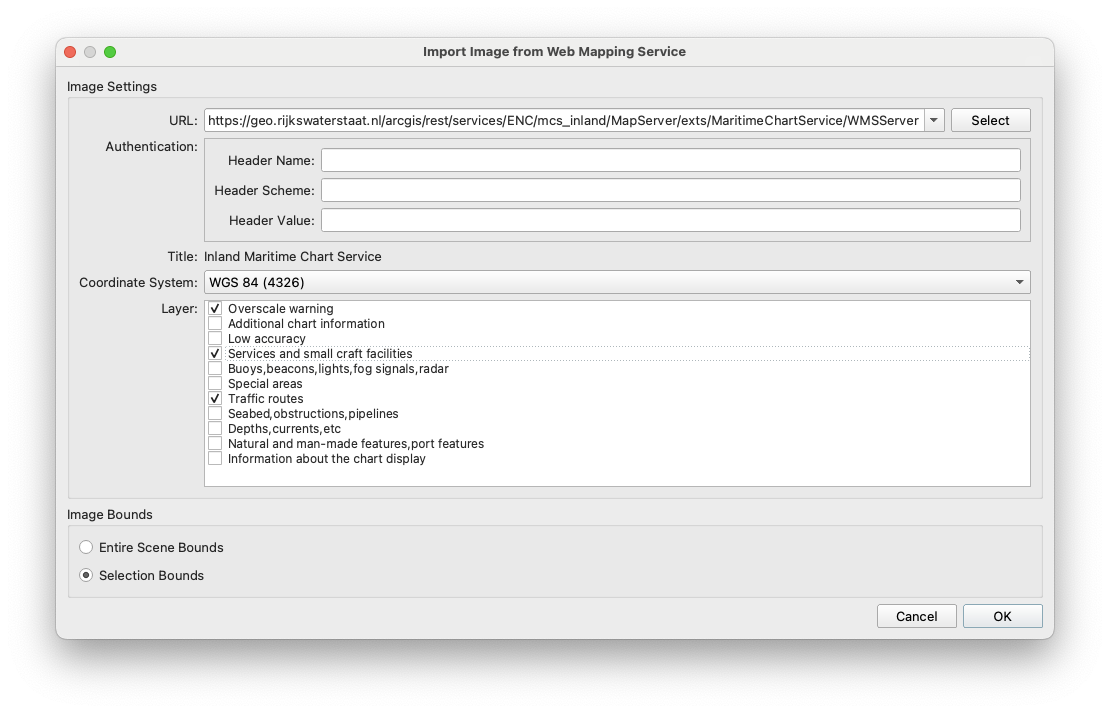
This dialog allows downloading of map images from a Web Mapping Service (WMS) server and adds them to your scene. You enter the server's URL and the dialog shows what the server offers. Most servers list the coordinate systems (CRS) they can deliver images in, and the layers you can download.
You can download one or more layers at a time. Each layer you choose is saved as its own image file and added to the scene.
If something is selected in the scene, only that area is downloaded. If nothing is selected, the dialog uses the scene's current bounds.
General Description
This dialog has the following options.
Server URL
Enter the address of the WMS server you want to download images from. When the dialog connects, it shows the server's details, coordinate systems and layers.
Authentication
Some WMS servers are protected and need an API key or other credentials before they return any data. If you connect to a protected server without credentials, the server refuses the request and no layers or coordinate systems are shown.
Your data provider supplies the credentials. Leave these fields empty for public servers.
-
Header Name: The name of the HTTP header the credential is sent in, such as apikey.
-
Header Scheme: The authentication scheme (for example, Basic or Bearer) placed in front of the credential.
-
Header Value: The API key, token or other credential from your provider.
Coordinate System (CRS)
The coordinate system the images will be downloaded in. The list shows the CRSs this server supports. You can choose only one, and every selected layer uses it.
-
If the chosen CRS differs from the scene's CRS, the images are reprojected to the scene's CRS.
-
If the scene has no CRS yet, the scene takes the chosen CRS.
Layers
A checklist of the layers available on the server, labelled with each layer's title. Tick each layer you want to import. You must select at least one.
-
Hover over a layer to see the server's description of it.
Area
An optional area can be selected in the scene allowing a specific bounded image to be downloaded.
-
If something is selected in the scene, only that area is downloaded.
-
If nothing is selected, the scene's current bounds are used.
Saving the Images
When you click OK, the application asks where to save the images. If a single layer is selected, you are asked for a file name, which defaults to the layer title. If multiple layers are selected, you are asked for a folder, and each image is named after its layer title. If a file name is already in use, a suffix (-1, -2, -3, …) is added so existing files are never overwritten.