
On this page:
Surfaces data management
You can now adjust the visuals (colormap scheme and shading and illumination) of several surfaces at the same time, allowing you to adjust the colormap and range to the selected set of surfaces. Figure 1 shows several geographic surfaces, loaded one at a time, before adjustment, each one has its own colormap and then after adjustment.
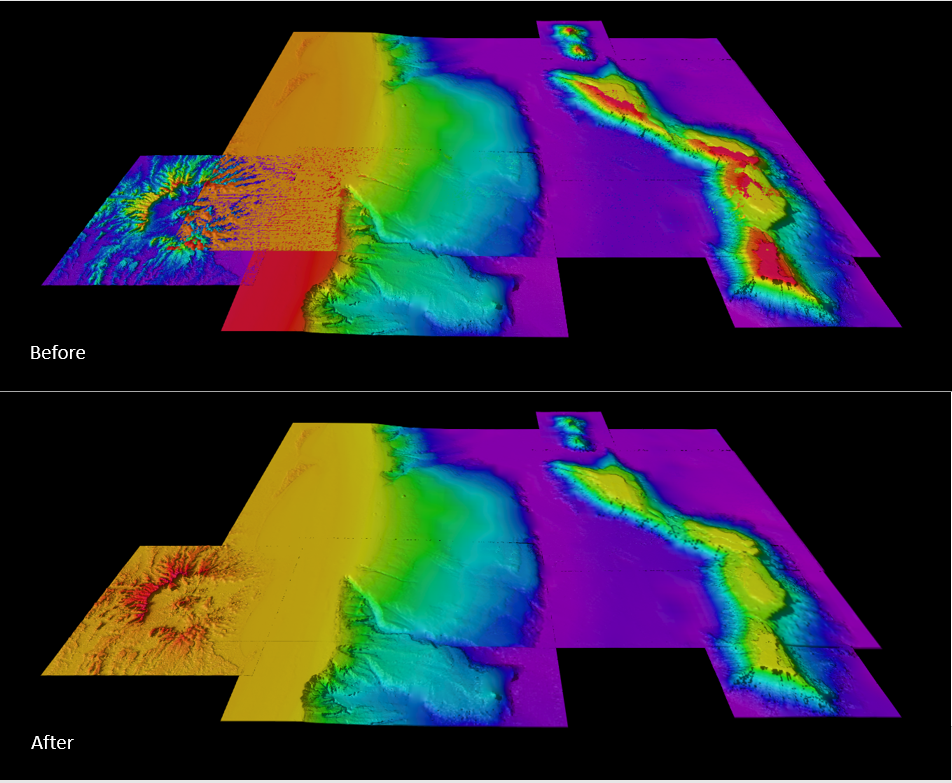
Figure 1. Surfaces loaded before and after color and total data histogram for the group of them.
The histogram loads for the entire selected dataset, allowing to work with the set in one go. See figure 2 with the histogram populated for all surfaces loaded in the 4D Scene.
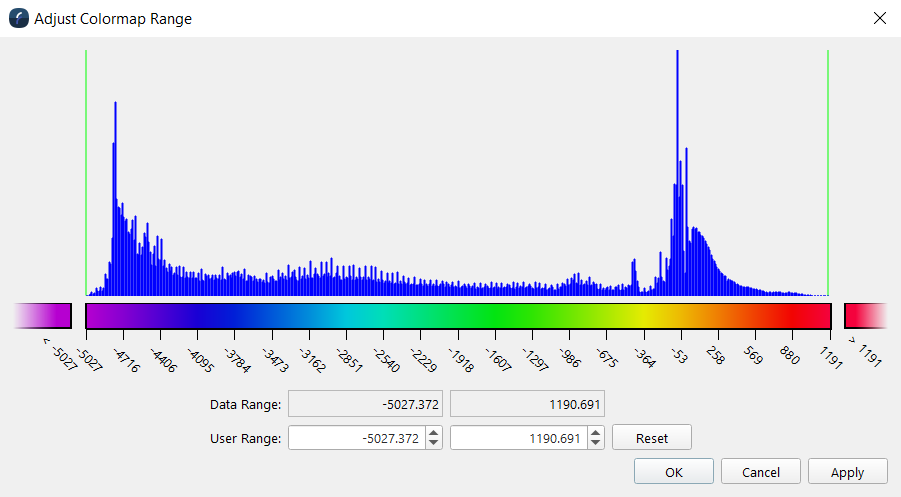
Figure 2. Adjust Colormap Range Dialog
Additional surface exports fixes and improvements were done: adequate empty cell values handling and the data fusion functionality released in 8.3.0 with the Export scene to geoimage, now supports transparencies. With the release of Fledermaus 8 there were a number of improvements and changes on how Fledermaus works with surfaces, these are explained in detailed in the Understand Surfaces in Fledermaus 8 technical note.
Scalar data management
You can now work, select and establish range with the colormap and histogram of the scalar object files, as well as that of the attached scalars through the Adjust Colormap Range dialog (Figure 3a). As with surfaces, you can work with several objects at the same time and they would be included in the total of the histogram adjust dialog. See figure 3b)
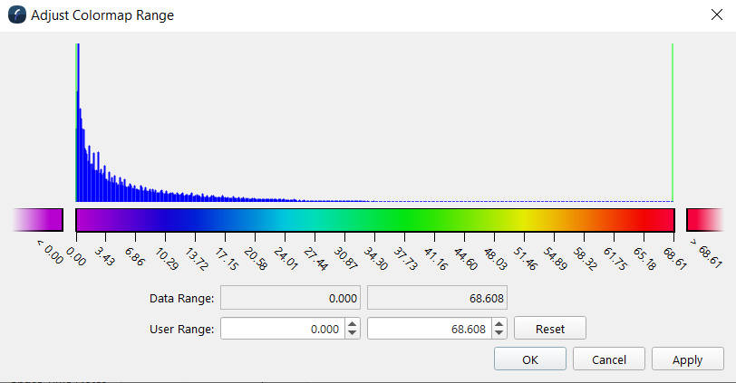
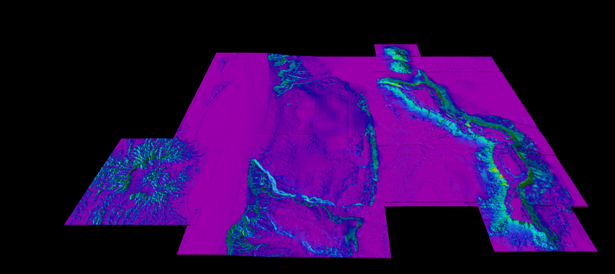
Figure 3. Scalar colormap and histogram adjust dialog
Turntable Widgets and Scene guides
Bounding box and Turntable widgets now have labels for guidance, as well as a North (N) label for having cardinal directions within a scene (as shown in Figure 4 and 5).
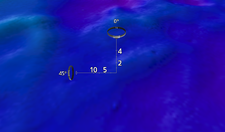
Figure 4. Turntable widgets with labels and N for reference
Note that units are that derived from the Coordinate Reference System (CRS) of the Scene and it is reported in the Scene properties Dock.
Geographic Data objects
It is now possible to work with geographic datasets by resampling non-uniform cells, as original data is in degrees, as such datasets that are geographic will align better, and now load. This was a known limitation from the last feature release of 8.3.0. See Figure 6 the 4D Scene with with a scene composition of several geographic datasets on Fledermaus 8.
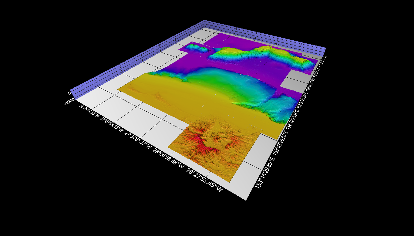
Figure 5. Fledermaus Scene with geographic datasets. Credits to DeepReef.org