
On this page:
Please note that the shading controls have new defaults that now match those in Qinsy and Qimera. This improves consistency when adjusting shading and moving between the three applications. However it is important to be aware of the changes when moving from FM7 to FM8.0/8.1 and to FM8.2
The largest changes are in the default value for the Vertical Scale shading parameter, and how it is used across surfaces. Note that if you have an existing version of Fledermaus installed, you will still see the old default values. To use the new values, you can reset your preferences by going to "File > Preferences...", and pressing the "Reset" button.
In addition to the change in default values, there are also changes in how the vertical scale is applied. In Fledermaus 7 the shading was automatically scaled based on the total Z range of the data set. The downside of this approach was that it made comparing shadows between data sets impossible to do. In Fledermaus 8.2, a 1 meter high feature will now produce the same shadow (when using the same shading parameters), regardless of the Z-range of the data set. This greatly improves the ability to do comparisons and analysis across different data sets.
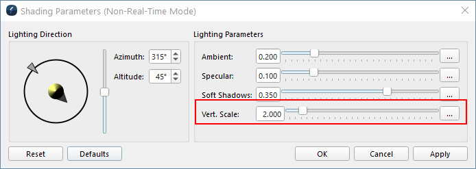
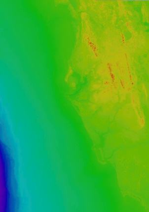
Please note that because of these changes, data sets with large Z ranges (such as a regional overview from the GEBCO data set) will look like they have little or no shadows when using the default parameters. In this situation, the shadows are correct, but are not visible at the large scale, as shown below. In these situations, you can increase the vertical scale to achieve shading results similar to the default output from Fledermaus 7, with a similar data set.
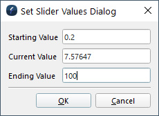
To increase beyond the default slider max of 20, press the button on the right labeled "...". This will display the "Set Slider Values" dialog, where you can set a new maximum value, such as 100.
Surface Shading
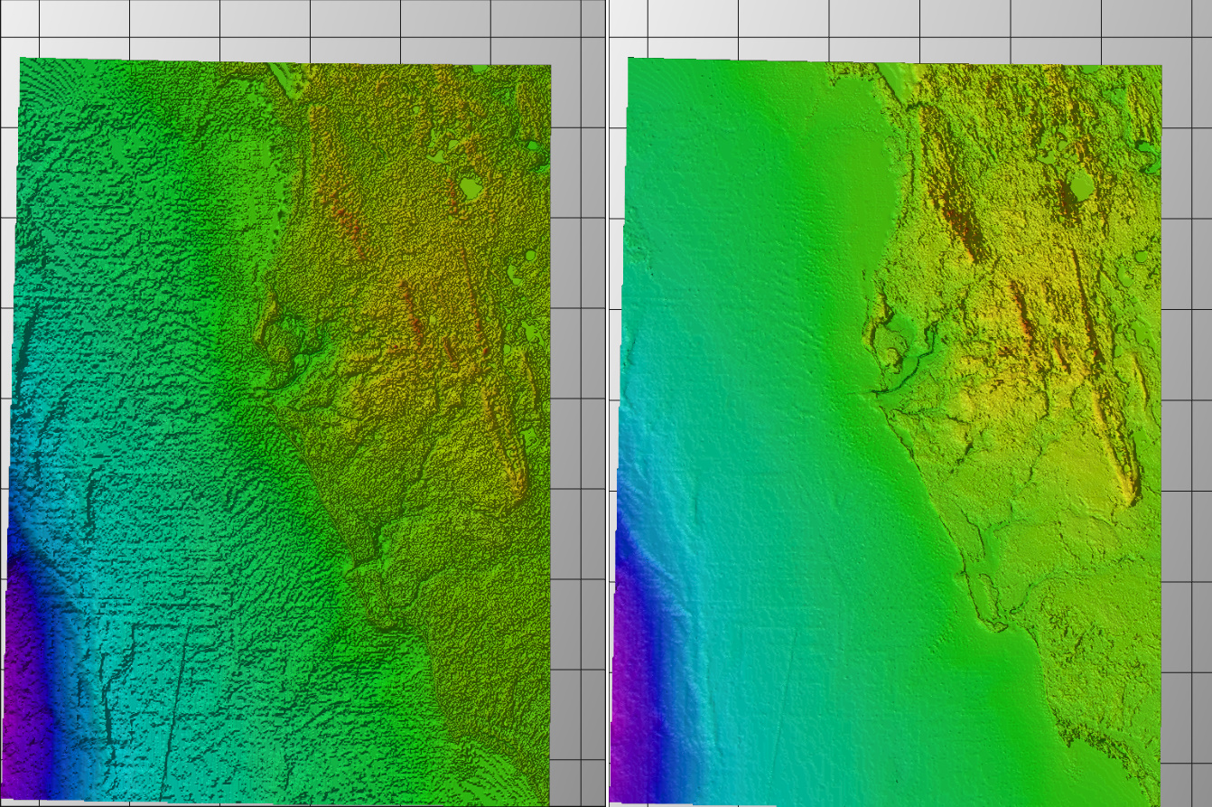
Significant improvements have been made to improve the consistency of shading between data sets, as well as to address issues with shading data with a large Z-range. In Fledermaus 7, the shadows had an automatic scaling, which provided a good result across multiple data sets, but prevented direct comparison between shadows when the Z-rage between data sets were different. Fledermaus 8.2 now has consistent shadows for equivalent features across data sets, independent of the actual Z-range.
The improvements for large Z-range data sets are visible in the image below, with FM8.1 on the left, and FM8.2 on the right. Note the FM8.2 shading is using a vertical scale of 100x to achieve a similar result to the defaults in Fledermaus 7.
NOTE: The shading problems with large Z-range data sets was often visible with geographic data in FM 8.2, however the coordinate system was not the source of the problem.
Geodetics
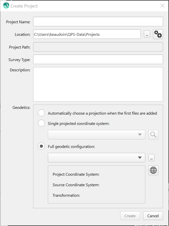
Several changes were made to the New Project dialog and the Geodetic configuration dialog based on user feedback on the new interfaces that were launched with Fledermaus version 8.1.0. Terminology has been improved in various dialogs, with the primary aim being to enhance clarity and reduce use of acronyms. Care has been taken to use terminology that is most commonly used and in some areas tool-tips have been added with further explanation. The behavior and layout of various dialogs has been improved for a cleaner and simpler user experience and workflow. All changes combined give an improved user experience. In addition a number of bug fixes have been made.
Starting with the project creation dialog, the previously used acronym CRS has been dropped in favor of full text.
Moving next to the Geodetic Configuration dialog, there are several minor improvements as well. In particular, it is much clearer now that the Guided Setup and Advanced Setup options are mutually exclusive workflows: the Detailed Overview tab has been removed in favor of having to specifically click a button to switch to an advanced setup. Acronyms have been removed and clearer terminology has been used to make it clear what is required from the user. A help button has been added that will launch a web browser with the manual for the Geodetic User Interface.
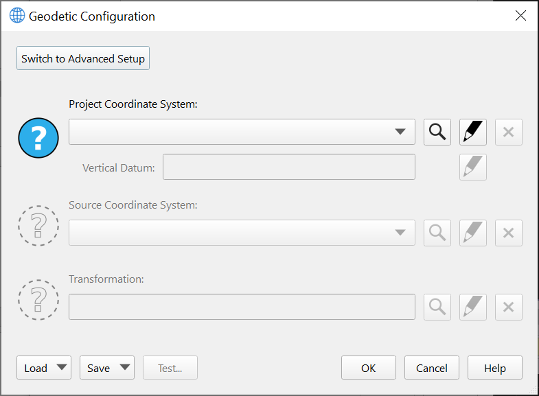
The Advanced Configuration has improved as well, largely with a review of terminology to ensure consistency and clarity, and also removing acronyms in favor of full text to help users with limited geodetic knowledge. Action buttons are at the top left to guide the user to the logical first step to take when coming to this mode.

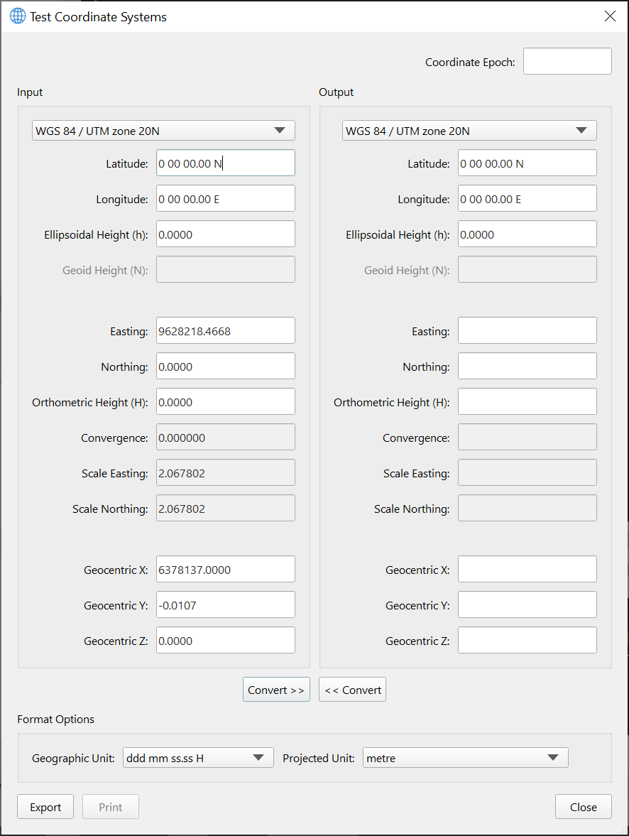
Lastly, the layout of the Test dialog has been improved as well to make it easier to compare geodetic test points with the current configuration, transform, vertical offsets, etc. We have used standard geodetic terms like "Ellipsoidal Height", "Geoid Height" and "Orthometric Height", along with the usual symbolic terms for these (h, N and H, respectively). As with the other dialogs, acronyms have been removed as much as possible. The vertical layout makes it easy to visually scan and compare between Input and Output systems, the previous layout of this dialog made it difficult to visually compare results between the Input and Output systems.
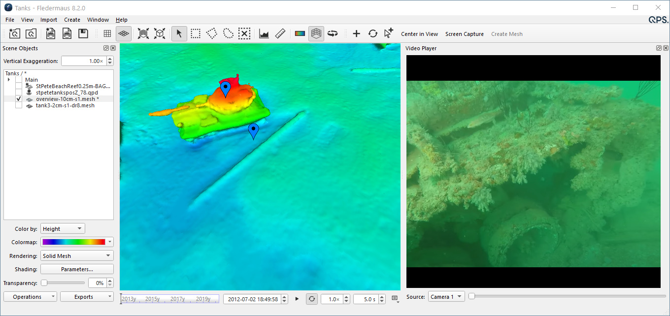
Optimized Video Playback
In Fledermaus 8.0 we introduced an integrated video player as part of the main application. One downside of the player was that quick transitions in time (for example jumping from one Space-Time Note to another) could result in lag in the primary 3d display. To address this issue, when doing large jumps in time, the video player will pause play back until arriving at the new scene location. During smaller jumps, or with accelerated time play back, the video will continue to play.
*Data from R2Sonic Sonic 2024 multibeam operated in UHR (700kHz) mode
Video File Management
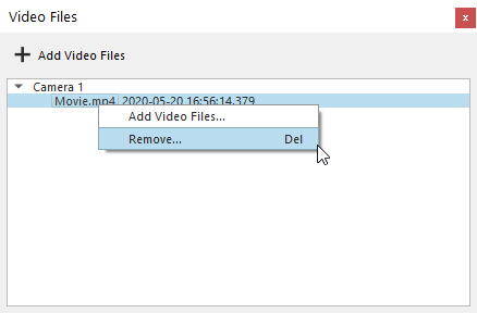
Video files in a project can now be removed by right-clicking on the selected file in the video files docks, and choosing the "Remove" option.
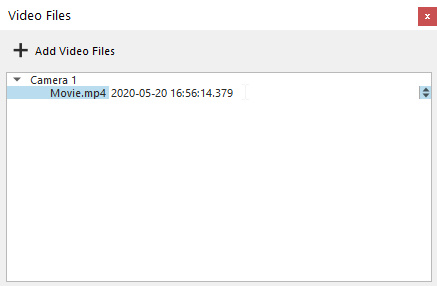
After a video has been added to a project, you can now double click on the object to modify the starting timestamp.
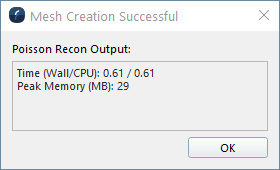
Mesh Creation Error Reporting and Stats
To provide feedback on the time and resources used during the creation of a mesh, we have added a stats summary dialog after the creation process completes. In addition to reporting running time, the dialog will display any errors that occurred during the creation process.
Improved measurement tool and geo-pick display
With mesh data sets often having resolutions well below 1m, the measurement tool was improved to display sub-meter values.
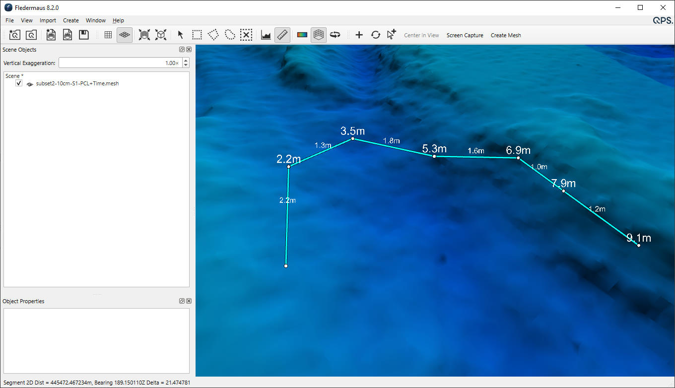
In addition, the geo-picking display located at the bottom left of the main window, will now display co-ordinates for mesh objects.
Dynamic Surface Improvements
The size of surfaces created in Fledermaus 8.2 (including those imported from FM7) are now considerably smaller on disk. The more efficient storage produces files that are on average 30% smaller than in previous versions of Fledermaus 8. There are also a number of general stability improvements when working with Dynamic Surfaces.
Translations, Rotations, and Scaling are now properly applied when importing FM7 data
Data objects such as solid models, and geoimages, often have manual adjustments applied to them in Fledermaus 7. These object were capable of being imported into Fledermaus 8.0 and 8.1, however support for the manual translations, rotations and scaling was not implemented in the first phases of support for these types of adjustments. This has now been implemented for Fledermaus 8.2, and imported scenes will have all objects in the correct location, with correct scaling and rotation.
Scalar Improvements
There are a number of critical bug fixes for using Scalars in Fledermaus 8.2. In addition, a number of missing features, such as being able to set the color map range, have been implemented. Scalars are important for working with a number of derived data types, such as slope, or uncertainty.